CURED MEAT & MONSTERS OF THE DEEP

Big Walking Gator at Lake Woodruff. © Andrea Westmoreland. From Wikimedia Commons

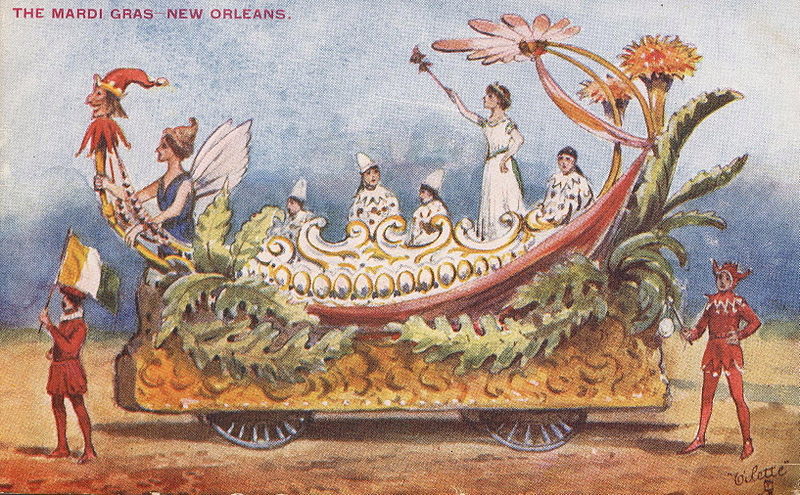
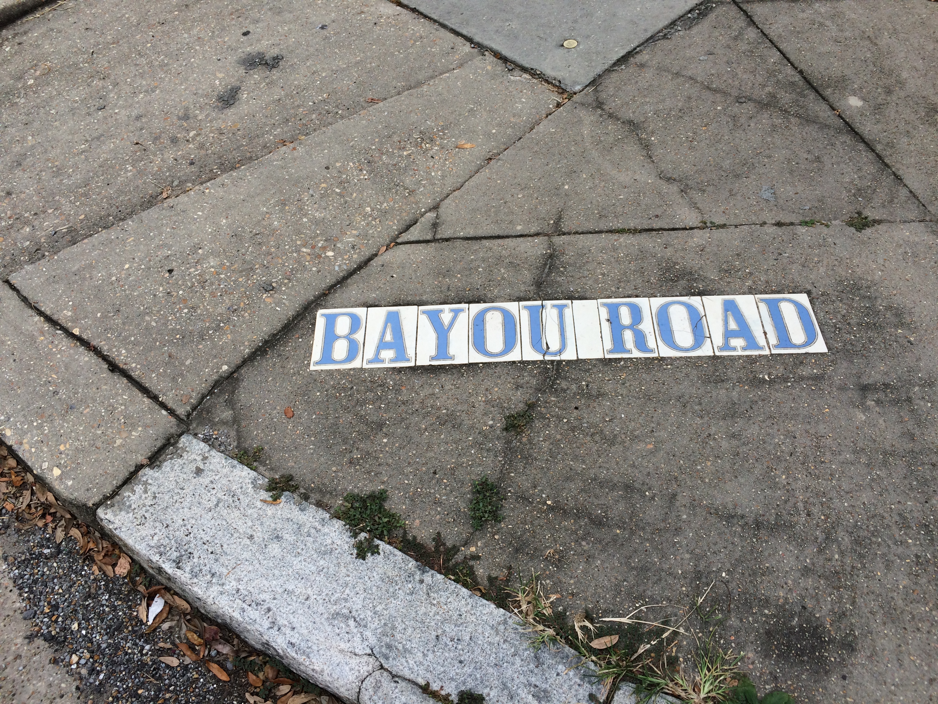
This past January, I wrote a post in which I quoted Marc-Antoine Caillot, 22-year-old clerk for the Company of the Indies, from his memoir A Company Man. On Lundi Gras 1730, Caillot initiated the first-known Carnival celebration in New Orleans on the banks of Bayou St. John, having trudged down Bayou Road with his buddies, all of them dressed as women.

Earlier in the account of his time spent in New Orleans, we find another mention of our beloved bayou. This time, it involves a gigantic Monster of the Deep fiending after some paté!

One day, Caillot gathered up some of his friends and they walked along the only passable road from the present-day French Quarter to the bayou—Bayou Road. Along the way, they would have seen a brickyard and an earthenware factory, and the homes of a few wealthy planters backed by indigo plantations, and maybe some grazing livestock here and there. They may have passed a few carts heading into the city, laden with goods that had been brought down Bayou St. John on flatboats.…

I’ll let Caillot take it from here!

“We had brought as provisions some good paté, a few dozen bottles of good wine, and some cured meat from the butcher’s in order to spend the day at the home of a certain Joseph Bon…who lived on the other side of the aforementioned bayou. In order to go to his house, we got into a little pirogue with our provisions.

We were only halfway when, all of the sudden, a huge crocodile [alligator] came and put his two front feet on the edges of our little boat, which he almost turned over, to get our meat. We were in a great deal of trouble, so, in the meantime, having loaded our muskets, together all shot him in the head and blasted out his eyes. He left us, making a dreadful turbulence in the water. Not knowing where he was going anymore, he beached himself on the bank.” Some slaves from a nearby plantation, having witnessed the encounter, “ran and pulled him out of the water. We measured him and discovered that was twenty-two feet long.” [1]

Now, Caillot is known to exaggerate throughout his memoir, so who knows if this 22-foot measurement is totally accurate—but needless to say, that alligator was big! Given his aggressive leap for Caillot’s cured meat, we might safely characterize him as a “nuisance gator.”

For more information on gators in our current bayou (certainly not 22 feat long!) read this nola.com article from last summer.

For a parallel gator-moment from recent times, check out this video of an innocent kayaker and his daughter out in Fausse Pointe State Park, and what they discovered at the end of their line….

1. Marc-Antoine Caillot, A Company Man: The Remarkable French-Atlantic Voyage of a Clerk for the Company of the Indies, ed. Erin M. Greenwald, trans. Teri F. Chalmers (New Orleans: The Historic New Orleans Collection, 2013) 114-115.

THE HISTORIC OSSORNO HOUSE

In a post last fall, in which I documented my trek along the modern-day path of the historic Bayou Road portage route, I mentioned the Ossorno House on Governor Nicholls Street. Well, I just can’t get enough of this old house, and soon after I posted about it, the house went up for sale. Oh, and it went up for sale for the first time in over a century!

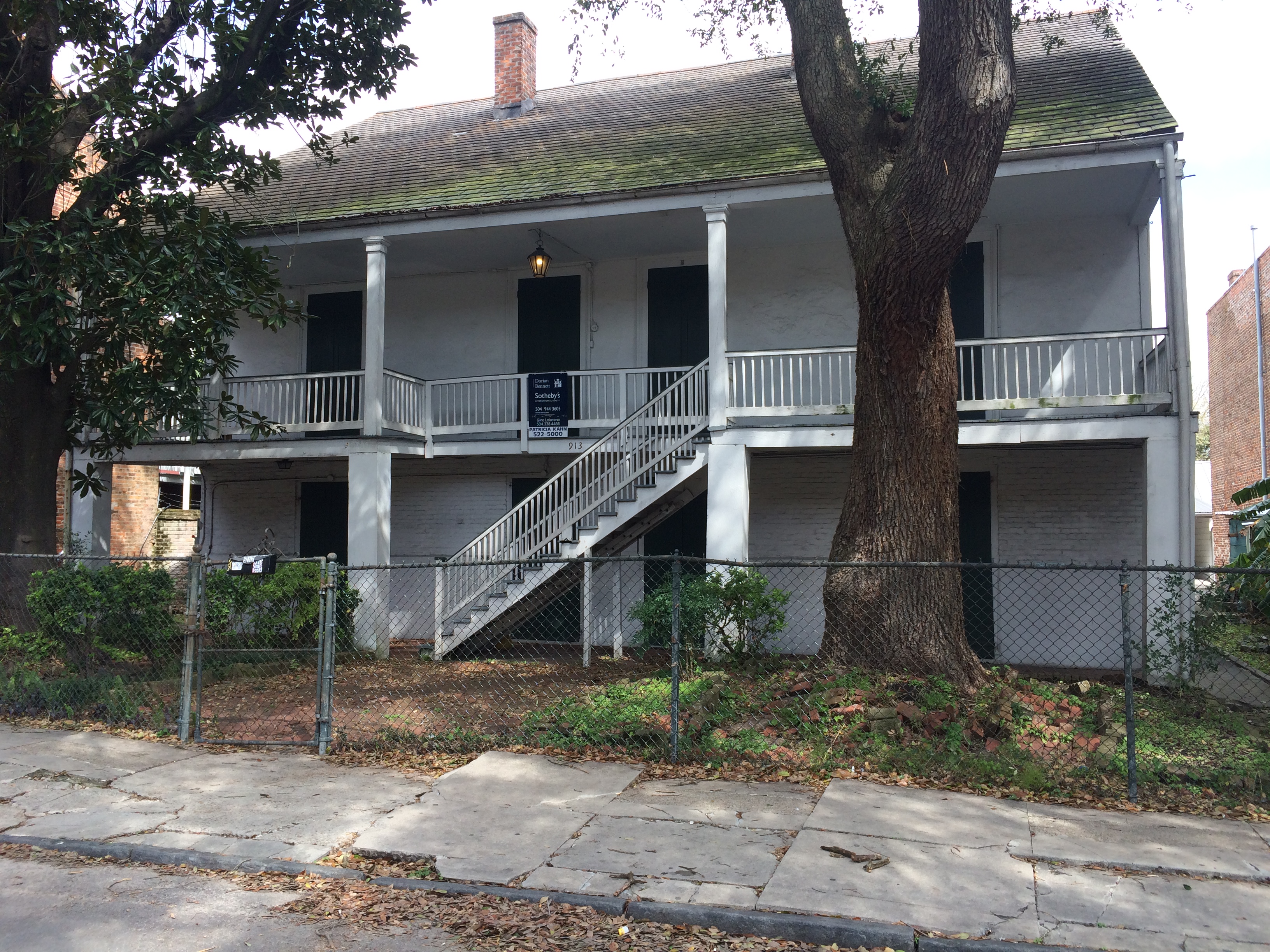
Ossorno House, 913 Gov Nicholls St, photo by author

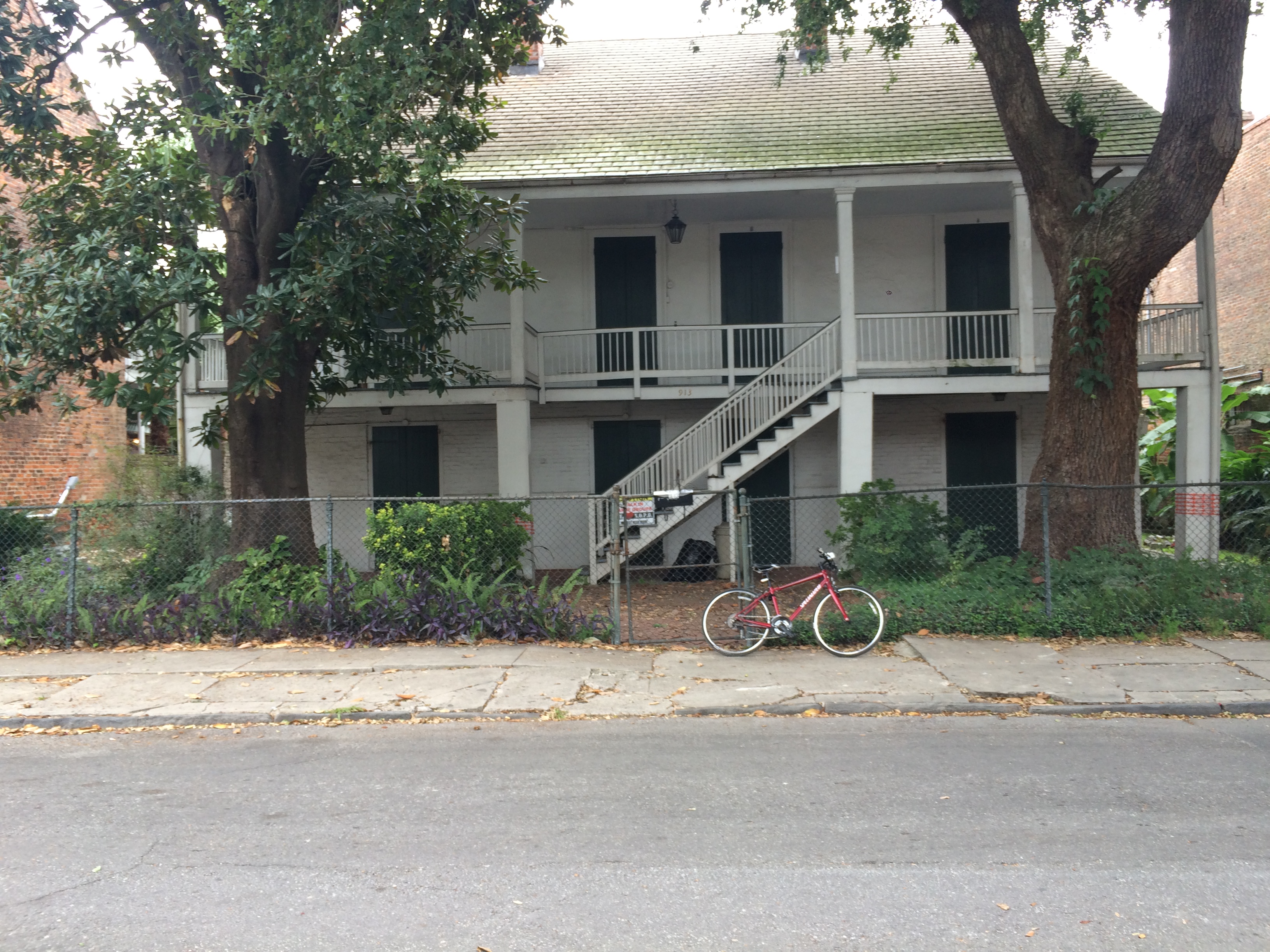
Ossorno House, 913 Gov Nicholls St, photo by author

The house, originally built on the bayou, was dismantled sometime around 1781, presumably carted down Bayou Road, and reassembled in the French Quarter by 1784. Its owner, Gabriel Peyroux, apparently wanted to move it from the rural village that surrounded the lower bayou at the time into town, although the reasons for such a move remain unclear.

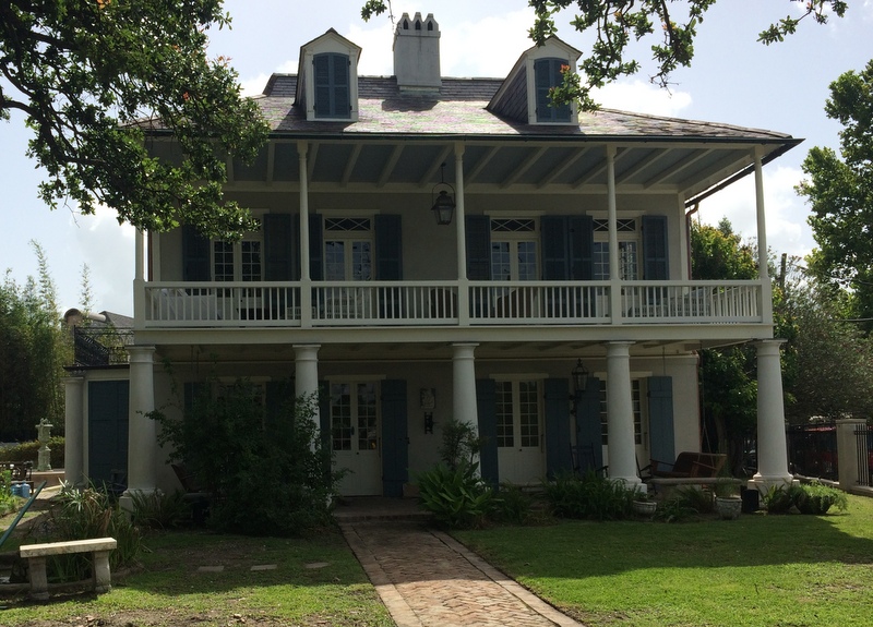
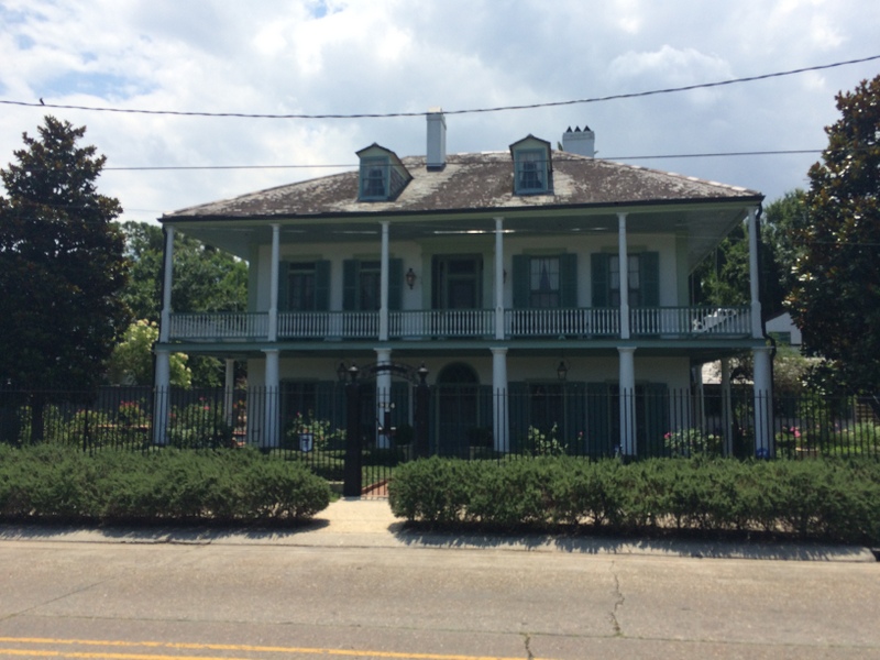
In the 1830s, its hipped roof (a roof with four sloped sides; see pictures of other examples below) was replaced by a gabled one, but other than that, the house still retains its French colonial plantation-style characteristics. The only other plantation-style house in the Quarter is the famous Madame John’s Legacy, but the Ossorno House is the only truly authentic plantation-style structure in the Quarter since it was actually utilized as such in a rural setting before being moved to the city. As Richard Campanella tells us in his Geographies of New Orleans, “[the Ossorno House] is over twenty-five years older than any building in the surrounding sixteen blocks, eighty years older than the area’s average age, and possibly the only structure ever to occupy its parcel.” [1]

On top of this, only three families have owned the house over the course of its 230-year history, and it hasn’t changed hands since 1912.

Colloquially-named Spanish Custom House, c. late 1700s, on Bayou St. John; photo by author; note the hipped roof

“The Sanctuary” on Bayou St. John, another French colonial plantation-style house hailing from the same era as the Ossorno House; photo by author; note the hipped roof

So, in short, we have a totally badass house here.

It witnessed the early days of bayou living—saw schooners gliding down the bayou, heavy with smuggled goods; saw fields of indigo and herds of cattle and orchards planted with rows of orange trees; maybe it even witnessed a runaway slave as she slipped silently along the bayou to hide in the cypress swamp beyond. Then, it was broken up and hauled along Bayou Road like nearly all the other goods arriving in the city at the time.

Again, Campanella sums it up elegantly: “That the Ossorno House may have literally come down Bayou Road from the Bayou St. John plantation country and ended up on Gov. Nicholls Street, where Bayou Road entered the city, is also of great significance. One may view it as a structural monument to the historic flow of materials and peoples traveling this route from city to bayou.”[2] Physical proof of the ancient artery of Bayou Road, once a stream of movement and activity, in the form of a slightly run-down plantation-style four-plex—which could be yours today for only 2.7 million dollars!

For awesome photos of the house’s current interior—six bedrooms, four baths, with a little retro kitchen tacked onto the back, and original fireplaces and wood floors—visit Curbed New Orleans.

 To continue traveling down the rabbit hole of this house’s unique history, visit the Historic New Orleans Collection’s Vieux Carré Digital Survey (complete with a brief history of the house, photographs from the 1930s-1950s, old drawings, surveys, and maps).

Better yet, go visit the house! You may not notice it at first, since it’s set back from the street and tucked in between the more stately and ornate townhouses that were built up around it in the 1800s. But don’t let its modest visage fool you—this house has stories to tell!


1. & 2.  Richard Campanella, Geographies of New Orleans: Urban Fabrics Before the Storm (Lafayette: University of Louisiana Press, 2006) 106.Campanella, Geographies of New Orleans, 107.

BRILLIANT ASSEMBLIES OF LADIES

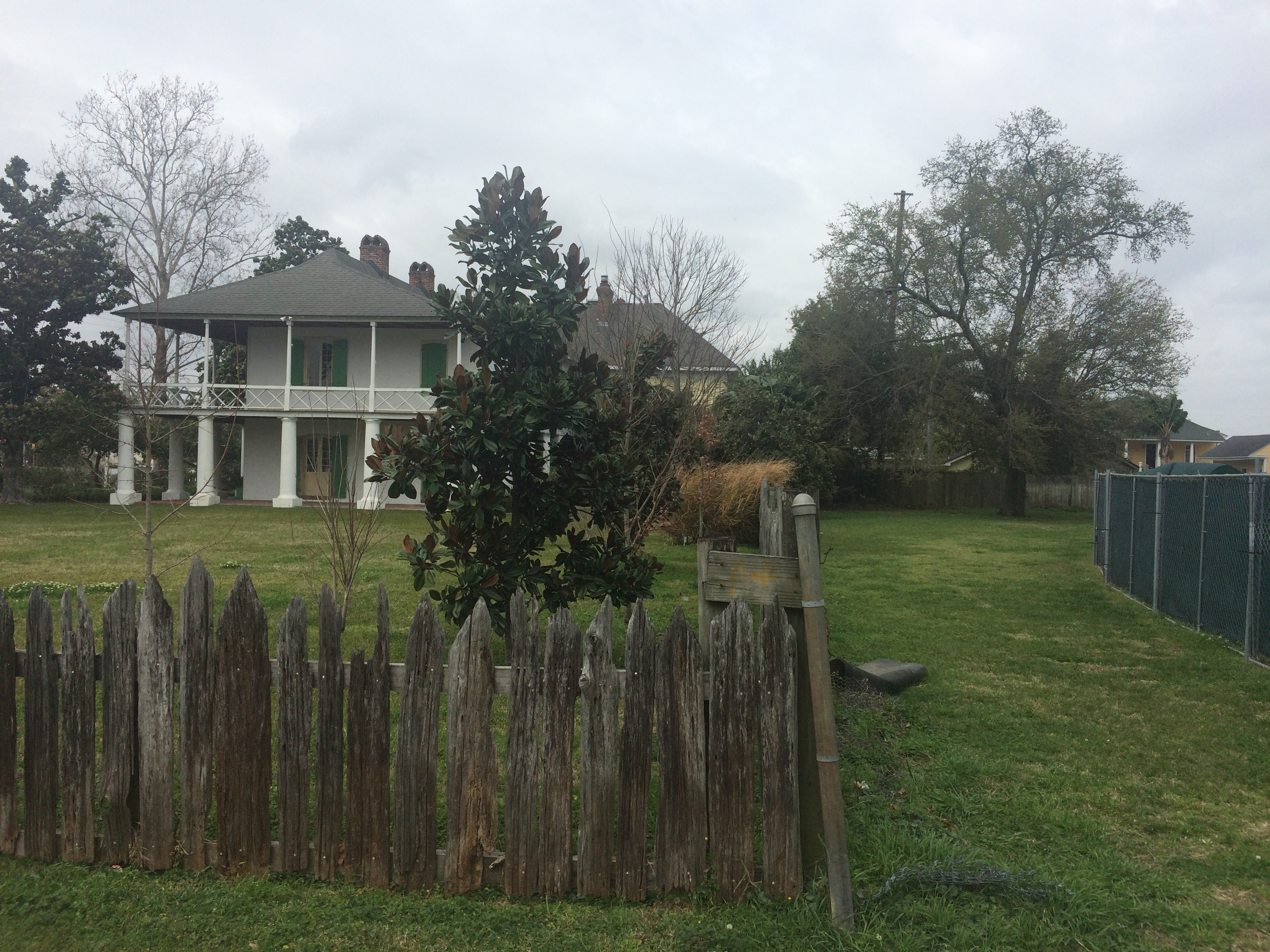
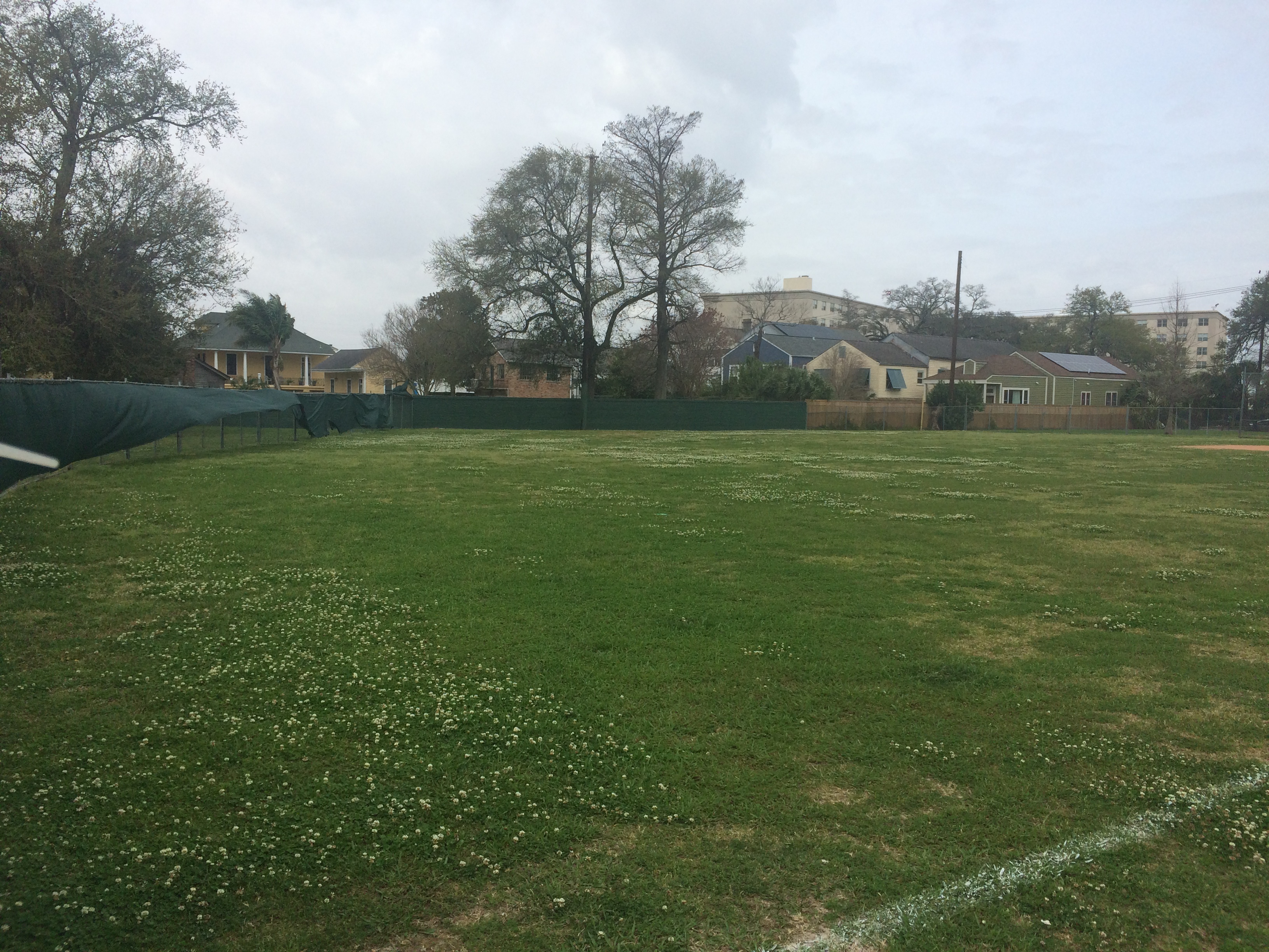
Did you know that where the Pitot House and Desmare Playground sit now was once a 19th century pleasure garden called “the Tivoli”? Leonard Victor Huber in his New Orleans: A Pictorial History even calls it New Orleans’ first park. At that time, the area around the bayou was seen as a rural escape from the hustle and bustle of city living and boasted several pleasure gardens by the end of the 19th century—green spaces where residents could dance, drink, and mingle in true New Orleans fashion.


Pitot House

Field behind Desmare Playground

Edna Freiberg, in her book Bayou St. John in Colonial Louisiana 1699-1803, includes a description of Tivoli patrons by a Mr. John F. Watson, a Philadelphia man visiting New Orleans in 1804. He tells us how those visiting the garden would “walk out in the dust and walk home after ten o’clock at night” (I picture ladies in their finery trudging along Bayou Road, although I’m not exactly sure what he means here). He also mentions ladies “of the best families” dressed to the nines, arriving at the gardens in their ox carts. [1]

LSU professor Lake Douglas, in his fascinating book Public Spaces, Private Gardens, quotes another traveler to New Orleans in 1806, the Irishman Thomas Ashe: “Every Sunday evening, ‘all the beauty of the country concentrates, without any regard to birth, wealth, or colour…. The room is spacious and circular; well painted and adorned, and surrounded by orange trees and aromatic shrubs, which diffuse through it a delightful odor. I went to Tivoli, and danced in a very brilliant assembly of ladies.’” [2]

Douglas goes on to highlight Ashe’s phrase “without any regard to birth, wealth, or colour,” which speaks volumes when put into the context of Ashe’s wider study of 19th century New Orleans’ social customs surrounding gender, race, and class—which were complicated to say the least, and which could often be observed in microcosm in the city’s dance halls. More on this to come: I am attempting to learn more about Ashe, New Orleans’ “quadroon balls,” and the city’s relationship to race and gender more generally as it transitioned into the 19th century.

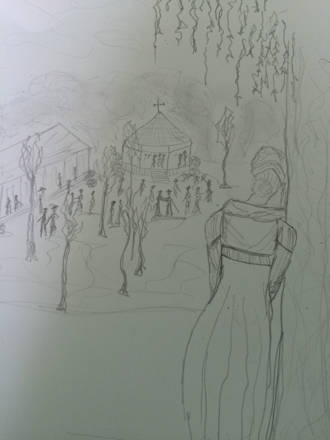
For now, I’ll just do a little poetic imagining. Beneath the traffic sounds of Esplanade, can you still hear the clopping arrival of those ladies in their ox carts? Can you smell the orange blossoms? Can you see the circular, lantern-lit pavilion set amongst the trees, and the couples strolling about in their fancy hats and walking canes and rustling skirts? When you look up, can you see the stars beginning to emerge around the edges of the evening clouds? Can you hear the music warbling in the breeze, distorted by the passage of hundreds of years and layers upon layers of history?

(This is me, hiding behind a cypress tree, imagining myself into the scene. I even put on my early 19th century dress with the high waistline for the occasion! Don’t ask me where the hill I’m standing on came from….it’s an illusion. I don’t have an ox cart (Uber?? Where are you??) so I’ll have to walk along Bayou Road to get home….)

1 .Edna Freiberg, Bayou St. John in Colonial Louisiana 1699-1803 (New Orleans: Harvey Press, 1980) 324.
2. Lake Douglas, Public Spaces, Private Gardens: A History of Designed Landscapes in New Orleans (Baton Rouge: Louisiana State University Press, 2011) 73.

AN INTERSECTION’S ANCIENT ENERGY Pt. 2

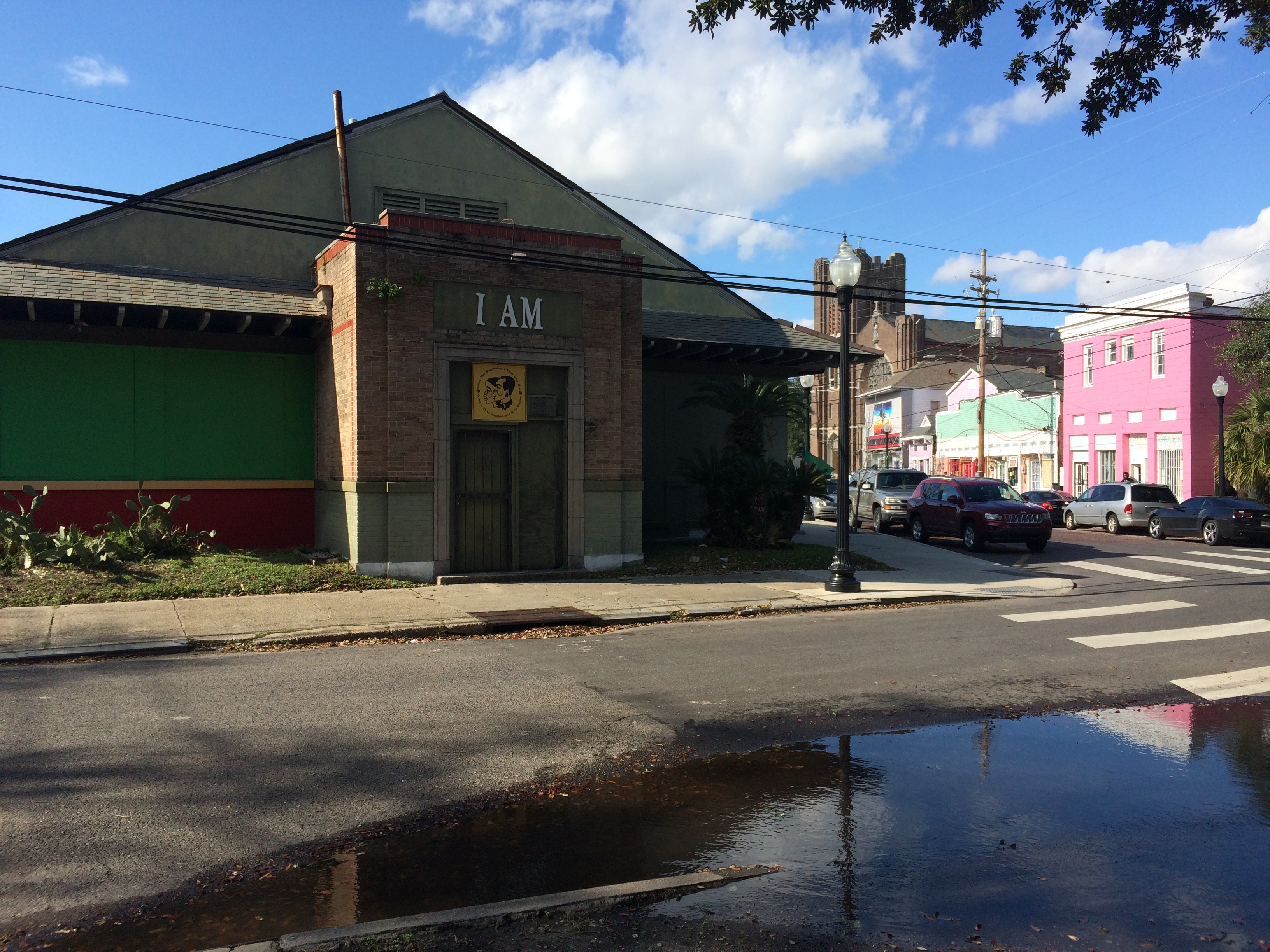
A couple weeks ago, I posted on my favorite New Orleans intersection: where N. Dorgenois, Bell, DeSoto, Kerlerec, and Bayou Road come together—that many-triangled flurry of streets that calls out to me as I walk my dog or pick up a breakfast burrito from Pagoda Cafe. As of my last post, I’d discovered that the site where the Church of I Am That I Am and King and Queen Emporium stands today was also site of the former home of Daniel Clark, prominent Anglo merchant of the Spanish period and the guy responsible for buying up a bunch of plantations between Dorgenois and Bayou St. John and mapping out Faubourg St. John in 1809. But, as I dug deeper, I discovered there was far more to learn….

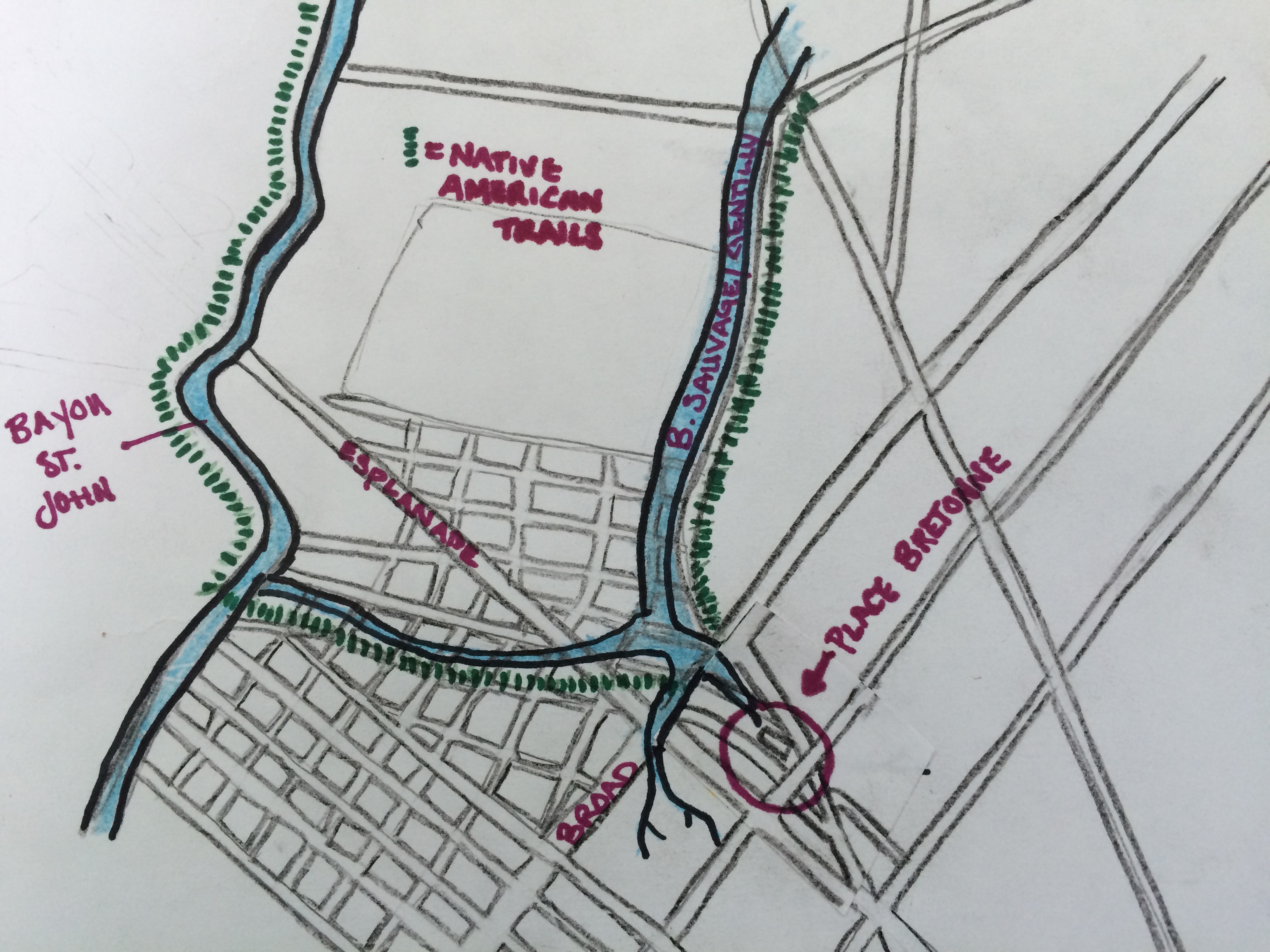
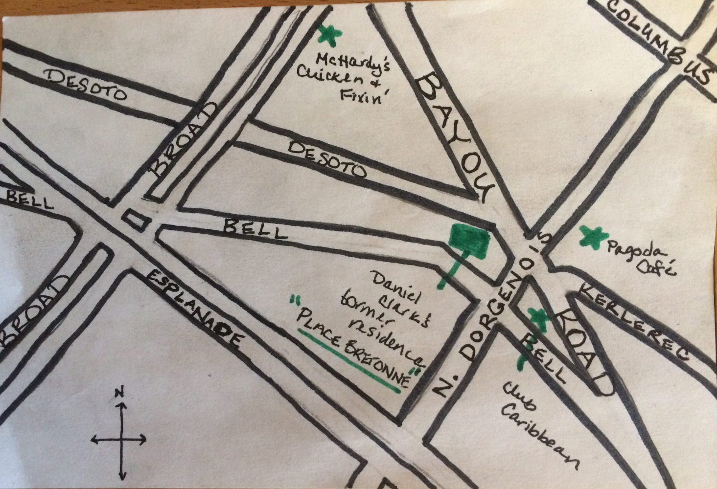
Based on colonial-era maps I’ve scoured, it looks like this intersection was the spot where two well-trafficked Indian trails merged from ancient times up until the French period. One of those was the path that led from Bayou St. John to the present-day French Quarter, that Bayou Road and Bell Street approximate today—the famous portage route that made New Orleans possible. The other path followed along Bayou Sauvage (or Bayou Gentilly, which followed the basic trajectory of present-day Gentilly Boulevard).

My most amateurish map to date! (Not to scale; everything is approximate.)

Based on written evidence and an appropriate dose of educated guessing, it would appear that where these paths came together, Indians from various tribes traded with one another—and this practice continued once Europeans arrived. According to historian Jerah Johnson, “New Orleans’ earliest, as well as its last, all-Indian market was held in an open area called the Place Bretonne at the conjunction of what are now Esplanade Avenue, Bayou Road, and Dorgenois, Bell, and DeSoto streets. It lasted, with gradually dwindling numbers of Indians after 1809 (when the opening of the Faubourg St. John separated it from Bayou St. John, which had been the main route the Indians followed into town), until the construction on that spot of the LeBreton Market building in 1867. Small groups of Indians still continued to sell goods there as well as in other parts of the city.”[1]

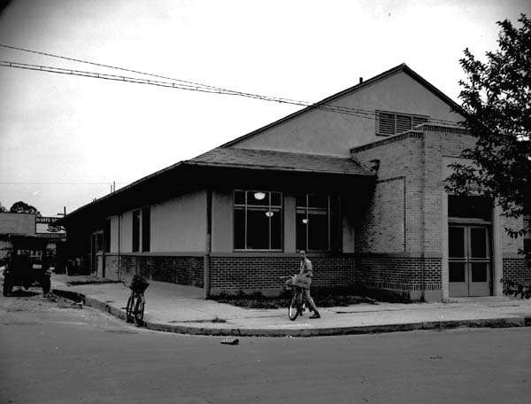
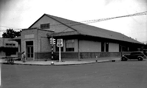
According to my research, Clark bought this parcel of land in 1804. He died in 1813 in his hip-roofed house that stood where the Church of I Am That I Am stands today. When he mapped out the future Faubourg St. John, he wanted this fan of streets to be the focal point of the neighborhood and called it “Place Bretonne.” Clearly, as Johnson mentions above, Clark’s decisions essentially closed off Native American trade connections between this site and Bayou St. John. After Clark’s death, the piece of land was sold to the city of New Orleans in 1836, and Johnson tells us a municipal market, called LeBreton Market, was then built on the site in 1867—which is the very same building the aforementioned church occupies today.

I’m still left wondering a bit about this site’s evolution. Did Clark, after buying up the land between Dorgenois and the bayou, simply build a house right where the Indian market had been? What did that look like when it was going down? And then what made the city decide to build a market there 60 years later, after the site had stopped being used for this purpose? Was its ancient past was well-known, and therefore the idea seemed obvious?

I don’t know yet whether there were more specific reasons for this evolution, but it seems to me that the Mississippi River might have everything to do with it. After it swung into its present channel, it left behind the Metairie-Gentilly ridge system that the Native Americans utilized, among many others, to traverse the landscape. Their movement along the ridges impacted the locations they chose for trade, and also influenced the founding of New Orleans in its present location. These pathways also influenced future streets (like Bayou Road) and plantation property lines like the ones that demarcated Clark’s land. Perhaps Clark wanted this site—an important intersection, a center of activity—for his own, and perhaps, after Clark was gone, the city recognized the site’s natural properties for what they were, and decided a municipal market simply belonged there.

LeBreton Market from Wikimedia Commons, 1938, by an uncredited WPA employee

LeBreton Market 1938, credits same as above photograph

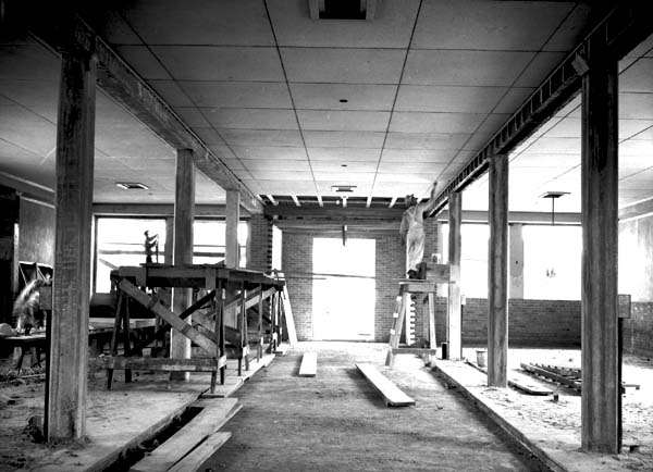
Interior of LeBreton Market during WPA restoration, 1938; credit same as for above photographs

If any of you reading this know more about this intersection than I do, please reach out! All I know is the spot continues to buzz with energy—and now, when I walk my dog across Bayou Road’s brickwork, I can feel how ancient that energy truly is….


  1. Jerah Johnson, “Colonial New Orleans: A Fragment of the Eighteenth Century French Ethos” in Creole New Orleans: Race and Americanization, ed. Arnold R. Hirsch and Joseph Logsdon (Baton Rouge: Louisiana University Press, 1992) 39-40.

ANCIENT AND ODD-ANGLED: THE ROAD TO BAYOU ST. JOHN

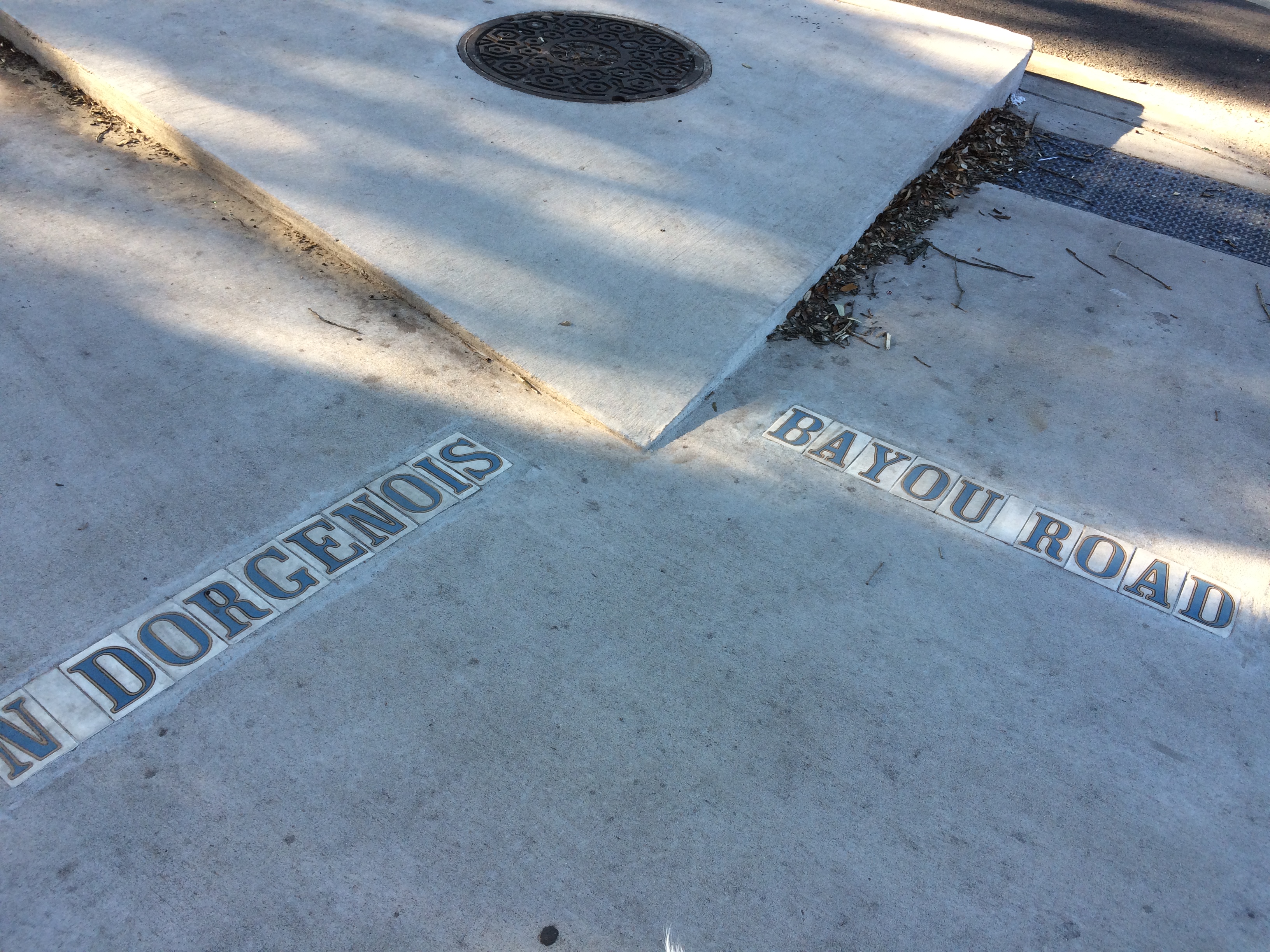
Since moving to my new address on N. Dorgenois Street, my fascination with the charming and disorienting formation of streets between Esplanade, N. Rocheblave, Columbus, and Broad has only grown. Residents may know this spot as home to Pagoda Café, Club Caribbean, and McHardy’s Chicken.

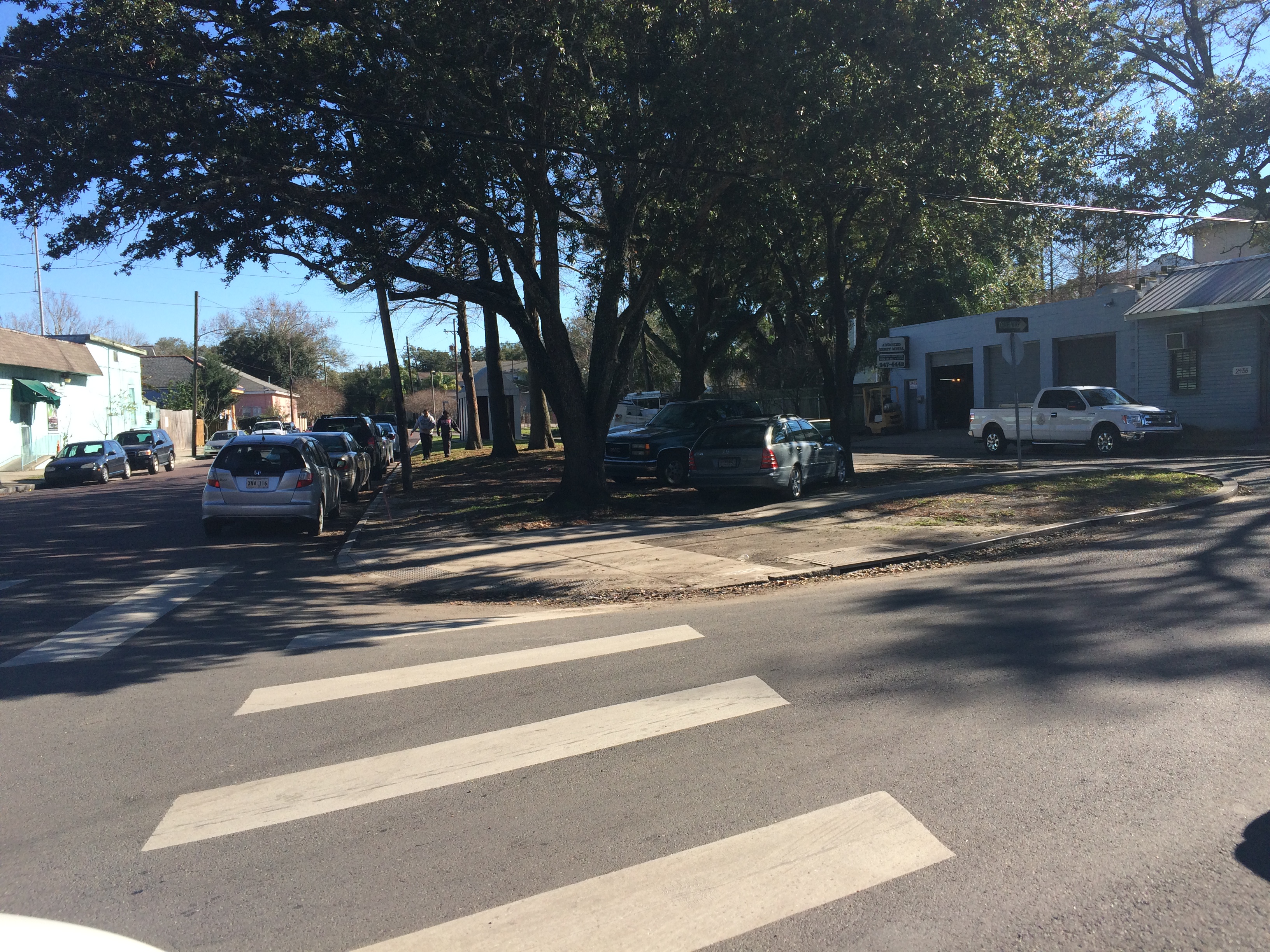
From N. Dorgenois, facing Bayou Road and Bell Street. photo by author

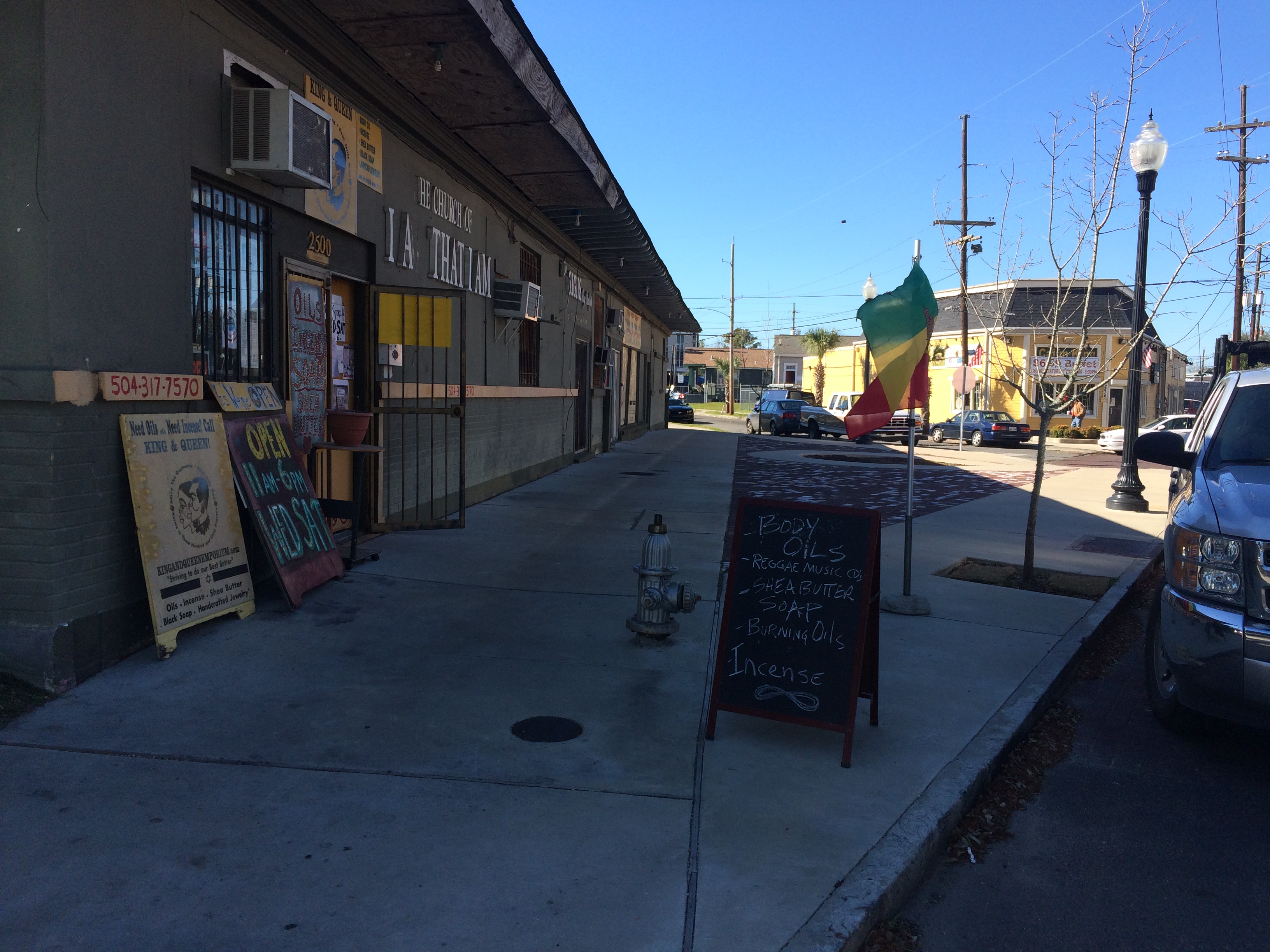
Alongside King and Queen Emporium Itn’l on Bayou Road, facing where Desoto breaks off to the left. photo by author

This bizarre intersection has everything to do with the odd-angled Bayou Road, “the road, trace, or portage [that] predated the city, following a narrow strip of high land that led from the Mississippi River past Bayou Sauvage, called Gentilly, to an intersection with Bayou St. John”[1]. Bayou Road was the thread, some argue, that made New Orleans possible—by lending the French a “backdoor route” from the Gulf through Lakes Borgne and Pontchartrain, down Bayou St. John, along the elevated ridge Bayou Road occupies to the Mississippi’s banks. The French could perch along the river’s edge, and thereby control the entire massive artery, without having to fight their way up its tumultuous mouth.

New Orleans Architecture explains that the corridor of “Bayou Road, on both its left and right sides, served as frontage for a series of concessions made first by the Company of the Indies, then by the kings of France, and later, the Spanish Crown. Simultaneously to the laying out of the city [ the present-day French Quarter]…these tracts of land to the rear of the city were developed into habitations (plantations) with houses and outbuildings facing each side of Bayou Road, having orchards behind and cultivated fields extending to the swamps” [2]. Even after the neighborhoods flanking Bayou Road were developed according to orthogonal street grids in the 19th century onward, Bayou Road was left to continue on its ancient, crooked way—there were too many houses and buildings already oriented along its trajectory.

So, back to my favorite intersection! Where, like, seven irregular triangles touch noses! The energy of the spot kept pulling me in, but until I did a little extra research in order to write this post, I didn’t realize how truly charged it was.…

It turns out N. Dorgenois Street formed the boundary line between some of these Bayou Road plantations that were continually changing hands throughout the city’s early history.

Chains of title can be kind of dull, but, in brief, between 1723 and 1834 the swath of land between N. Dorgenois and Bayou St. John (broken up into various parcels) was owned by folks with surnames like: Française, Langlois, Lebreton, Brasilier, Chalon, Almonester (the city’s wealthiest resident by the mid-1780s), Blanc, Vidal, Suarez, Clark, and Blanc again, until “…on September 26, 1836, Blanc sold to the Corporation of the City of New Orleans his ‘land or plantation, irregularly shaped having about twelve arpents frontage on Bayou St. John and bound by said Bayou, Carondelet Canal, Bayou Road, and Dorgenois…for $50,000’”[3].

Until around the time of the Louisiana Purchase, the particular sliver of land between N. Dorgenois and Broad was cultivated, but had no structures on it yet. Then comes Daniel Clark, Jr., the man who wanted to turn the land between the bayou and Dorgenois into Faubourg St. John. Historian Lawrence Powell tells us more about Clark: “…a young Philedelphian named Daniel Clark, Jr., Irish-born and Eton-educated, parlayed fluency in French and Spanish to become Governor Miró’s English translator, and then used that position to facilitate an illegal tobacco trade in which the governor silently partnered with Clark’s uncle, a wealthy Baton Rouge planter and New Orleans merchant. The younger Clark soon amassed a fortune from shipping and real estate, in the meantime joining the ranks of the slave-holding gentry”[4]. Later Powell tells us the two Daniel Clarks were some of the city’s largest slave-importers during the latter half of the 18th century.

Daniel Clark’s daughter, Myra Clark Gaines, stalled the development of Faubourg St. John after Clark’s death for close tosix decades via “the longest-running lawsuit in the history of the United States court system”(!!!) claiming she was the sole heir to his properties. (More on this fascinating lawsuit to come!) Before he died, Clark had succeeded in subdividing the faubourg into 35 irregularly-shaped blocks, however, and had envisioned the focal point of the neighborhood to be the fan-like formation of streets that inspired this blog post. New Orleans Architecture tells us that Clark built his country seat at the juncture of Bell, Desoto, and Bayou Road, roughly where King & Queen Emporium International is today. He died in the house in 1813 and it “ultimately fell into ruin and was demolished” [5].

So now we know a bit about the mainstream history of this tangle of streets in the 7th Ward. In my next post, I will seek to explore the little-known, less-recognized facets of this intersection’s history.…

1. Roulhac Toledano and Mary Louise Christovich, New Orleans Architecture Volume VI: Faubourg Tremé and the Bayou Road (Gretna: Pelican Publishing Company, 1980) xi.
2. Toledano and Christovich, New Orleans Architecture, xi.
3. Toledano and Christovich, New Orleans Architecture, 54-56.
4. Lawrence N. Powell, The Accidental City: Improvising New Orleans (Cambridge: Harvard University Press, 2012) 194.
5. Toledano and Christovich, New Orleans Architecture, 56.

NEW ORLEANS’ FIRST CARNIVAL MASQUERADE

Imagine this: the year is 1730. You’re a 22-year-old clerk for the French Company of the Indies, and you’ve recently been sent from Paris to the new fledgling colony of Louisiana to be a bookkeeper in New Orleans, the colony’s capital. In what’s now the present-day French Quarter, a basic street grid extends a few blocks back from the river, populated by a handful of brick-between-post timber structures shellacked with lime made from crushed oyster shells. Untamed wilderness threatens to overtake the town from all sides. Un-penned pigs wander the streets. The air is thick with mosquitos. Here and there, crumbling ditches have been dug to help with drainage, but still—after a hard rain, the city streets blur into a series of shallow muddy lakes.[1] All around you, colonists are panicking. Violent conflicts between the French and the Natchez tribe upriver have set everyone on edge. At the tavern, talk of the Indians and slaves banding together and murdering colonists in their sleep is all you seem to hear. And yet, it’s Carnival season! And you’ve barely had alickof fun!

In 2004, The Historic New Orleans Collection acquired the unpublished manuscript of one Marc-Antoine Caillot, clerk for the French Company of the Indies, that details his time spent in New Orleans between 1729 and 1731. What resulted is a beautiful collaboration between Erin M. Greenwald, Teri F. Chalmers, and many scholars and researchers calledA Company Man: The Remarkable French-Atlantic Voyage of a Clerk for the Company of the Indies, published by The Historic New Orleans Collection in 2013. For anyone interested in this era of our city’s history, I highly recommend this book. For our purposes today, we’ll focus on the section of the manuscript devoted to a Lundi Gras celebration along the banks of—you guessed it!—our very own Bayou St. John!

Before we get to Lundi Gras, though, Caillot gives us a glimpse of what the area around Bayou St. John might have looked like in 1730: “At three-fourths of a league’s distance on the left you will find a hamlet called Bayou Saint John, where there live five or six inhabitants very rich in livestock.” Greenwald’s footnote explains: “In 1727 the population along Bayou Saint John totaled 121, including forty-one whites, three indentured servants, seventy-three blacks, and four Indian slaves.”[2]Caillot was probably referring to those several landowners that had settled their large concessions along the bayou’s banks in the early years of the 18th century, resulting in a rural “hamlet” consisting of those landowners’ families, servants, and slaves.

Ok, back to the Lundi Gras revelry. Caillot explains: “We were already quite far along in the Carnival season without having had the least bit of fun or entertainment, which made me miss France a great deal…. The next day, which was Lundi Gras, I went to the office, where I found my associates, who were bored to death. I proposed to them that we form a party of maskers and go to Bayou Saint John, where I knew that a lady friend of my friends was marrying off one of her daughters….”

Caillot explains that his associates were like, Oh cool, yeah that sounds fun…it’d be cool to crash the wedding party…but uhhh we don’t have anything to wear! and kind of lost motivation to make it happen. “But, upon seeing that no one wanted to come along, I got up from the table and said that I was going to find some others who would go, and I left.” Caillot couldn’t be deterred. “…I did not delay in assembling a party, composed of my landlord and his wife, who gave me something to wear. When we were ready and just about to leave, we saw someone with a violin come in, and I engaged him to come with us. I was beginning to feel very pleased about my party, when, by another stroke of luck, someone with an oboe, who was looking for the violin, came in where we were, to take the violin player away with him, but it happened the other way around, for, instead of both of them leaving, they stayed. [Doesn’t this sound like just the kind of Carnival fortuitousness we’re used to in modern-day New Orleans?! An impromptu party, and then some guy with a guitar just happens to walk by….] I had them play while waiting for us to get ready to leave. [Oh, we all know this story: the hours and hours it takes for everyone to get out of the house and to the parade!] The gentlemen I had left at the table…came quickly upon hearing the instruments. But, since we had our faces masked, it was impossible for them to recognize us until we took them off. This made them want to mask, too, so that we ended up with eleven in our party. Some were in red clothing, as Amazons, others in clothes trimmed with braid, others as women. As for myself, I was dressed as a shepherdess in white. I had a corset of white dimity, a muslin skirt, a large pannier, right down to the chemise, along with plenty of beauty marks too. [Love the attention to detail. This is what a good Carnival costume requires.] I had my husband, who was the Marquis de Carnival; he had a suit trimmed with gold braid on all the seams. Our postilion went in front, accompanied by eight actual Negro slaves, who each carried a flambeau to light our way. It was nine in the evening when we left.” [3]

On the way to the bayou, presumably along the path occupied by present-day Bayou Road, the travelers came upon several bears, which they scared away with the flambeaux. When they got to the bayou, they sent a slave to go check out the wedding party and see what was going on—as in, are they done with all the boring parts yet? Are they dancing yet or not?

The slave returned with the news that, yes, they had just begun dancing. “Right away, our instruments began playing, the postilion started cracking his whip, and we walked toward the house where the wedding celebration was taking place.” Caillot goes on to describe the wedding party receiving them with excitement, requesting that they join in and dance, and then forcing them to finally remove their masks. Everyone was recognized very quickly, aside from our cross-dressing young friend: “What also made it hard for people to recognize me was that I had shaved very closely that evening and had a number of beauty marks on my face, and even on my breasts, which I had plumped up. [!!!] I was also the one out of all my group who was dressed up the most coquettishly. Thus I had the pleasure of gaining victory over my comrades, and, no matter that I was unmasked, my admirers were unable to resolve themselves to extinguishing their fires, which were lit very hotly, even though in such a short time…”[4]. Our narrator was so sexy and convincing as a lady, the menfolk in the crowd were hard pressed to “extinguish their fires”!

To hear more about the festivities that took place on this 1730 Lundi Gras, and to experience more of Caillot’s adventures, go findA Company Man. And when you go out this Lundi Gras, perhaps you’ll plump your breasts with a little extra gusto—and contemplate, on your way to the parades, some of the ingredients of our city’s founding: the violence, the distribution of power, the bizarre revelry….

1. Lawrence N. Powell, The Accidental City: Improvising New Orleans (Cambridge: Harvard University Press, 2012) 66-68.
2. Marc-Antoine Caillot, A Company Man: The Remarkable French-Atlantic Voyage of a Clerk for the Company of the Indies, ed. Erin M. Greenwald, trans. Teri F. Chalmers (New Orleans: The Historic New Orleans Collection, 2013) 82.
3. Caillot, A Company Man, 134-135.Caillot, A Company Man, 135-136.

FLUNG ROSES AND STOPLIGHT GRAVEYARDS

After a long hiatus, bayou posts are back! I know you’ve been waiting on tenterhooks….

After four months of more general Bayou St. John research, I am about to start focused research for the first chapter of the book—on the bayou’s geomorphic/geographic and Native American history. If anyone has any advice for me—ideas for what to read, who to talk to, etc.—reach out! I get to talk about former Mississippi River pathways, sediment deposits, pirogues, trade routes, slight-but-significant ridges.… CAN’T WAIT.

The past couple weeks, I’ve been on a few bayou adventures.

I biked the almost-100%-completed Lafitte Greenway—a 2.6-mile bicycle and pedestrian trail extending from N. Alexander St., near the base of City Park, to the French Quarter.

New Orleans residents may or may not realize that the Lafitte Greenway follows the path of the former Carondelet Canal, a waterway hand-dug by slaves in the late 18th century, when New Orleans was still under Spanish control, and utilized throughout the 19th century as a commercial conduit between the bayou and the French Quarter. This meant ships laden with goods from settlements north of Lake Pontchartrain or along the Gulf could avoid navigating the Mississippi River altogether and travel through Lake Pontchartrain, down Bayou St. John and into the Carondelet Canal in order to off-load their goods at the rear of the French Quarter.

A vew of the Lafitte Greenway between the bayou and Broad St.

If you ever wondered where old New Orleans stoplights ended up….

The open canal that runs between Broad Street and the bayou, positively gushing as it exits the Broad St. pumping station. Doesn’t it look almost turquoise? Don’t let that fool you. It stinks.

The giant locks at the Broad St. pumping station that control whether water flows up the underground culvert beneath Broad St., or else out to the Orleans outfall canal, via the open canal along the greenway.

There is much more I could (and WILL, in the book) say about the Carondelet Canal. But for now: there is a fabulous (free!) exhibit at the Pitot House on the history of the Carondelet Canal, curated by the Louisiana Landmarks Society, in celebration of the opening of the Lafitte Greenway. So many beautiful old maps and photographs!!! It is both succinct and intensely interesting. I HIGHLY recommend it.

After biking the greenway, I checked out the historic Ossorno House in the Quarter, at 913 Governor Nicholls.

This house was built on the Bayou St. John sometime before 1781 and apparently dismantled and transported, most likely via mule and cart, along Bayou Road to its present location—as were all goods traveling from the bayou to the Quarter before the Carondelet Canal was dug. According to geographic historian Richard Campanella (one of my heroes), in his Geographies of New Orleans: Urban Fabrics Before the Storm, the house is a fine example of a French Creole-style plantation house (although the roof was remodeled sometime in the 1830s)—one of only two plantation-style houses to be found in the French Quarter (the other being Madame John’s Legacy)—which testifies to its rural birth on the bayou. Campanella tells us it’s “the oldest extant structure in the rear of the original city” (106).

I then decided to bike the approximate path of this all-important route along Bayou Road, one of the principal reasons why New Orleans was founded where it was (for access to the river without having to navigate its mouth, as was mentioned above).

In traveling along the (approximate) portage route, one follows Bayou Road, which ends at the crazy, navigationally-nightmarish, odd-angled intersection of Bayou Road, N. Dorgenois, Desoto, Bell, and Kerlerec streets (thank god there’s delicious food right there, at Pagoda Cafe, for the weary, confused traveler) and continues along Bell Street (approximately) to the bayou. The exact location of the original route’s intersection with the bayou was probably somewhere between Bell St. and Desoto (more on this once I continue more in-depth research on the subject).

This terrible panoramic photo (thanks iPhone!) taken from next to Pagoda Cafe, while inaccurate in perspective, I think does justice to the psychological experience of navigating this intersection….

While in this neighborhood, I found…

A historic cornstalk fence at the historic (1870) Dufour-Plassan House.

The approximate general region where Almonaster built a leper hospital in the late 18th century.

An awkward spot where Barracks Street and Bayou Road diverge at a bizarre angle, since Bayou Road does not adhere to the grid plan the rest of the streets in the area adhere to—following, as it does, a natural ridge, the one the Native Americans used to cross the uncrossable swamp between the bayou and what is now the French Quarter.

Finally, I arrived at the bayou itself. Here are a few spots of interest along its banks, a couple of which I was lucky enough to get to go inside of (!!), courtesy of the generous, unsuspecting homeowners I found busying themselves in their front yards.

The house, at 1222 Moss Street, that sits atop what was once a small bayou connecting Bayou St. John and Bayou Sauvage, long since filled in.

What is referred to as “the old Spanish custom house,” although it never officially served as a custom house (there are various theories as to why people refer to it as such). I was lucky enough to get an in-depth tour of the inside of this home (!!!), the owner of which has been painstakingly renovating it for six years. Beneath layers and layers of renovations that have been done over the past two and a half centuries, he has made some amazing discoveries—like anactual iron jail cell, apparently dating from the Spanish colonial period, that the current owner suspects was used to hold folks who were smuggling illegal goods up the bayou, or who perhaps couldn’t pay the toll. ARE YOU KIDDING THAT’S AMAZING.

Below is the plaque that explains a bit more about the house.


Roses that someone had flung into the bayou near the Magnolia Bridge.

And, last but certainly not least, what is perhaps my favorite historic house along the bayou, built in the last decade of the 18th century: “The Sanctuary.” Walter Parker, former mayor of New Orleans, who spearheaded the “beautification” of the bayou in the 1920s and 1930s and who is therefore responsible, in large part, for the bayou as we know it today, once lived in this house. I wasalsolucky enough to be able to see the back courtyard of this home—guarded by a three-hundred-year-old live oak tree that predates the house, and other amazing, old, beautiful things. More on this house, and its many previous owners, to come.