A PICTORIAL TOUR OF THE LAFITTE GREENWAY

If you didn’t get a chance to make it out to the 10th annual  Lafitte Greenway hike last Saturday, well have no fear! I took lots of photos and notes for you!


The hike of the recently-opened bicycle and pedestrian trail that follows along the filled-in bed of the old Carondelet Canal (the waterway that connected Bayou St. John to the edge of the French Quarter from the 1790s until the early 1900s) began in Congo Square, at 10am sharp. Hundreds of sunscreened people milled about and formed groups around volunteer tour guides. One of the founders of Friends of Lafitte Greenway, Bart Everson, gave a short speech—and soon enough, the groups were off!

After crossing Basin Street, named after the turning basin where the Carondelet Canal once culminated, we began strolling down the Greenway. Volunteer tour guide Kevin Centanni (who recently purchased the abandoned 10th Precinct Police Station near Delgado and is teaming up with Susan Spicer to open a restaurant in the renovated space, hopefully sometime in the next few months) told us all about the following fascinating features as we walked along:


–The gravel path to the right of the Greenway, where the Lafitte Projects once stood, that gives a nod to the “lover’s lane” that once ran alongside the canal in its early days. City residents would escape the hustle and bustle of the French Quarter and stroll hand-in-hand along the canal, taking in the relative quiet and breathing in the fresh air. This pathway is lined with old stones reclaimed from foundations of demolished buildings that were once in the area.

–The old brick posts that once marked the entrance to the Lafitte Projects. Centanni reminded us that Iberville and Lafitte were once sister housing projects of a sort—one for whites, and one for blacks—across the street from one another.

–A soon-to-be-finished storm water retention pond (among others along the Greenway). Eventually, the pond will hold rainwater and allow it seep back into the surrounding land instead of being pumped out into Lake Pontchartrain.

–Something called an “eco-swale,” which Centanni defined as a “ditch with the right kinds of plants in it.” I don’t know much about how these special ditches function yet, but the idea is to plant native species there in order to promote filtration of runoff into the surrounding land.

–Mr. Fred’s garden, one of the first along the Greenway, behind the Sojourner Truth Neighborhood Center.

–An example of “permeable pavement,” which is just what it sounds like: pavement that allows water to seep through it so it can flow back into the ground instead of spilling off into streets and storm drains.

–The Broad Street pumping station and the open canal that empties into it, recently fenced off for pedestrian safety.

–The “stoplight graveyard” I mentioned in a previous blog post about the Lafitte Greenway (soon to be removed and turned into green space along the trail, says Centanni), where the city piles up broken stoplights and lightbulbs. Don’t the bulbs look like fish eggs?

–The small memorial for David Lee Thompson, who died when attempting to cross a bridge over the canal running alongside the Greenway last December. The bridges have been fenced off to try and prevent people from using them, but they remain in place.

-What?!? Public recycling receptacles in New Orleans?!?!

–Where the Lafitte Greenway passes below Bayou St. John: the spot where the bayou once flowed into the Carondelet Canal, where the top of the “L” met its bottom leg and shot off toward the Quarter. Well…it didn’t exactly shoot, but sort of trickled its way down there—often becoming clogged and impassable, exasperating residents and officials time and time again for decades.

–Sydney Torres’ property, stretching from Jefferson Davis toward Rouses, planned to become a high-end residential and retail space. 

–Some pretty impressive graffiti along the side of a building on Torres’ property.

–A fully-equipped bike repair station (!!!) next to Winn Dixie along the Greenway.

–Where the Greenway ends for the timing being, at N. Alexander Street.

–A pothole full of clam shells that sets me musing about the shells’ possible connection to Indian middens found in the vicinity of Metairie Road….

–And finally, the hike’s final stop at Second Line Brewing! It was a blast to hike the Greenway, learning about the corridor’s many-layered history as we walked along. If I missed anything, reach out and share!

One more thing: you know how I mentioned those hoards of sunscreened folks preparing to set off in Congo Square? Well I was not one of them. As in, I did not wear sunscreen, and ended up with a mega legging calf-burn! Embarrassing, but too funny not to share!

ANCIENT AND ODD-ANGLED: THE ROAD TO BAYOU ST. JOHN

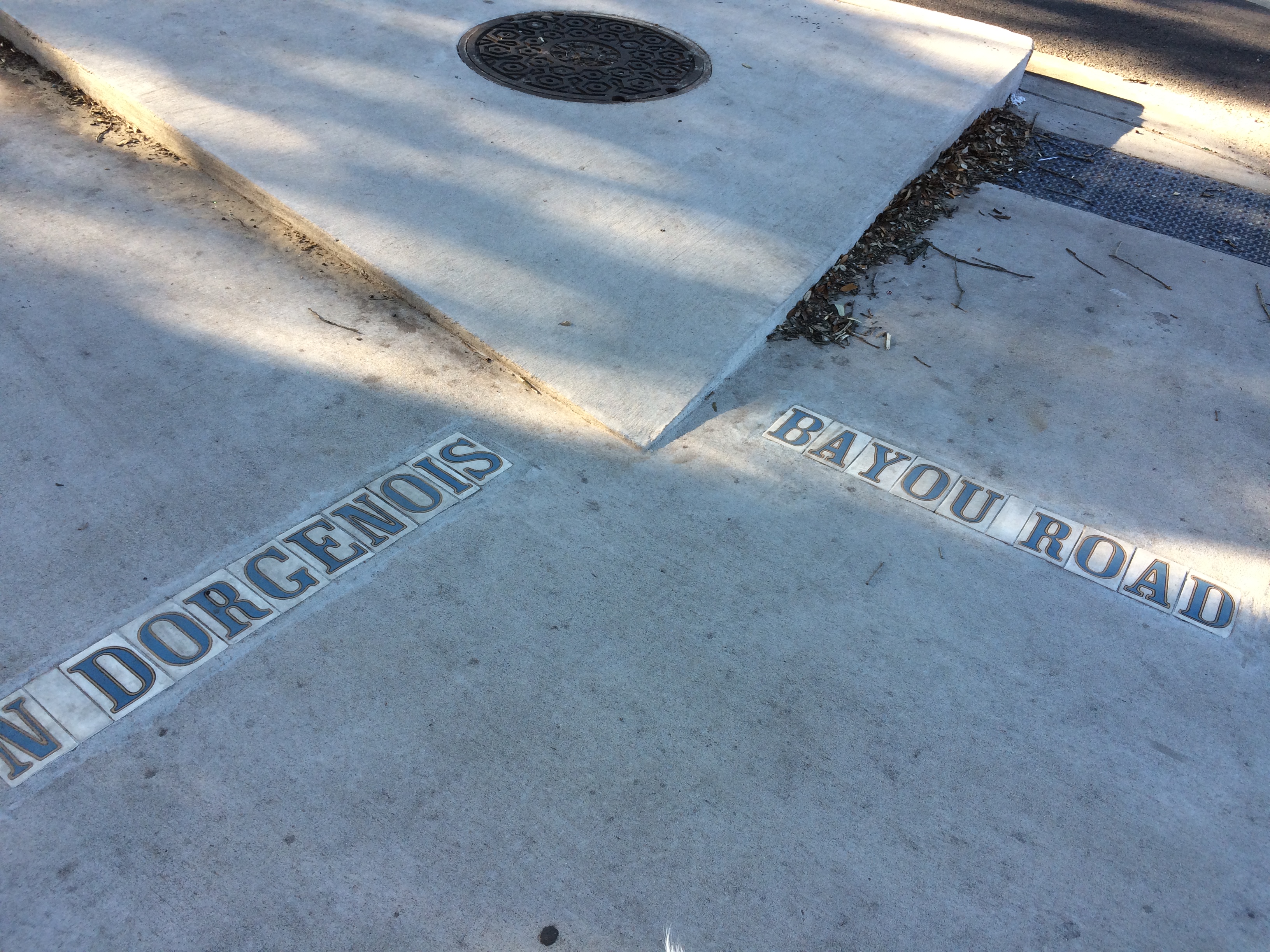
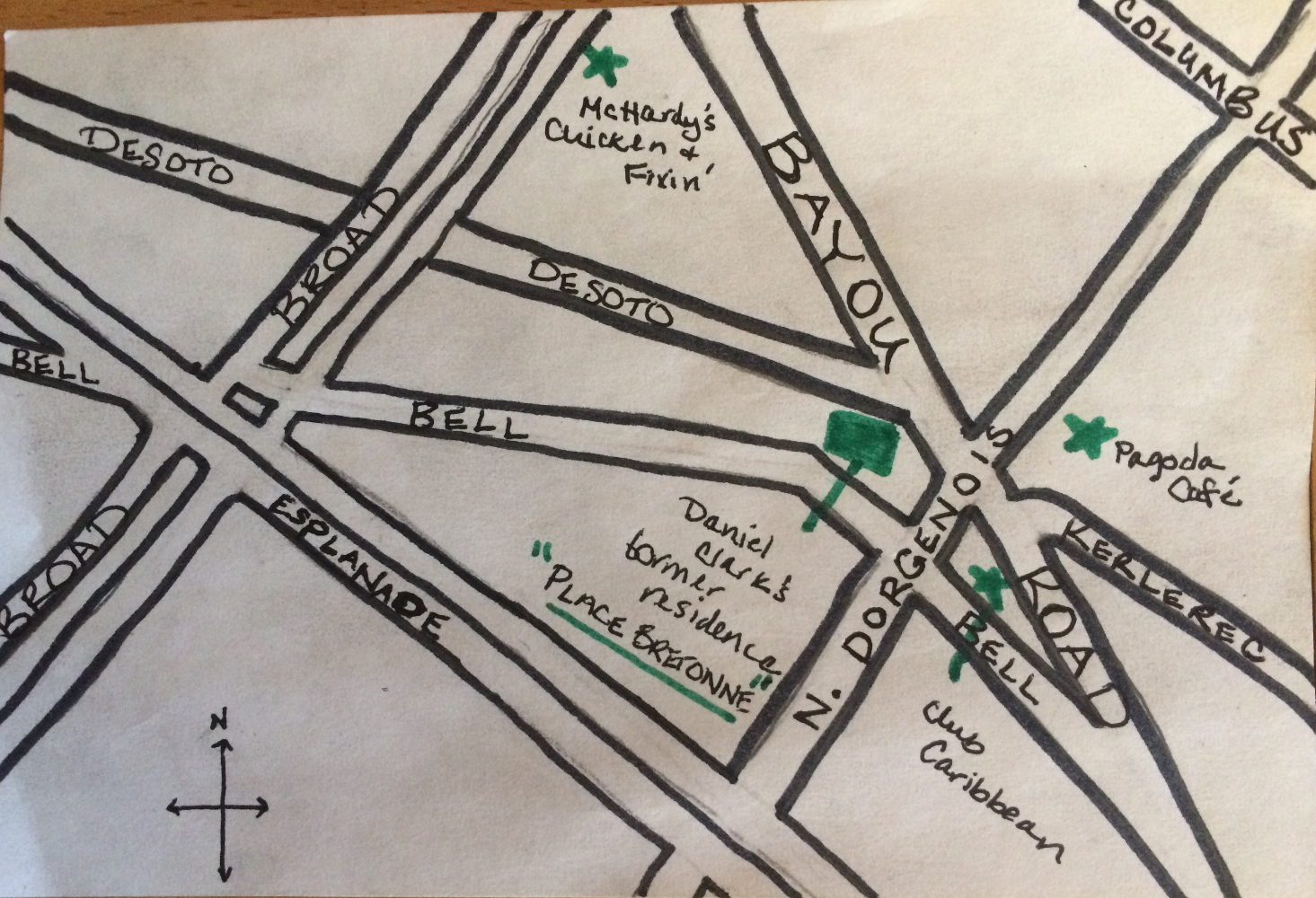
Since moving to my new address on N. Dorgenois Street, my fascination with the charming and disorienting formation of streets between Esplanade, N. Rocheblave, Columbus, and Broad has only grown. Residents may know this spot as home to Pagoda Café, Club Caribbean, and McHardy’s Chicken.

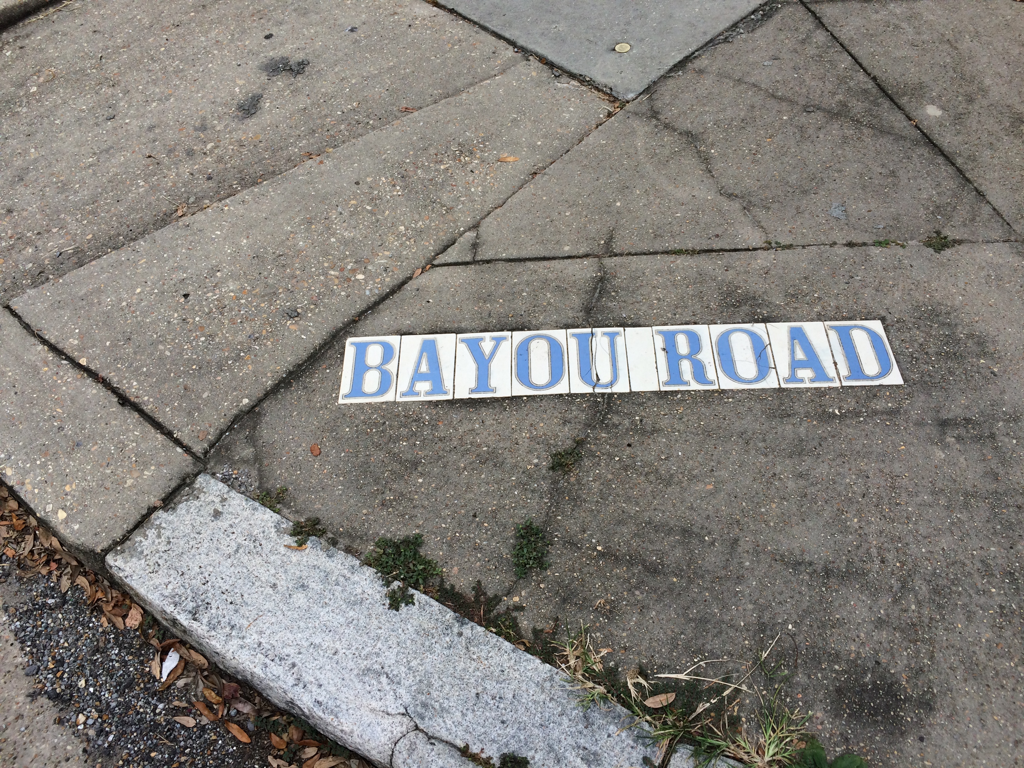
From N. Dorgenois, facing Bayou Road and Bell Street. photo by author

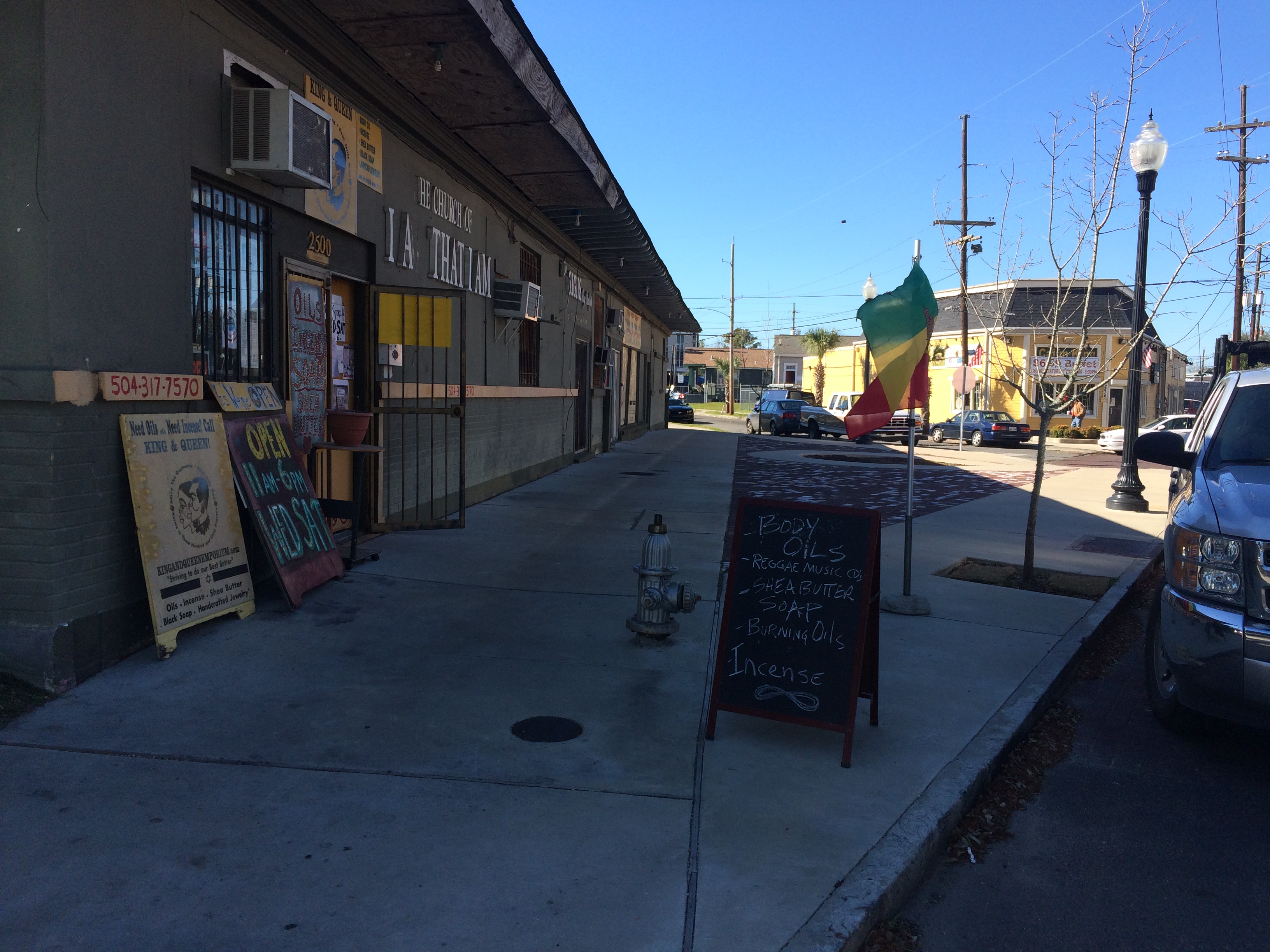
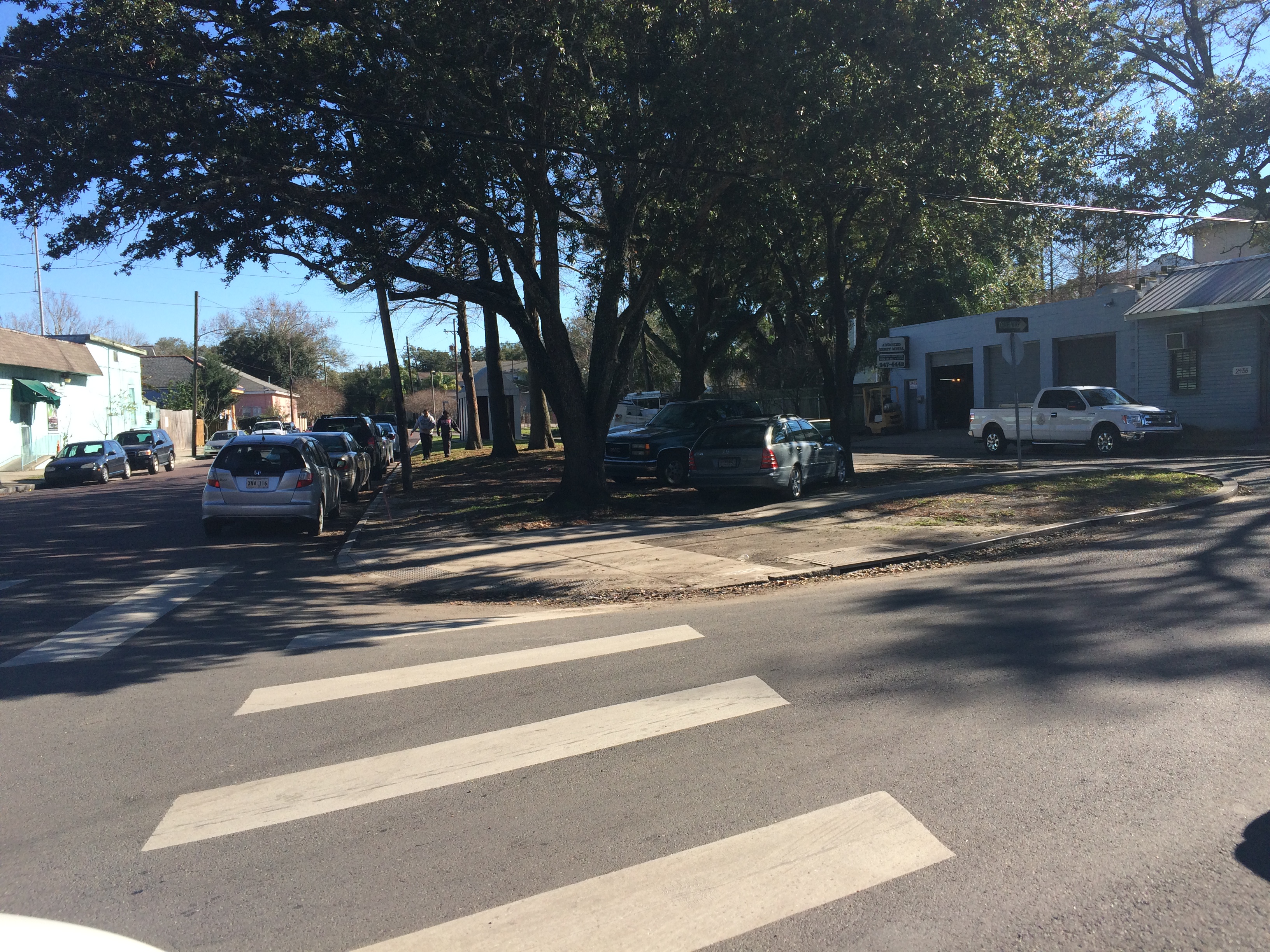
Alongside King and Queen Emporium Itn’l on Bayou Road, facing where Desoto breaks off to the left. photo by author

This bizarre intersection has everything to do with the odd-angled Bayou Road, “the road, trace, or portage [that] predated the city, following a narrow strip of high land that led from the Mississippi River past Bayou Sauvage, called Gentilly, to an intersection with Bayou St. John”[1]. Bayou Road was the thread, some argue, that made New Orleans possible—by lending the French a “backdoor route” from the Gulf through Lakes Borgne and Pontchartrain, down Bayou St. John, along the elevated ridge Bayou Road occupies to the Mississippi’s banks. The French could perch along the river’s edge, and thereby control the entire massive artery, without having to fight their way up its tumultuous mouth.

New Orleans Architecture explains that the corridor of “Bayou Road, on both its left and right sides, served as frontage for a series of concessions made first by the Company of the Indies, then by the kings of France, and later, the Spanish Crown. Simultaneously to the laying out of the city [ the present-day French Quarter]…these tracts of land to the rear of the city were developed into habitations (plantations) with houses and outbuildings facing each side of Bayou Road, having orchards behind and cultivated fields extending to the swamps” [2]. Even after the neighborhoods flanking Bayou Road were developed according to orthogonal street grids in the 19th century onward, Bayou Road was left to continue on its ancient, crooked way—there were too many houses and buildings already oriented along its trajectory.

So, back to my favorite intersection! Where, like, seven irregular triangles touch noses! The energy of the spot kept pulling me in, but until I did a little extra research in order to write this post, I didn’t realize how truly charged it was.…

It turns out N. Dorgenois Street formed the boundary line between some of these Bayou Road plantations that were continually changing hands throughout the city’s early history.

Chains of title can be kind of dull, but, in brief, between 1723 and 1834 the swath of land between N. Dorgenois and Bayou St. John (broken up into various parcels) was owned by folks with surnames like: Française, Langlois, Lebreton, Brasilier, Chalon, Almonester (the city’s wealthiest resident by the mid-1780s), Blanc, Vidal, Suarez, Clark, and Blanc again, until “…on September 26, 1836, Blanc sold to the Corporation of the City of New Orleans his ‘land or plantation, irregularly shaped having about twelve arpents frontage on Bayou St. John and bound by said Bayou, Carondelet Canal, Bayou Road, and Dorgenois…for $50,000’”[3].

Until around the time of the Louisiana Purchase, the particular sliver of land between N. Dorgenois and Broad was cultivated, but had no structures on it yet. Then comes Daniel Clark, Jr., the man who wanted to turn the land between the bayou and Dorgenois into Faubourg St. John. Historian Lawrence Powell tells us more about Clark: “…a young Philedelphian named Daniel Clark, Jr., Irish-born and Eton-educated, parlayed fluency in French and Spanish to become Governor Miró’s English translator, and then used that position to facilitate an illegal tobacco trade in which the governor silently partnered with Clark’s uncle, a wealthy Baton Rouge planter and New Orleans merchant. The younger Clark soon amassed a fortune from shipping and real estate, in the meantime joining the ranks of the slave-holding gentry”[4]. Later Powell tells us the two Daniel Clarks were some of the city’s largest slave-importers during the latter half of the 18th century.

Daniel Clark’s daughter, Myra Clark Gaines, stalled the development of Faubourg St. John after Clark’s death for close tosix decades via “the longest-running lawsuit in the history of the United States court system”(!!!) claiming she was the sole heir to his properties. (More on this fascinating lawsuit to come!) Before he died, Clark had succeeded in subdividing the faubourg into 35 irregularly-shaped blocks, however, and had envisioned the focal point of the neighborhood to be the fan-like formation of streets that inspired this blog post. New Orleans Architecture tells us that Clark built his country seat at the juncture of Bell, Desoto, and Bayou Road, roughly where King & Queen Emporium International is today. He died in the house in 1813 and it “ultimately fell into ruin and was demolished” [5].

So now we know a bit about the mainstream history of this tangle of streets in the 7th Ward. In my next post, I will seek to explore the little-known, less-recognized facets of this intersection’s history.…

1. Roulhac Toledano and Mary Louise Christovich, New Orleans Architecture Volume VI: Faubourg Tremé and the Bayou Road (Gretna: Pelican Publishing Company, 1980) xi.
2. Toledano and Christovich, New Orleans Architecture, xi.
3. Toledano and Christovich, New Orleans Architecture, 54-56.
4. Lawrence N. Powell, The Accidental City: Improvising New Orleans (Cambridge: Harvard University Press, 2012) 194.
5. Toledano and Christovich, New Orleans Architecture, 56.

FLUNG ROSES AND STOPLIGHT GRAVEYARDS

After a long hiatus, bayou posts are back! I know you’ve been waiting on tenterhooks….

After four months of more general Bayou St. John research, I am about to start focused research for the first chapter of the book—on the bayou’s geomorphic/geographic and Native American history. If anyone has any advice for me—ideas for what to read, who to talk to, etc.—reach out! I get to talk about former Mississippi River pathways, sediment deposits, pirogues, trade routes, slight-but-significant ridges.… CAN’T WAIT.

The past couple weeks, I’ve been on a few bayou adventures.

I biked the almost-100%-completed Lafitte Greenway—a 2.6-mile bicycle and pedestrian trail extending from N. Alexander St., near the base of City Park, to the French Quarter.

New Orleans residents may or may not realize that the Lafitte Greenway follows the path of the former Carondelet Canal, a waterway hand-dug by slaves in the late 18th century, when New Orleans was still under Spanish control, and utilized throughout the 19th century as a commercial conduit between the bayou and the French Quarter. This meant ships laden with goods from settlements north of Lake Pontchartrain or along the Gulf could avoid navigating the Mississippi River altogether and travel through Lake Pontchartrain, down Bayou St. John and into the Carondelet Canal in order to off-load their goods at the rear of the French Quarter.

A vew of the Lafitte Greenway between the bayou and Broad St.

If you ever wondered where old New Orleans stoplights ended up….

The open canal that runs between Broad Street and the bayou, positively gushing as it exits the Broad St. pumping station. Doesn’t it look almost turquoise? Don’t let that fool you. It stinks.

The giant locks at the Broad St. pumping station that control whether water flows up the underground culvert beneath Broad St., or else out to the Orleans outfall canal, via the open canal along the greenway.

There is much more I could (and WILL, in the book) say about the Carondelet Canal. But for now: there is a fabulous (free!) exhibit at the Pitot House on the history of the Carondelet Canal, curated by the Louisiana Landmarks Society, in celebration of the opening of the Lafitte Greenway. So many beautiful old maps and photographs!!! It is both succinct and intensely interesting. I HIGHLY recommend it.

After biking the greenway, I checked out the historic Ossorno House in the Quarter, at 913 Governor Nicholls.

This house was built on the Bayou St. John sometime before 1781 and apparently dismantled and transported, most likely via mule and cart, along Bayou Road to its present location—as were all goods traveling from the bayou to the Quarter before the Carondelet Canal was dug. According to geographic historian Richard Campanella (one of my heroes), in his Geographies of New Orleans: Urban Fabrics Before the Storm, the house is a fine example of a French Creole-style plantation house (although the roof was remodeled sometime in the 1830s)—one of only two plantation-style houses to be found in the French Quarter (the other being Madame John’s Legacy)—which testifies to its rural birth on the bayou. Campanella tells us it’s “the oldest extant structure in the rear of the original city” (106).

I then decided to bike the approximate path of this all-important route along Bayou Road, one of the principal reasons why New Orleans was founded where it was (for access to the river without having to navigate its mouth, as was mentioned above).

In traveling along the (approximate) portage route, one follows Bayou Road, which ends at the crazy, navigationally-nightmarish, odd-angled intersection of Bayou Road, N. Dorgenois, Desoto, Bell, and Kerlerec streets (thank god there’s delicious food right there, at Pagoda Cafe, for the weary, confused traveler) and continues along Bell Street (approximately) to the bayou. The exact location of the original route’s intersection with the bayou was probably somewhere between Bell St. and Desoto (more on this once I continue more in-depth research on the subject).

This terrible panoramic photo (thanks iPhone!) taken from next to Pagoda Cafe, while inaccurate in perspective, I think does justice to the psychological experience of navigating this intersection….

While in this neighborhood, I found…

A historic cornstalk fence at the historic (1870) Dufour-Plassan House.

The approximate general region where Almonaster built a leper hospital in the late 18th century.

An awkward spot where Barracks Street and Bayou Road diverge at a bizarre angle, since Bayou Road does not adhere to the grid plan the rest of the streets in the area adhere to—following, as it does, a natural ridge, the one the Native Americans used to cross the uncrossable swamp between the bayou and what is now the French Quarter.

Finally, I arrived at the bayou itself. Here are a few spots of interest along its banks, a couple of which I was lucky enough to get to go inside of (!!), courtesy of the generous, unsuspecting homeowners I found busying themselves in their front yards.

The house, at 1222 Moss Street, that sits atop what was once a small bayou connecting Bayou St. John and Bayou Sauvage, long since filled in.

What is referred to as “the old Spanish custom house,” although it never officially served as a custom house (there are various theories as to why people refer to it as such). I was lucky enough to get an in-depth tour of the inside of this home (!!!), the owner of which has been painstakingly renovating it for six years. Beneath layers and layers of renovations that have been done over the past two and a half centuries, he has made some amazing discoveries—like anactual iron jail cell, apparently dating from the Spanish colonial period, that the current owner suspects was used to hold folks who were smuggling illegal goods up the bayou, or who perhaps couldn’t pay the toll. ARE YOU KIDDING THAT’S AMAZING.

Below is the plaque that explains a bit more about the house.


Roses that someone had flung into the bayou near the Magnolia Bridge.

And, last but certainly not least, what is perhaps my favorite historic house along the bayou, built in the last decade of the 18th century: “The Sanctuary.” Walter Parker, former mayor of New Orleans, who spearheaded the “beautification” of the bayou in the 1920s and 1930s and who is therefore responsible, in large part, for the bayou as we know it today, once lived in this house. I wasalsolucky enough to be able to see the back courtyard of this home—guarded by a three-hundred-year-old live oak tree that predates the house, and other amazing, old, beautiful things. More on this house, and its many previous owners, to come.