FANTASIES OF HISTORY-SIFTING

In 2013, as part of FEMA’s Environmental and Historic Preservation program, archaeologists conducted a dig at the colloquially-named Spanish Fort site along Bayou St. John. I’m lucky enough to have been given an official report of the dig, which includes both historical information as well as an exhaustive inventory of discovered artifacts.

The behemoth is somewhere around 450 pages long, and much of it is incomprehensible to those of us not trained in the field. However, the artifact list is poet’s dream come true—a veritable treasure-trove of bizarre sounds, a cacophony of seemingly disparate words placed side-by-side, which, to the uninitiated, reads like nonsense delivered with utter authority. Object names—a “post-bottom mold base,” for example—could mean anything, and yet, one knows without a doubt that every object, whatever it may be, is steeped in history.

Right away, I longed to write a poem in which I pretended to be an archaeologist, so I could appropriate some of this language: a hyper-focussed, hyper-detailed sifter of history, another version of myself on hands-and-knees, troweling, brushing, labeling, gently lifting, gently rinsing (you know, all the things archaeologists do, but more whimsical and exaggerated) to find the fragments of forgotten stories.

If I were to write a poem from the perspective of my archaeologist alter-ego, here are some of the words and phrases I might use (jumbled up from the official inventory mentioned above):

grog-tempered ceramic sherds,one rim sherd, two body sherds,one from each stratum

ball clay pipe

pink-bodied/buff-bodied Albany slip

amber, cobalt, olive, aqua

cut nails, cut spike, soft paste

indeterminate amorphous ferrous metal

salt-glazed

indeterminate spike

slag, mortar, coquina, concrete

scalloped rim sherd like a segmentof a humpback’s fin [she adds in a metaphor]

a singular stamped pipe stem reading “BELLE/SERVE”

sliders, cooters, painted turtles

tooled bead, tooled blob, applied blob, applied brandy

applied champagne, chert pebbles

button, hinge, wire, dagger

UID bird

faunal material:evidence of butchering: pig rib, cow patella [1]

Ok, ok—back to the history. I learned so much from this report! Last summer, I posted about an adventure I took to the Spanish Fort, and I included photographs of conical piles of rocks (if you’ve been there, I’m sure you know what I’m talking about!) that I just couldn’t make sense of….

photo by author

*drum roll please*

The report has informed me that these are the remnants of granite rock fountains built in the late 19th century when the amusement park at the Spanish Fort site was at its zenith. Alligators in pens! Music halls and fish ponds! Carousels! Railroad cars with patrons pouring out of them! And yes, granite fountains, spilling and bubbling, day and night….

Ok, the poet has tired herself out now. I promise more history next time!

1. 2013  Phase I Archaeological Inventory of Portions of New Orleans City Park and Phase II Testing and Evaluation of Sites 16OR626 and 16OR19 in New Orleans, Orleans Parish, Louisiana & Analysis of 1976 Archaeological Collection from Fort St John/Spanish Fort (Site 16OR19), prepared for FEMA by R. Christopher Goodwin & Associates, Inc. , New Orleans, LA.

LOAFING ROWDIES AND GOOSE RACES

This past New Year’s Eve, there was no shortage of conflict between revelers and police along Bayou St. John. I personally witnessed a city garbage truck chow down on a wooden barge that was to be set into the bayou near Magnolia Bridge and lit on fire—an extension, perhaps, of the debates over New Year’s Eve bonfires in Mid-City over the past decade.

The bayou, you may not be surprised to learn, has been the site of many “fringe rituals” over the centuries—as well as plenty of city-sanctioned recreational activities too, of course. New Orleans seems to specialize in these kinds of tensions; apparently we simply cannot resist the opportunity for a bit of fun, no matter the potential repercussions.…

In perusing the City Engineer’s Bridge Records from 1918-1967 this past summer, I found a letter from Walter Parker, Chairman of the Bayou St. John Improvement Association and future New Orleans mayor, to Honorable George Reyer, Superintendent of Police, dated April 10, 1934:

“It would help a great deal were some of your men to pass along the Bayou as frequently as practicable. Some boys who do not have bathing suits, do not hesitate to bathe in very scant underwear. At the Dumaine Street bridge many boys make the dangerous practice of climbing on the bridge structure. At the Magnolia Bridge (Harding Drive) boys dive from the top of the bridge pretty much all day. In so far as I know, people have a right to fish on the Bayou. But when they leave crab bait, old papers and remnants of lunch behind, they create a nuisance. I have found that such things usually are the result of thoughtlessness rather than viciousness, and a simple request or word of warning brings a correction….” [1]

Many of you have probably heard about the annual St. John’s Eve voodoo ceremony that takes place on the Magnolia Bridge every June 23rd. Bayou historian Edna Freiberg explains that after the Haitian Revolution, New Orleans authorities began to get jittery about potential slave uprisings in their own city. On October 15, 1817, City Council forbid people of color from congregating in large groups “except in times and places specified by authorities.” [2]

Following this mandate, voodoo rituals moved to the untamed upper bayou, along the shores of Lake Pontchartrain, where the authorities wouldn’t be as likely to quash them. The voodoo rituals performed on the bayou today may be an extension of these religious ceremonies pushed to the fringe by the powers that be. (More on this when I conduct in-depth research on the subject.)

Aside from the recreational pursuits of the New Orleans elite in the 19th and early 20th centuries (rowing races for which thousands of finely-dressed spectators turned out during the summer months; picnics at Magnolia Gardens, where visitors could purchase beer and ice cream; sketching parties on the bayou’s banks; a “young ladies rowing club,” complete with “costumes” and “chaperones”; and “pleasure drives” along the shell road to Lake Pontchartrain, to name a few), neither was there a shortage of ad hoc recreational events along the bayou during those years, some deemed more acceptable than others.

Readers may remember a “strange duel” I mentioned in a previous post, for example.

Or take this Times-Picayune piece from June 20, 1872, in which a set of “loafing rowdies” are up to no good: “The attention of the police is called to the fact there is a crowd of men who daily congregate on or about the bridge over Bayou St. John and demean themselves most disgracefully. They appear to find especial pleasure in making use of the vilest sort of language, yelling, singing unchaste songs, and insulting persons whose necessities carry them in that direction. This sort of thing has grown to be an intolerable nuisance, and should be abated at once. Bayou St. John is one of our most popular afternoon promenades during the heated term, and the ladies and gentlemen who seek recreation and pleasure at that point are entitled to a share of police protection from the misconduct of loafing rowdies. It is suggested that one or more officers be stationed near the bridge, day and night, as the services of the police are very often needed by the residents in the neighborhood.”[3]

And one of my favorite examples, from 1876: “A goose race is proposed to come off at Bayou St. John next Sunday. There will be several contestants, each in his tub, which will be drawn upon the water by six geese. There distance will be one hundred yards.”[4] Does anyone else feel like a hundred yards is actually pretty far to travel via goose-drawn tub?

Or an example of the kind of entertainment one might hope to find on a summer’s day at Spanish Fort: “Prof. Clark, the renowned swimmer, appears again this evening and to-morrow in a series of difficult feats on water at the lake end of Bayou St. John. This novel exhibition is to include eating, drinking, and writing under water; also a military drill by the skillful Professor. To the end of providing for the many going, the cars of the City Park and Lake Railroad will run every half hour without fail.”[5]

Lastly, although this is a bit of a stretch, I wanted to include the strange recreational habits of a Mrs. Taylor Shatford, who lived for a time on Bayou St. John: “It was in 1916, after a trip abroad, that Mrs. Shatford became convinced that she was controlled by the spirit of Shakespeare. Operating with a ouija board she began to take dictation from him, and later declared she had trained her psychic senses…and could actually hear the words from his ghostly lips.”

The article provides us with a snippet of The Bard’s genius-beyond-the-grave, via Shatford’s ouija board: “‘We carry here the man we were. Our longings, like, some hatreds as of yore. And I who wove my rhyme am he, the same, except for my soul’s tears. To all who yearn to know if still man lives without his bones I say Complete. He dies never. His ashes are remnants of his suit. I have my whiskers still.”[6]

See?! Even the long-dead William Shakespeare can’t resist shenanigans the bayou every now and again!

1. New Orleans City Engineer’s Bridge Records, 1918-1967, City Archives Louisiana Division, New Orleans Public Library
2. Freiberg, Edna B., Bayou St. John in Colonial Louisiana 1699-1803. (New Orleans: Harvey Press, 1980) 294.
3. “The City. Public Hacks and Hack Drivers. Their Condition And Future Prospects.” Times-Picayune 20 Jun. 1872: 2. NewsBank. Web. 13 Jan. 2016.
4. “City Gossip.” Times-Picayune 29 May 1876: 2. NewsBank. Web. 13 Jan. 2016.

5. “Aquatics At Spanish Fort.” Times-Picayune 14 Jul. 1876: 1. NewsBank. Web. 13 Jan. 2016.
6. “Spirit Of Shakespeare Works Through Medium Revelations of Poet Made in New Orleans to “Medium.” Times-Picayune 11 Jan. 1920, |: 33. NewsBank. Web. 13 Jan. 2016.

THE SPANISH FORT AND ITS MANY HATS

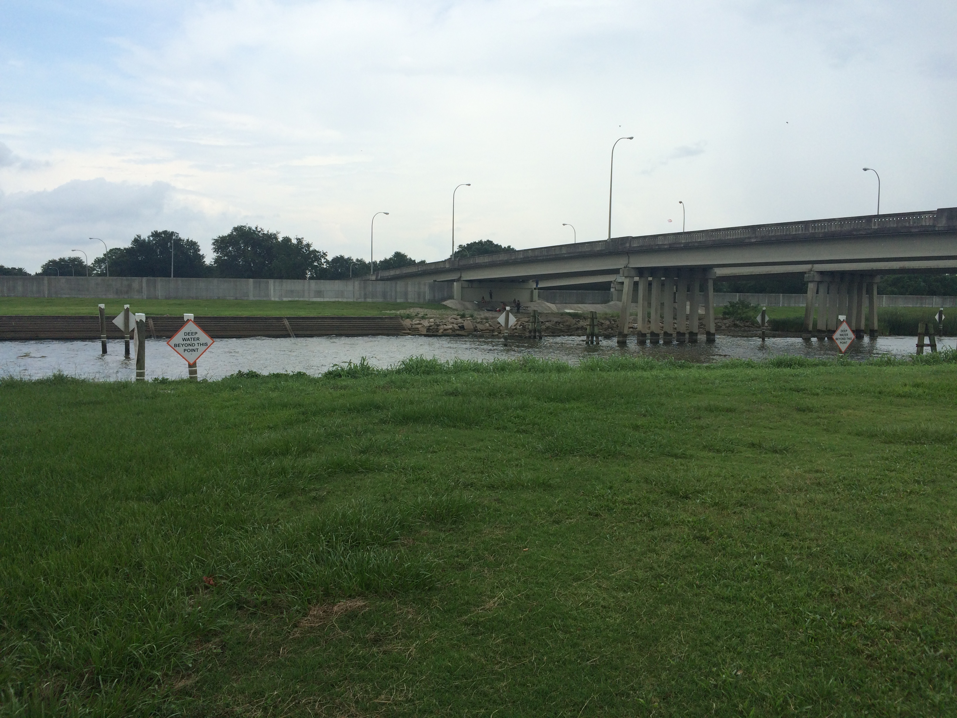
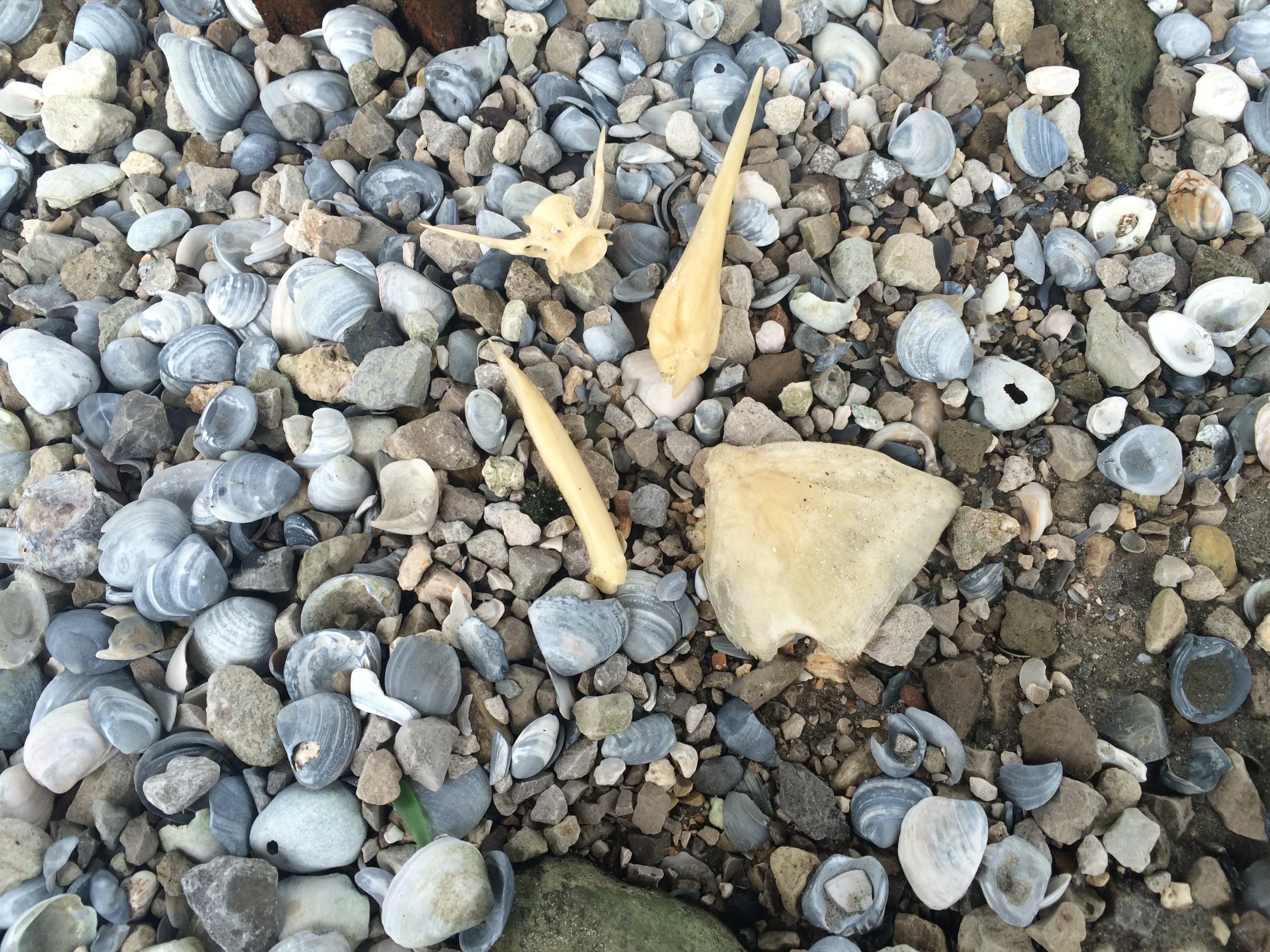
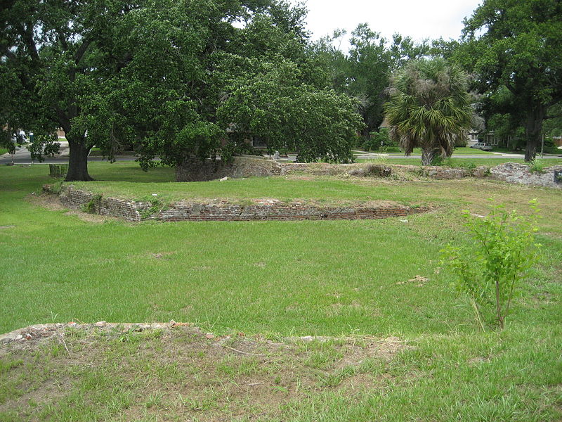
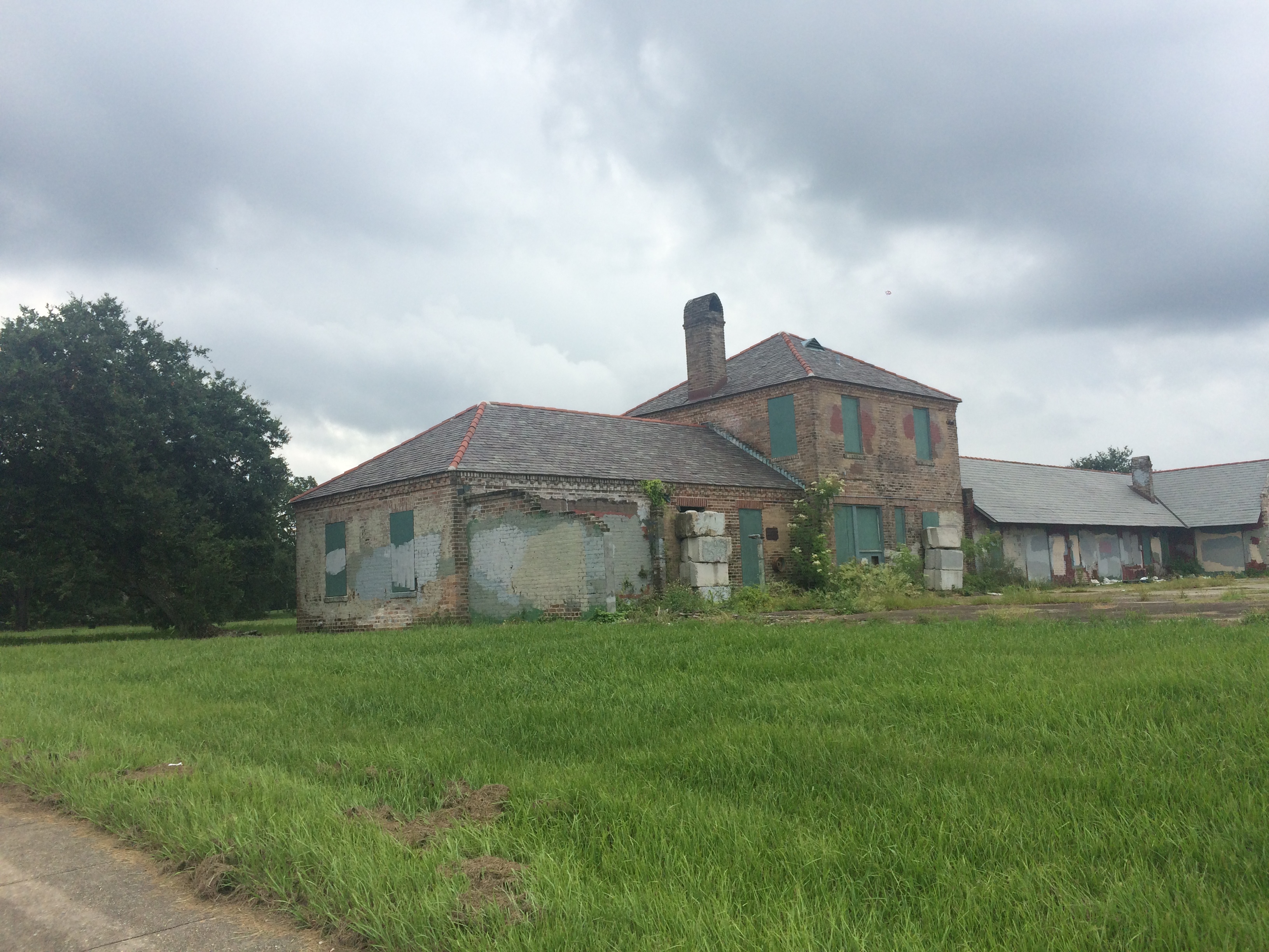
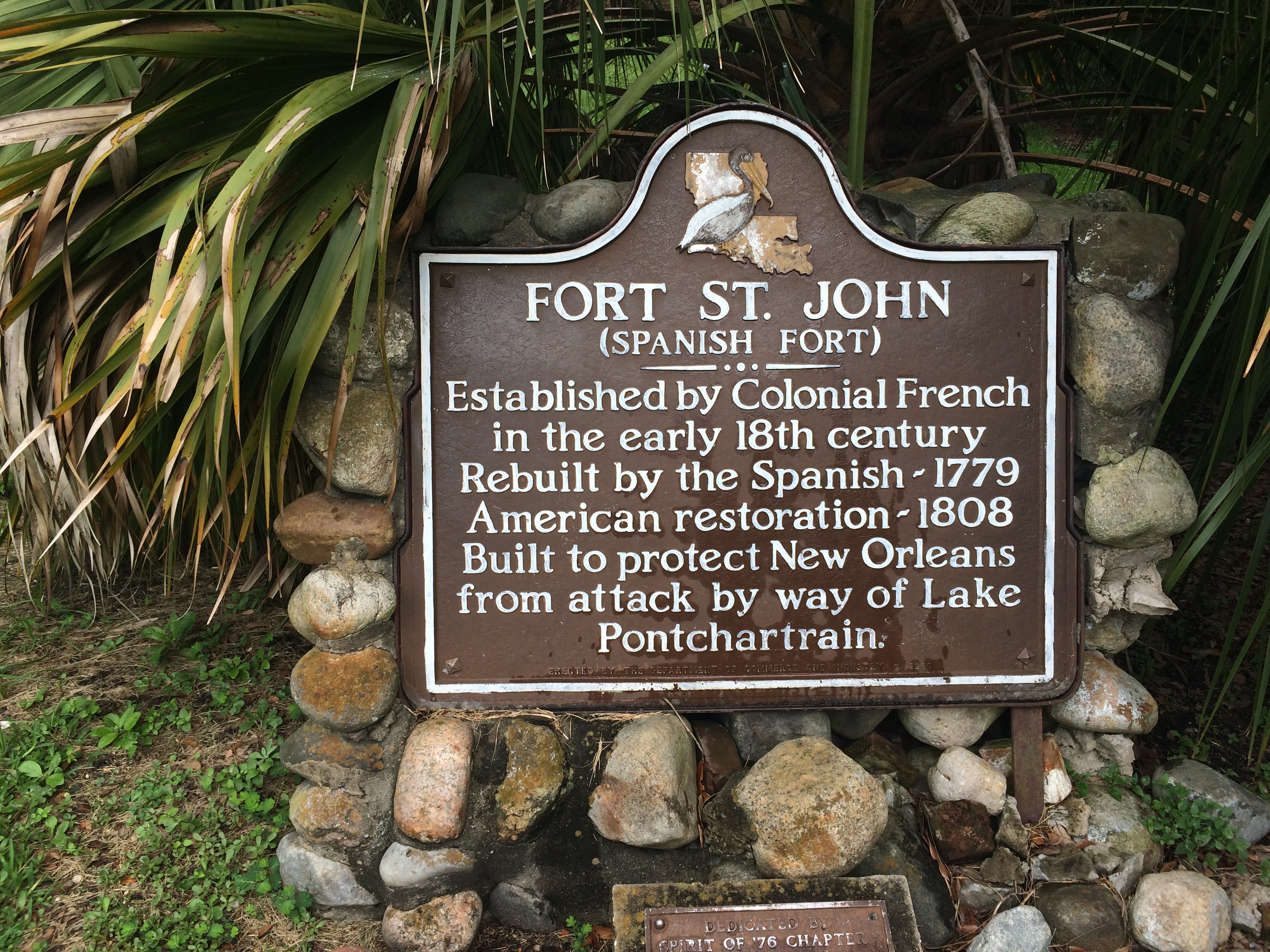
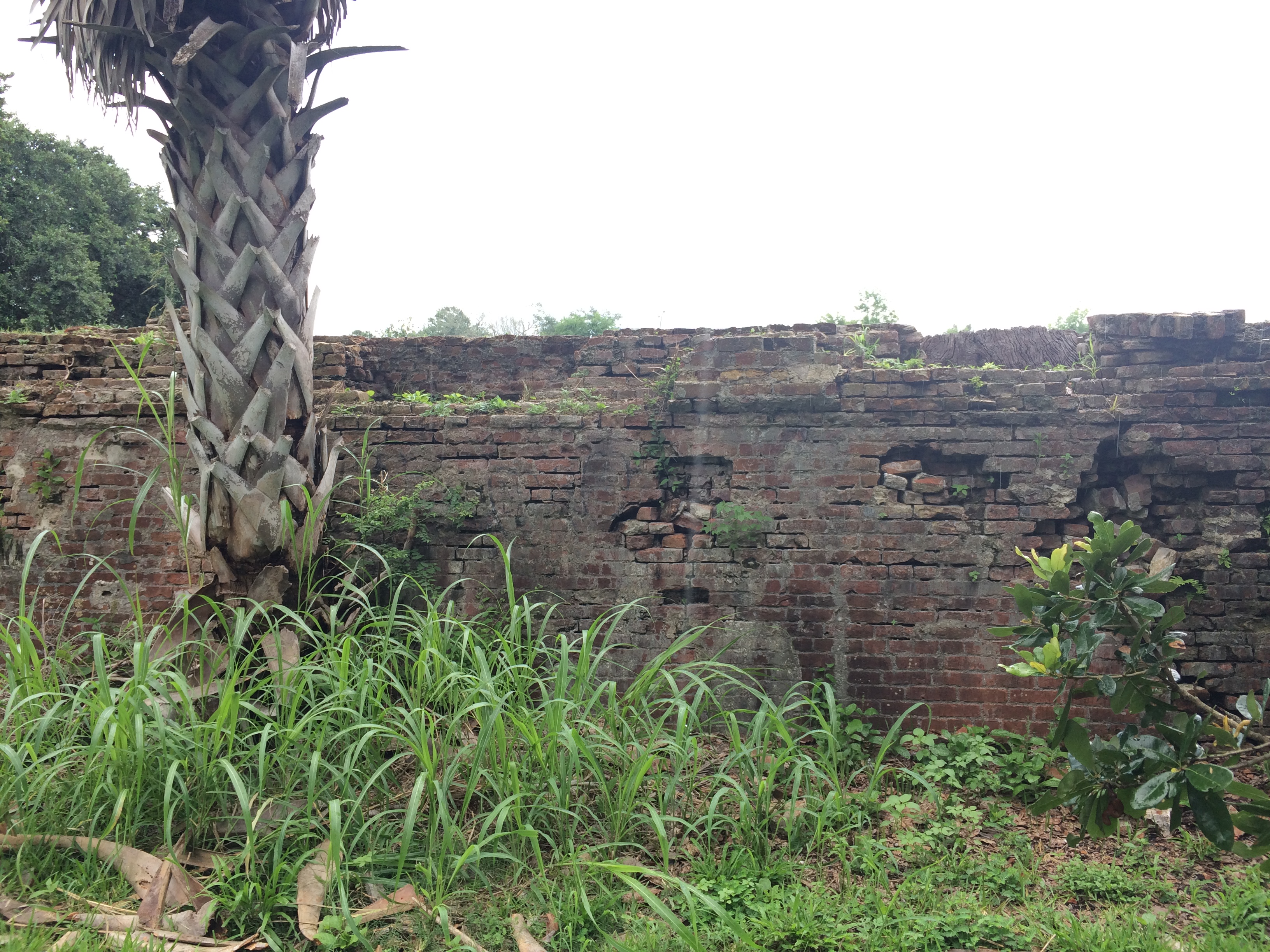
In learning recently of a 2013 archaeological dig at the colloquially termed “Spanish Fort” site on Bayou St. John, my fascination with this spot was renewed. The dig, conducted by FEMA, revealed a Native American shell midden peppered with fragments of animal bones, pottery, clay pipes, and other artifacts dating from the late Marksville period, from around 1,600-1,700 years ago.

Instead of destroying it entirely, as early colonial accounts had suggested they’d done, the French simply sliced off the top of the midden and used it as a foundation for the wooden fort they built there in 1701. The Spanish then reinforced the fort in the latter half of the 18th century, and the Americans reinforced it still further in 1808.

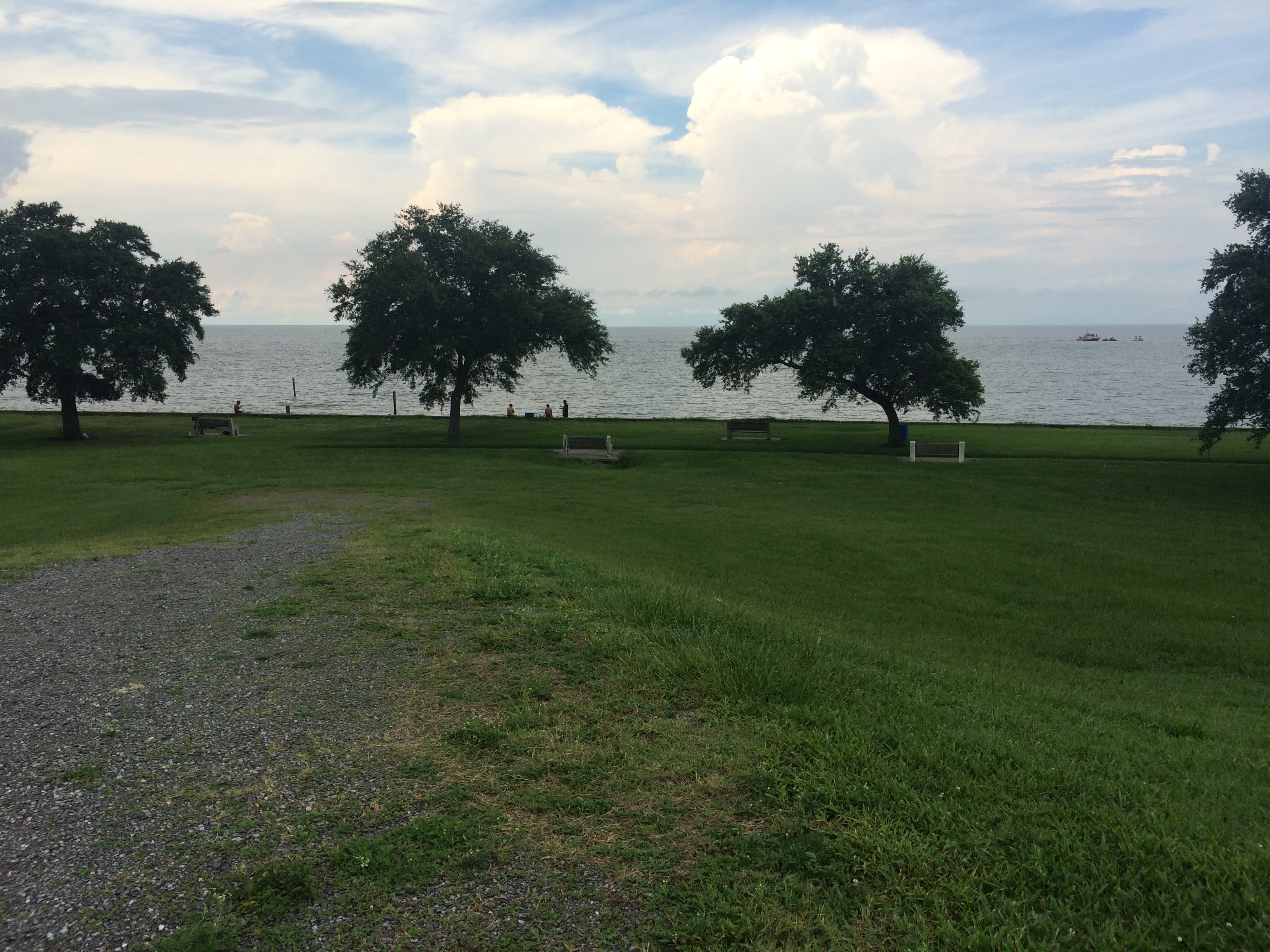
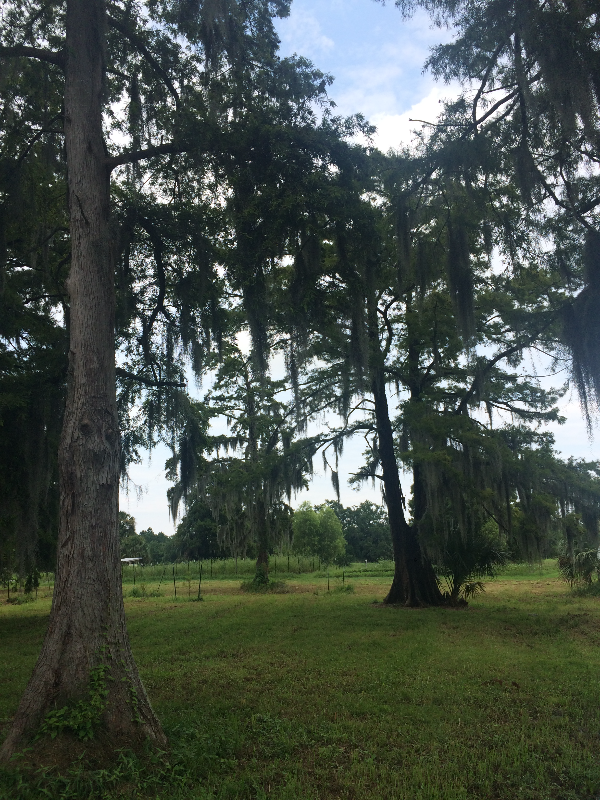
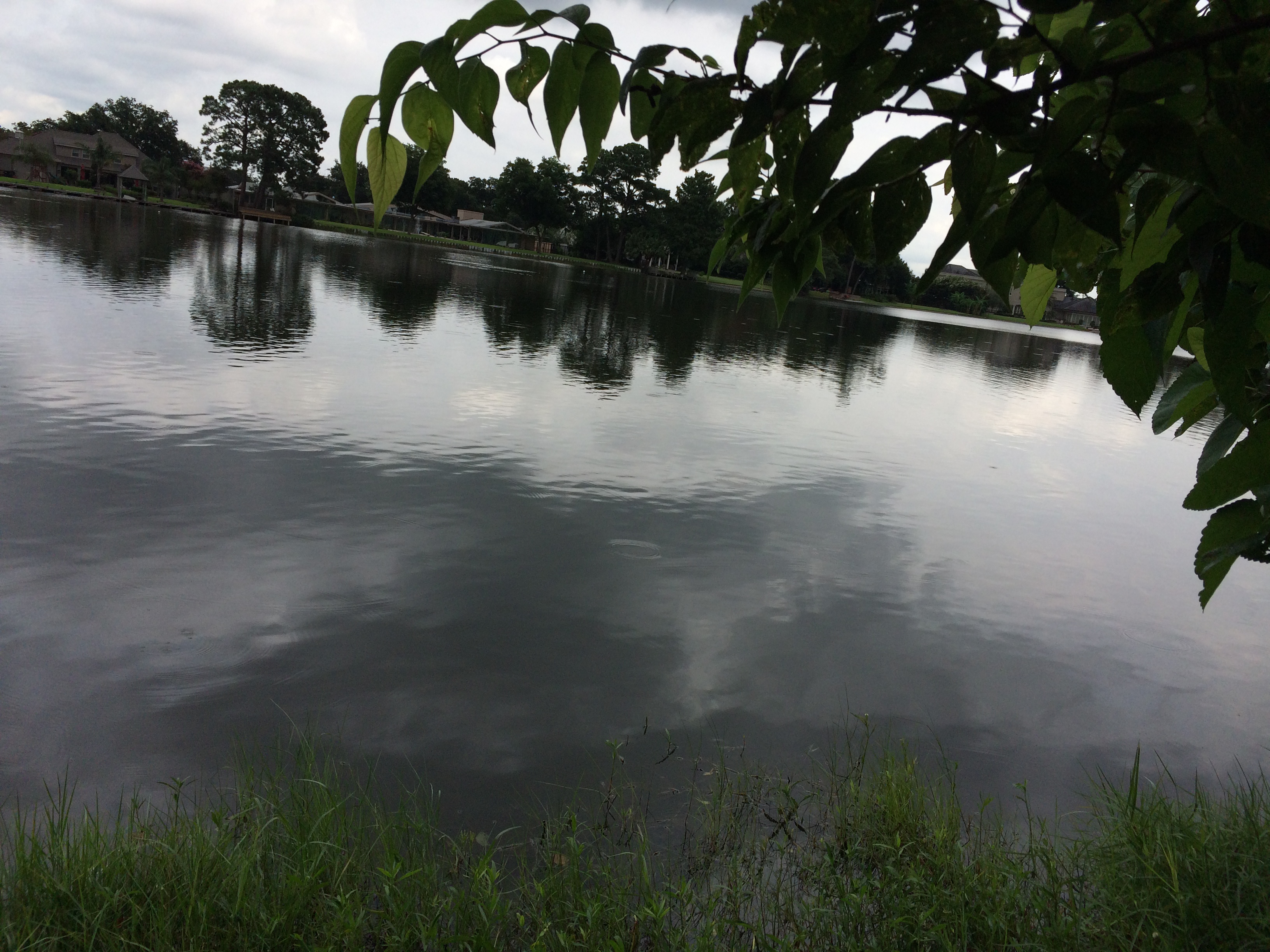
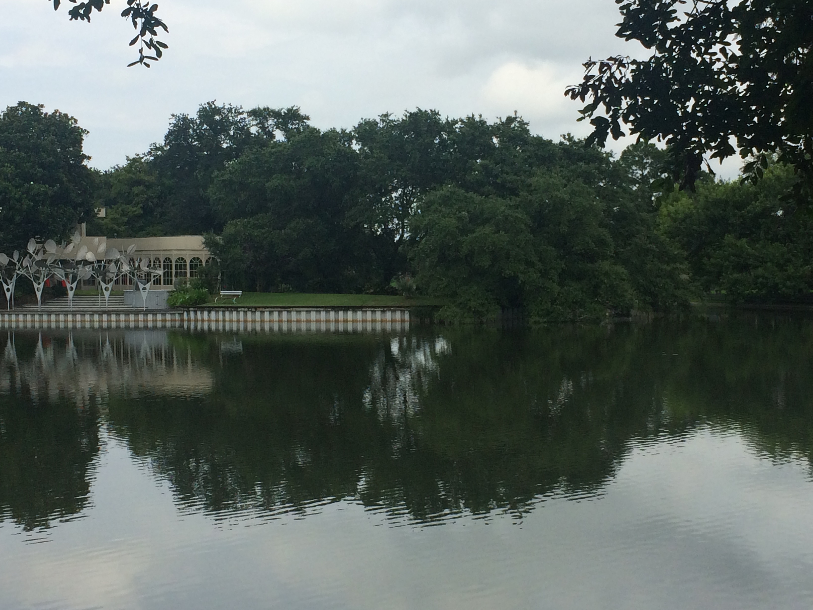
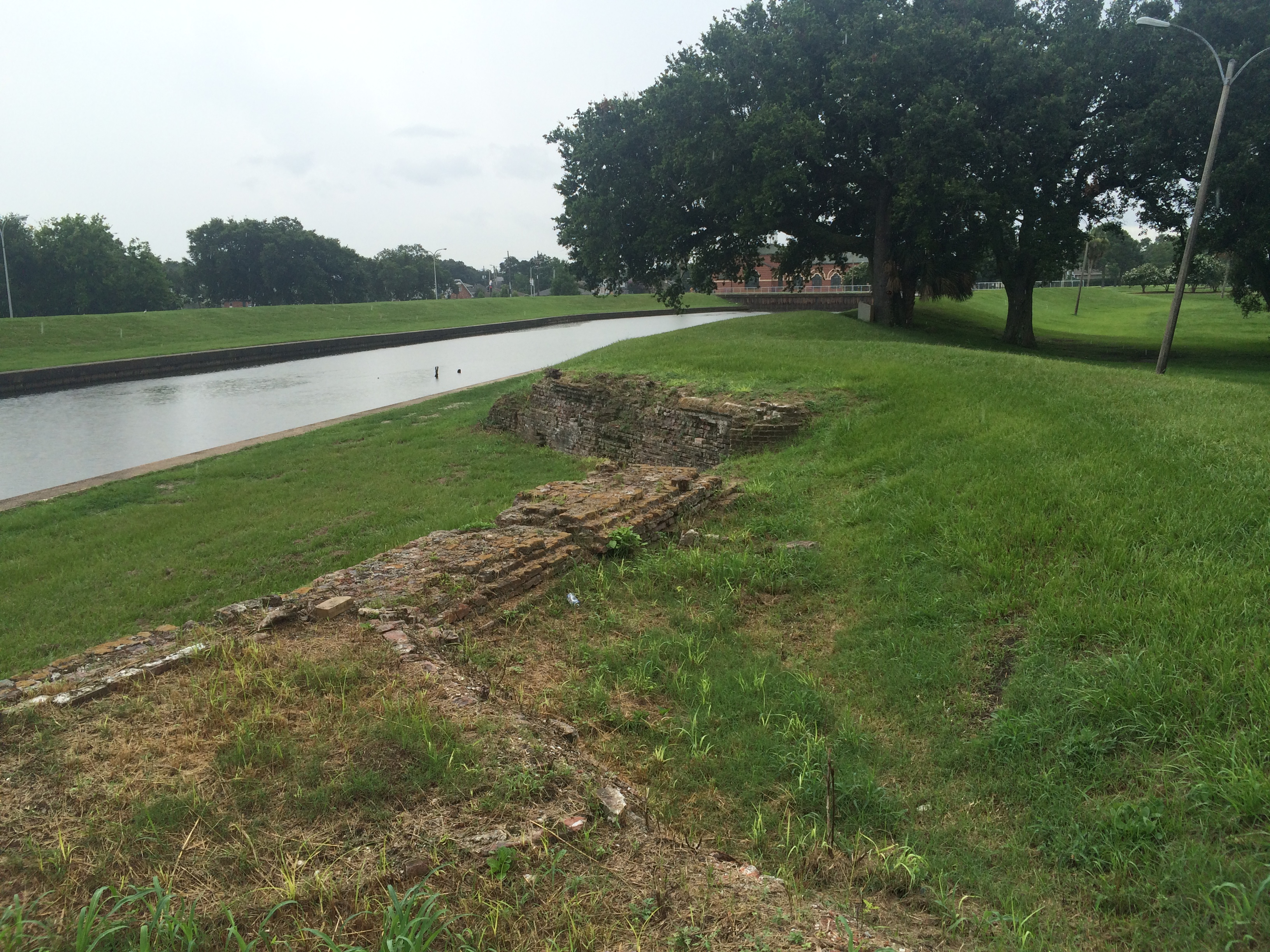
Although the fort never saw much military action, the piece of land it sits on has seen an astounding amount of human activity over the past 2,000 years. Throughout much of the 19th century, the site was a popular spot for picnics and swimming, boasting a resort hotel catering to New Orleans elite looking to escape the city and spend an afternoon on the shores of Lake Pontchartrain.

After a fire destroyed the hotel in 1906, the New Orleans Railway and Light Company built an amusement park that drew New Orleanians to the site by the thousands. By the 1920s, activity at that crook of land between Bayou St. John and the lake began to decline when the Orleans Levee Board began their extensive Lakefront Project, “reclaiming” land from the lake in Orleans Parish and fortifying it with a sea wall.

That’s a lot of activity for one small slip of bayou bank! The site has “worn many hats,” you might say—first a shell midden hat, then three different kinds of fort hats, then a hotel hat, then an amusement park hat…. What a stylish and versatile hunk of mud! Such elaborate head-pieces!

What follows are some quotations and photographic snippets of these many layers of Spanish Fort history.

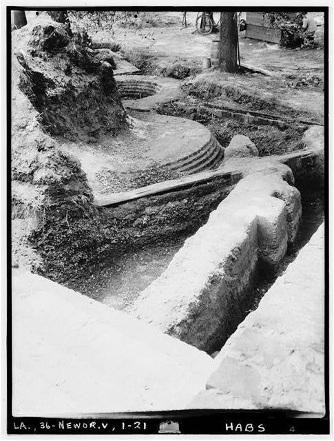
From the Library of Congress, a 1934 photo taken as part of the Historic American Buildings Survey. Look at all those layers of fort!

A notice posted by Louis Lacuna & Co. in the July 4, 1841 Times-Picayune:

The fine Hotel at the Lake end of the Bayou St. John is now ready for the reception of visitors, having every variety for amusement—Billiards, pistol shooting, bathing, &c. The Restaurant is furnished with the best the markets afford.”[1]

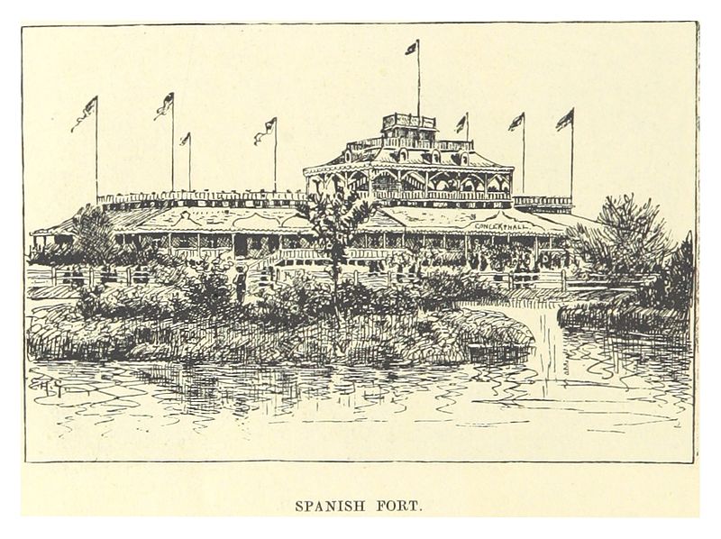
From Wikimedia Commons, a circa 1883 drawing of the Spanish Fort by Mark Twain (!) from his book Life on the Mississippi.

From a book written by Eliza Ripley, called Social Life in Old New Orleans, published in 1912, we have a description of the “Lake End” resort and what its fine dinners can do for a person’s femininity:

“There was a large hotel (there may be still—it is sixty years since I saw it), mostly consisting of spacious verandas, up and down and all around, at the lake end of the shell road, where parties could have a fish dinner and enjoy the salt breezes….The old shell road was a long drive, Bayou St. John on one side, swamps on the other, green with rushes and palmetto, clothed with the gay flowers of the swamp flag. The road terminated at Lake Pontchartrain, and there the restful piazza and a well-served dinner refreshed the inner woman.”[2]

(In reading this, I can’t help but wonder if that shell road was paved with shells dredged from the midden at the Spanish Fort site….)

On December 30, 1913, the Times-Picayune ran a full-page ad for New Orleans Railway and Light Co., in which the new amusement park was mentioned:

“SPANISH FORT: A historical spot situated on the lake shore at the junction of Bayou St. John. A delightful resort, operated in summer with music, vaudeville and light opera. Full of romantic reminiscence,—a beautiful spot, shaded with an abundance of trees and other shelters. In the summer there are many attractions, various amusement devices, restaurants, casinos, and ice cream parlors. An excellent electric train service from Canal and South Rampart St.”[3]

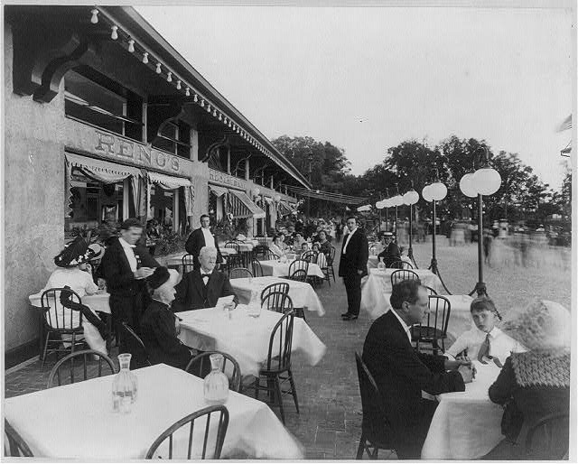
Some Spanish Fort diners in a Library of Congress photo titled “Afternoon scene of Reno’s Restaurant,” dated May 27, 1912. I love being able to see the movement of passersby just off the patio to the right….

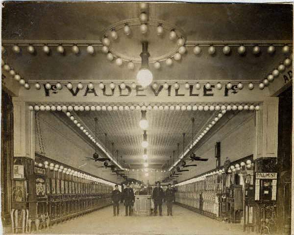
From Wikimedia Commons: “‘Fitchenberg’s Penny Arcade’ at Spanish Fort amusement park, New Orleans, circa 1910,” photo by John Norris Teunisson.

Lastly, a rollicking description of the Spanish Fort amusement park in its later years from the Times-Picayune, June 8, 1924:

“NEW RECORD MADE AT SPANISH FORT—Popular Lake Resort Reports Heaviest Attendance in Its History—The last week witnesses a new record for crowds at Spanish Fort amusement park. Despite the rain thousands of Orleanians attended the dances at Tokio Gardens and made a round of the various amusements and concessions, including the Giant Dipper, the Dodgem, the Whip, the Caterpillar, the Merry-Go-Round, the Penny-Arcade and other attractions. As usual Emile Tosso and his concert band drew a heavy patronage….Tokio Gardens continues to be the center of attraction of the younger dancing set of the city, and any night until midnight hundreds of dancers attend. Of all the thrilling attractions at the park, the Giant Dipper seems to have the most appeal. The thriller is a mile long and is negotiated at the rapid speed of 57 seconds. Second in popularity is the Dodgem, which has all the excitement of a railroad wreck with none of the dangers. The Whip, next in choice of the crowds, is the famous ride first established at Coney Island. The Caterpillar is especially popular with young couples. It consists of riding under cover in the dark at a rapid speed in an artificial cyclone.…With the increase in temperatures many persons are finding relaxation at Tranchina’s bathing pavilion where all facilities for an enjoyable swim are at hand, including dressing rooms, towels, lockers, bathing suits and other equipment, such as slides and chutes of the finest type.…”[4]

Shooting through the darkness with one’s sweetheart “at a rapid speed”—that Caterpillar sounds positively scandalous!

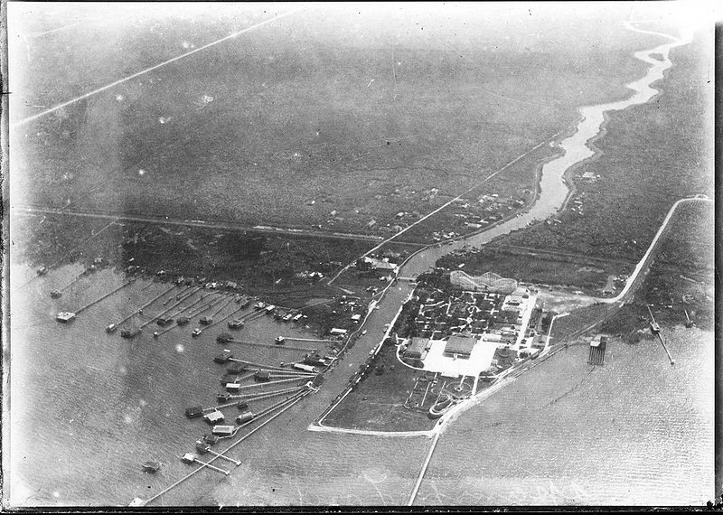
From Wikimedia Commons, before the Lakefront Project extended the lake shore: “Aerial photograph of Spanish Fort Amusement Park, New Orleans, 1922. Showing intersection of Bayou St. John and Lake Pontchartrain, “camp” houses on piers in the shallows of the lake, and undeveloped (pasture) land to the south.”

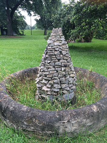
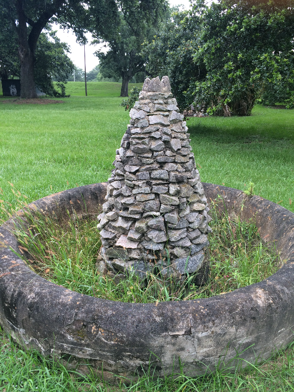
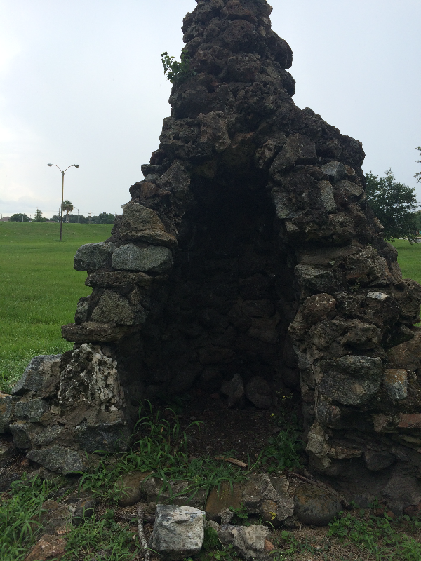
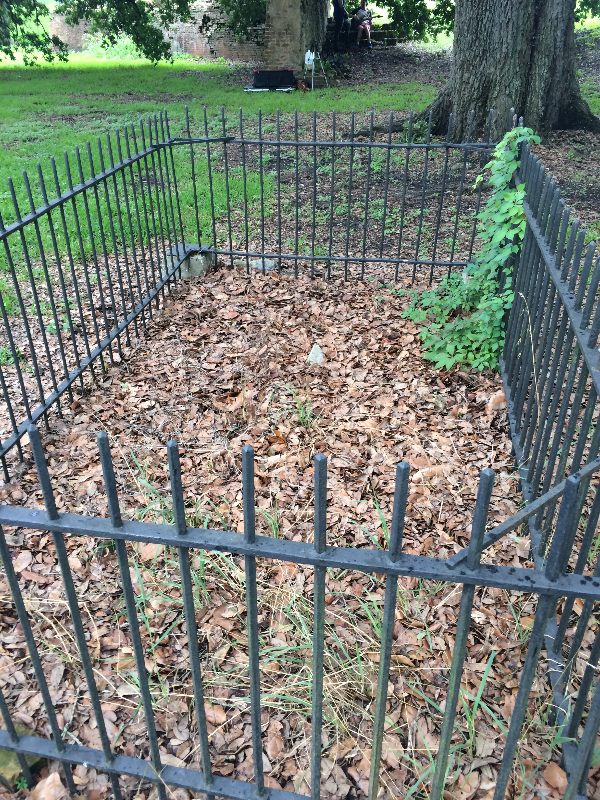
There are many mysteries associated with the Spanish Fort that I didn’t get into today—like the unmarked grave enclosed by an iron fence at the site, or the unidentified Civil War submarine that was hoisted from the bottom of the bayou next to the fort over a century ago, now housed in the Louisiana State Museum in Baton Rouge, or the strange rock sculptures that may be associated with the amusement park of yesteryear still visible to those driving by….

If this doesn’t inspire you to visit the quiet, unassuming Spanish Fort ruins of today—in order to imagine the waves of activity the site has witnessed over the years—then I don’t know what will!

1. Times-Picayune 4 Jul. 1841: 3. NewsBank. Web. 16 Dec. 2015.
2. Ripley, Eliza Moore Chinn McHatten,Social Life in Old New Orleans, Being Recollections of My Girlhood.(New York; London: D. Appleton and Company, 1912) 63.
3. Times-Picayune 30 Dec. 1913: 24. NewsBank. Web. 16 Dec. 2015.
4. Times-Picayune 8 Jun. 1924: 67. NewsBank. Web. 16 Dec. 2015.

BAYOU BIKE RIDE

Over the weekend, my best-adventure-companion Lauren Gauthier and I took a bike ride from the bottom of the bayou to the top. That is, from Jefferson Davis Parkway to Lake Pontchartrain, the brackish estuary that serves as the bayou’s water source (and that is also home to, supposedly, the longest, continuous bridge in the world). We biked along the bayou’s crooked southern section—arguably the most historic, since most of the original planters in the Bayou St. John area made their homes there, beginning in 1708, and since much of the Faubourg St. John’s most historic homes can be found along Moss Street, the charming street split down the middle by the bayou itself.

(Planters wanted land near the southern end of the bayou because it’s the most suitable for agriculture. It’s the most suitable for agriculture a) because it’s above sea level and b) because it was chock-full of nutrient-rich Mississippi River sediment. It’s both of those things because the ridges around the bayou’s southern half—Gentilly and Metairie Ridges—were former natural levees of a former distributary of the Mississippi River, formed by the river overtopping its banks and dumping its sediment in the process.But I digress!)

We then cut through City Park…

The statue of Confederate General P.G.T. Beauregard, one of several Confederate monuments the city is considering removing, at the entrance to City Park.

Will Ryman’s rose blossom sculpture, set up in City Park as part of Prospect 3.

Cypress trees: north of Gentilly and Metairie Ridges, the land around the bayou toward the lake was primarily swampland and cypress forest before the city drained it in the early 20th century.

Beautiful old building in City Park. Does anyone know what this is/was?

View from beneath the Wisner overpass, leaving City Park…

and cut back toward the bayou bike path…

Imagining I am a Houma Indian or a French explorer from the 17th century, scanning the bayou from the underbrush…ignore those buildings on the far bank.

It’s hard to make out, but the right edge of that property marks the southern tip of Park Island, created because the bayou made a sharp curve here back in the day, and, because of the stream feeding it at this point and filling it up with silt and sand, folks decided it was too difficult to navigate and so dredged an additional straight path for the bayou to travel. Now it “flows” (a bayou doesn’t really “flow”) around the piece of land created when they sliced it straight.

Bayou natives on a Sunday stroll.

The lock at Robert E. Lee Boulevard, referred to as the “old flood control structure,” built in 1962. Slated to be removed when the newer flood control structure was built closer to Lake Pontchartrain in 1992, but because of lack of funding was never removed.

Above Robert E. Lee, on the west bank of the bayou, we find the colloquially-named “Spanish Fort,” built to protect the city of New Orleans from invaders from the north. Because of the bayou’s important position as part of the “lake route,” which many ships would take instead of fighting their way up the mouth of the Mississippi River, it was important to keep the mouth of the bayou extra fortified. See pictures below.

See the bayou “flowing” languidly by….

Also, does anyone know what this…

Or this is?? Located near the Spanish Fort. What am I looking at?

<

Knock knock! Who’s in this grave?? Also near the Spanish Fort. I’ve heard a folktale about this…something about a Spanish soldier, an Indian princess, and an angry Indian Chief. Somehow I question this storyline…. Anybody got any info?

And finally we reached the lake!

Where the bayou meets the lake. Once a major destination for boating and swimming…

…until this puppy was built in the 1990s for flood-control purposes. Post-Katrina, there has been much debate between the New Orleans Levee Board, in charge of flood-control, and scientists and residents regarding whether or not the bayou should be opened back up to the lake, except in times of potential flooding. Doing so would improve water quality, encourage swimming critters of all kinds to come back, and would enhance recreational use of the bayou. As of 2014, there was talk of opening this lock more often. I don’t see much recent news on the subject. Does anyone know more about what’s currently happening here?

Naturally-occurring New Orleans rocks, i.e. sandbags.

Critter bones.

Last but not least, the feathered guardian of this liminal space between locked-up bayou and Lake Pontchartrain.