CASCADES OF ENERGY: A WHIMSICAL TAKE

These bayou posts have become a way for the two sides of my writing life to converge: the history and the poetry, the “reality” and the imaginary. See below for an example of what I mean.

My favorite part of Sherwood Gagliano’s “Geoarchaeology of the Northern Gulf Shore” is when he talks about natural systems: “Natural systems are defined by recurring patterns of flow of energy and materials on, or near, the earth’s surface. These energy flows or fluxes are most commonly in the form of fluid movement (water, ice, wind, etc.) but may also be through chemical processes. Energy flow is the integrating factor that defines the natural system.”[1 ]In New Orleans, we are part of a deltaic coastal “cascading system.” We live at a point of interaction between deltaic and coastal forces—where fresh water and salt water meet: “a chain of systems…dynamically linked by a cascade of energy.”[2] This energetic formula defines our geography, and therefore our history. I love the word “energy” because it’s both scientific and whimsical in its usages. Another convergence. Let’s follow it!

Around where the Bayou St. John meets Esplanade Avenue, near the entrance to City Park: this place is its own energetic system, according to me. The phenomena, geological and historical, that have unfolded at this location over the last few thousand years have charged it up so much that next time you’re there—crossing over the bridge to go to the NOMA, for example—you might be able to feel it. Let me give you the briefest of brief histories about this particular spot:

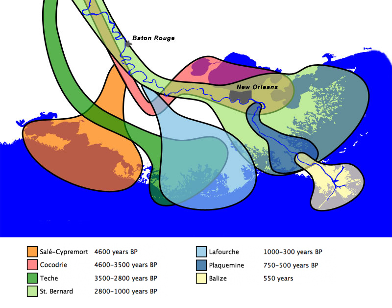
When the planet warmed after the last ice age, the frozen water that had spread across our continent began to melt, flushing into a massive declivity in the landscape called the Mississippi Embayment and flowing down to the Gulf, bringing with it monumental amounts of sediment. The sediment accumulated until it rose up out of the sea and formed its own land. Anywhere this proto-Mississippi River went, it built the land beneath itself higher and higher. Eventually, with the help of gravity, it would slice through its own banks and find a more direct path to the sea. In this way, the Mississippi has been building and swinging, building and swinging, for thousands of years. For a while, before it swung toward its current path 700 years ago, a main arm of it flowed west to east from present-day Kenner, through the heart of New Orleans, out to present-day New Orleans East.[3]

They call this, among other similar names, the Metairie-Sauvage distributary. This former limb of the Mississippi River is crucial to our tale. For one thing, it built up the relatively high, well-drained Metairie-Gentilly ridge system (which, along with the Esplanade Ridge, was crucial to our city’s early history) through the alluvial process outlined above. It also spawned (gasp!) the bayou itself! Near where modern-day Esplanade Avenue nears City Park, this former distributary meandered…sharply. No one quite knows why it did, but we do know that in the process of meandering it sent yet another distributary southward (a body of water simply called the Unknown Bayou, that would eventually form Esplanade Ridge) and another, smaller distributary northward, toward the lake (the Bayou St. John!). For some inexplicable reason, the Metairie-Sauvage distributary split into three, irregular fingers at this location—and thank goodness it did!

Here’s another theory about the bayou’s birth, since what I’ve explained above is not 100% certain: it’s possible that after the Mississippi chose its current path 700 years ago and the Metairie-Sauvage course was abandoned, becoming a sluggish bayou in the process, the Bayou St. John formed as a drainage conduit for this larger bayou. At a weak point in the natural levee (around where present-day Esplanade nears City Park!) the Metairie-Sauvage flood waters crevassed and flowed toward the lake, a process that would repeat itself until the bayou was gouged permanently into the landscape. It’s possible, indeed probable, that the formation of the bayou is a combination of these theories—a drainage conduit throughout the millennia, if you will.

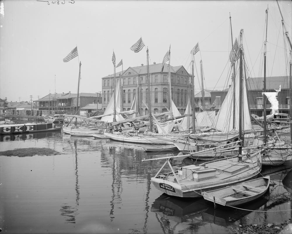
Either way you slice it, this spot—near where City Park Avenue meets Carrollton at Moss, near the roundabout with P.G.T. Beauregard at its center, near where the bridge spans the bayou and oak-lined Esplanade begins—has seen a lot of prehistoric action. Water trickling, gushing, overflowing, bifurcating—to the north, to the southeast, to the east. Water heaping up and creeping through. It’s seen a lot of historic action as well. Did you know, for example, that in 1908 they removed the bridge that spanned the bayou at Esplanade to make way for a larger bridge, more accommodating to automobiles, and that after they removed it, they strapped it to a barge and floated it down to a spot just across from present-day Cabrini High School? That’s right: our iconic Magnolia Bridge was once at Esplanade Avenue. And did you know that in the construction of this new fancy bridge at Esplanade, there was a tragic accident and the thing collapsed and fell, killing and injuring workers on its way down?

Yes, this mini energy system is roiling indeed. See if you notice it next time you’re there!

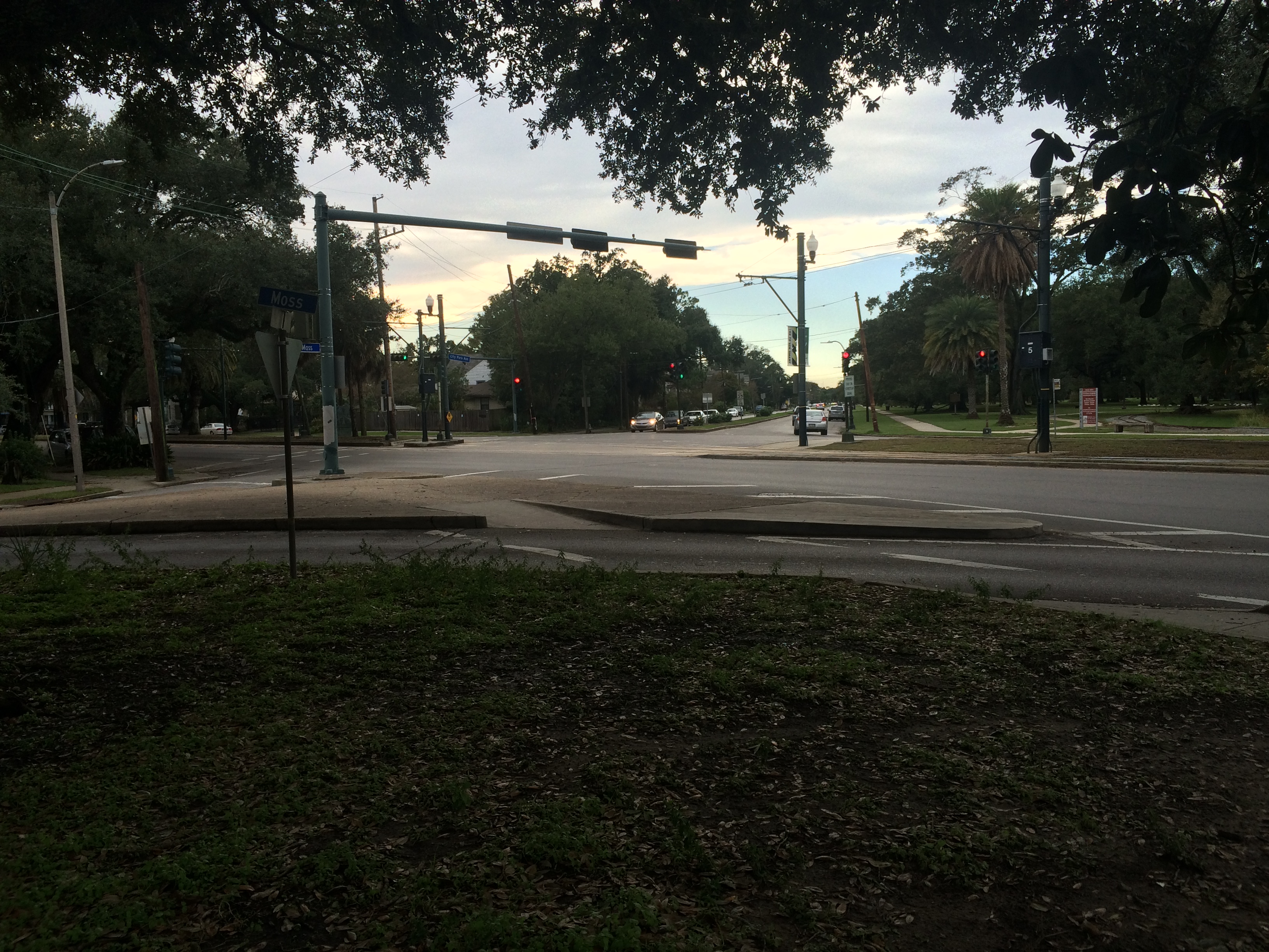
Where City Park Avenue intersects Carrollton Avenue at Moss Street. photo by author

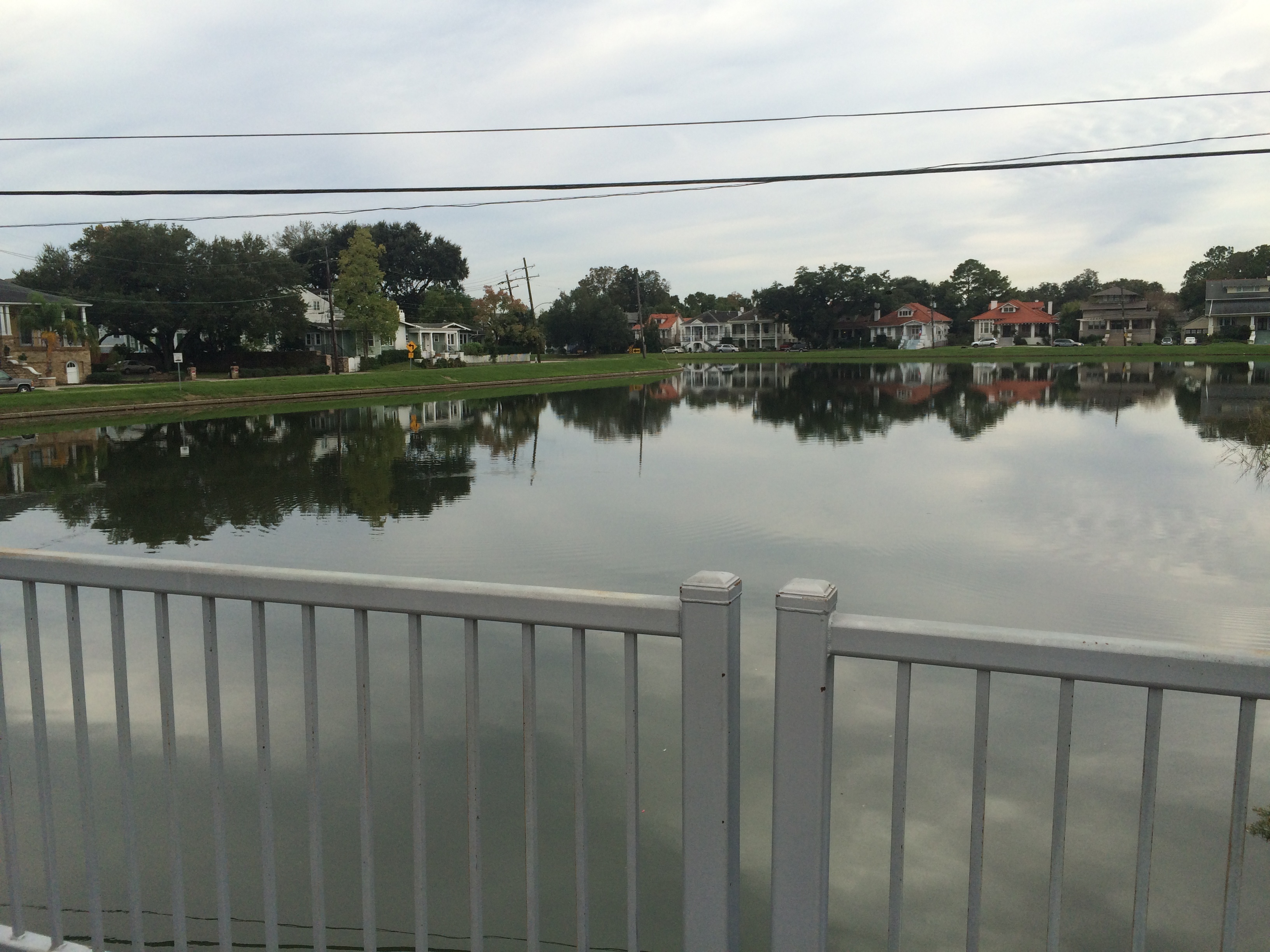
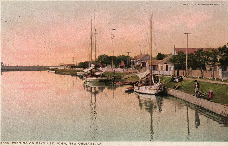
The bayou, riverside of the Esplanade bridge. photo by author

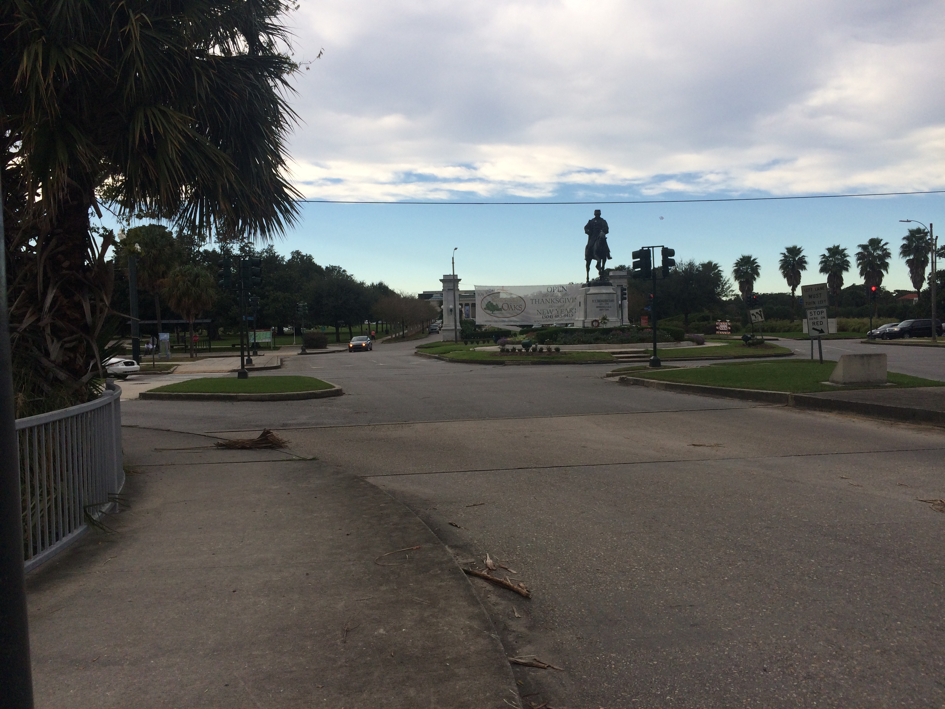
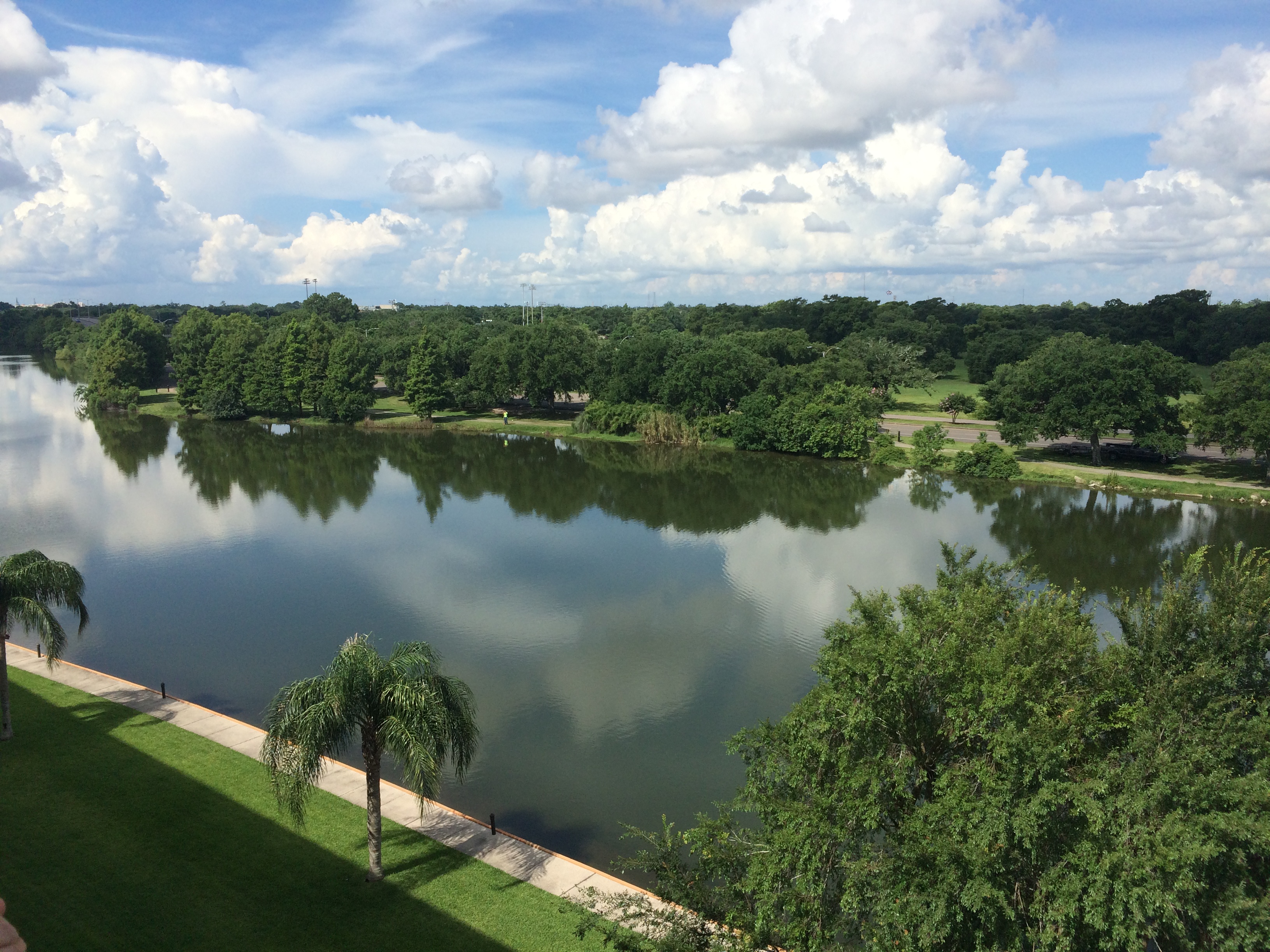
The Esplanade bridge looking toward the entrance of City Park. photo by author

1. Sherwood M. Gagliano, “Geoarchaeology of the Northern Gulf Shore,” Perspectives on Gulf Coast Prehistory, ed. Dave D. Davis (Gainesville: University of Florida Press/Florida State Museum, 1984) 6.
2. Gagliano, “Geoarchaeology of the Northern Gulf Shore,” 11.
3. Richard Campanella,Bienville’s Dilemma: A Historical Geography of New Orleans(Lafayette: Center for Louisiana Studies, 2008).

PEACE PIPES AND CONFESSIONS

In continuing research on the Bayou St. John’s prehistory, I’m often overwhelmed by all that wedon’t know. 2,600 years of Native American existence in coastal Louisiana—settlements blooming and disappearing according to the river’s swing; tribes and families and physical structures, knowledge and folklore and ritual, all the tangible and intangible elements of daily life—and nearly all of it erased. This emotion I experience—a kind of grief in the face of the irretrievable (I am a poet, after all!)—often results in attempts toimaginethose we’ll never know about, to see the world through their eyes for even just a flicker of a moment. Reading accounts of European explorers, however inaccurate or biased they may be, nevertheless fuels my curiosity.

Iberville’s description of a rendezvous with members of the Bayogoula tribe, for example, sends me into a tailspin of daydreams: the thrill of imagining these unprecedented moments of intimacy between humans from vastly different parts of the globe. The strangeness, for all involved, of the smells and tastes and sounds. The way neither party seemed to have words, at first, for their sensory input, and would ultimately reach for a metaphor to bridge the rupture: “They [the Ouma] gave us two types of walnuts. One is similar to Canadian black walnuts, while the other, a diminutive variety, is similar in appearance to, and no larger than, an olive.” [1] or the way the approaching European ships were often described as “floating houses” by those who observed from shore.

But the responsible poet (and budding historian) in me has to wonder: what value does this kind of inquiry have? By this I mean, what, if anything, can be gained from imagining the life of the historical other, particularly when the person doing the imagining is a white woman of privilege, a direct product and recipient of the colonial processes that erased the other to begin with? Of course, there’s the famous quote by Edmund Burke: “Those who don’t know history are doomed to repeat it.” The idea that history (done well) will teach us about ourselves, will help us feed the forces of compassion and graciousness within us, and not those of greed, power, and apathy. And I would argue that knowledge of the “facts,” plain and simple, isn’t enough to teach us about ourselves. We have to exercise the imagination, and therefore empathy, in order for history to matter.

But, as Claudia Rankine and Beth Loffreda write in their essay “On Whiteness and the Racial Imaginary,” the imagination is “a place crossed up by culture and history, where the conditions into which we were born have had their effect.” As in, the imagination is not some ahistorical, pristine realm. Is imagining the life of the other, therefore, particularly another about which you factually know very little, just another form of entitlement? There’s a fine line between empathy for the sake of learning and growth, and empathy as just another form of colonization.

In asking myself these questions over the past couple weeks, I kept coming back to what, for me, provides that extra charge, that extra surge of curiosity and thrill, when imagining pre-colonial life. For me, it has to do first and foremost with place. That’s right: I’m confessing to the imaginative use of historical others to get to the land—to imagine the landscape in all its previous permutations. That’s right: I seek to erase myself, and all I represent, in order to experience this place as I’ll never truly get to experience it; I want to be in this place before it had me in it.

I love imagining the energy stored up in a place from all that’s come before—an accumulation of phenomena, layers upon layers of energetic residue. When I first moved here, catching site of a sago palm would result in a hologram of a giant longneck dinosaur rising up before me, those prehistoric-looking plants setting off a series of whimsical visions—until I learned, of course, that this alluvial land we stand on is far too young for dinosaurs. But then learning that got me even more fired up! I mean, come on: those of us below Baton Rouge live on land the river made. The earth below us was swept into the Mississippi thousands of years ago from all over the continent. It careened down the river, exploded into the Gulf and accumulated until it rose above the level of the sea. We live in a city built upon spewed river innards—because wealth and power require permanence, require clawing terra firma from the softness. The river, therefore, has been walled up and locked into its bed. Without river sediment and groundwater, the land sinks and condenses and the wetlands melt away. I think this might explain a fascination with “pristine” nature, at least for the tiny human writing this blog post: everything, the entire planet, is changing, and we’re the ones doing the changing. And yet, as individuals, we often feel powerless in the face of this fact. And so we grasp at imagined landscapes of lush, uninterrupted swampland, and great swaths of forest filled with mammoth trees, and birdsong so loud we have to cover our ears, and roaming wild beasts, and the people who lived here before we took their land away and altered it forever.

“Having arrived at my brother’s campsite, the chief or captain of the Bayogoula came to the seashore to pay me compliments and civilities in their customary manner, which is to pause near you and rub their hands on your face and chest. They then place their hands upon yours, after which they lift them skyward, rubbing them and kissing them again. I repeated the ceremony, having seen it done to the others….After our encounter and the exchange of civilities, we went to my brother’s tent….I made them smoke, and we all smoked my iron peacepipe, made in the form of a ship with a white flag marked with afleur de lis, and embellished with beads. I then gave them a present, consisting of hatchets, knives, blankets, shirts, beads and other things valued by them, and made them understand that with this calumet I had rendered them united with the French and that we were now one nation.” [2]

1. d’Iberville, Pierre Le Moyne,A Comparative View of French Louisiana, 1699 and 1762.Trans. Carl A Brasseaux (Lafayette: University of Southwestern Louisiana, 1979) 55.
2. d’Iberville,A Comparative View of French Louisiana, 1699 and 1762.34.

BONE BEDS AND BACKSWAMP

First of all, I want to thank ViaNolaVie​ for including my bayou blog posts on their site going forward! I am honored to be presented alongside the stories of exceptional quality NolaVie consistently offers on life and culture in our fair city. I will be writing, from here on out, bi-weekly posts on what I’ve been learning while researching the history of the Bayou St. John—“field notes,” if you will—much as I’ve been doing over the past few months.

This week, I will be talking about Native American shell middens again—because they’re so incredibly cool, and because, as I learn more about the prehistory of our area, I’ve come to realize shell middens are even cooler than I initially thought….

Because, here’s the thing: we know so few specifics about Native American life in this particular region before the end of the 17th century. Between when the first European “explorers” traveled up the Mississippi in the mid-16th century and the second wave of “explorers” came to the region more than one hundred year later, European-borne diseases had already ravaged the local Native American population. For reasons we aren’t entirely sure of—intertribal warfare, and/or other consequences of French arrival—tribes were moving around incredibly quickly, and generally changing their habitation and subsistence patterns in drastic ways by 1699. But accounts by these later European explorers are the only written descriptions we have to go on: questionable vocabulary, snippets of detail about post-contact native life, and virtually nothing reliable on pre-contact native life at all. We can learn a lot from archaeological evidence, of course, but most of that has been destroyed in the New Orleans area. So, we are left to imagine….

and talk about shell middens.…

and look at the patterns that emerge when we consider the landscape. Those of us in New Orleans happen to live upon a very unique and dynamic landscape. A landscape with very specific resources and challenges—an example of what happens when an alluvial river (the Mississippi) sweeps its arm out and encloses a little circle of the sea (Lake Pontchartrain). Obviously it’s a bit more complicated than that, but my point is we live in what they call a “deltaic coastal” natural system: Lake Pontchartrain is an estuarine ecosystem, thought to be one of the richest and most diverse kinds of ecosystems on the planet, and, until we “tamed” the Mississippi, the land along and below Lake Pontchartrain was constantly moving and changing according to the river’s proximity. By considering the natural system we live in, in combination with the archaeological evidence we find here, we can make certain broad (very un-nuanced) guesses about Native American movements and subsistence habits in the region.[1]

I’m still trying to get a grasp on the different fields that explore the intersection between human history and landscape (geoarchaeology and historical ecology, to name a couple): the vocabulary used by scholars in those fields, how the fields have grown and changed over time, etc. But my heart was pounding with excitement reading an essay called “Geoarchaeology of the Northern Gulf Shore,” by Sherwood M. Gagliano. In it, one finds terms like:

“man-land relationships”

“bone beds”

“Holocene still stand”

“subsided site situations”

“drowned river valleys”

“cascades of energy”

and “fringing backswamp”[2]

Among many other things, we learn from Gagliano what it means when archaeological deposits are found on top of (vs. “interbedded” into, or foundbehin​d) natural levee surfaces: the deposits must have “accumulated after the distributary had been abandoned as an active course of the parent stream.” [3]

Meaning, when we find a shell midden on top of a ridge that was formed by a former path of the Mississippi (as in, shell middens found on the Metairie-Gentilly Ridge, for example, near the bayou), we learn that people must have lived on this ridge once it had fully matured. Meaning, Native Americans probably utilized the high ground of the ridge after the Mississippi had already swung south, leaving a mere trickle of itself behind. This trickle would have been perfect though! It would have been a great means of transportation to the overland portage that led to the current trunk of the Mississippi River, as well as to the mollusk-strewn shores of Lake Pontchartrain. The ridge would have allowed access to both brackish and fresh water, but wouldn’t have presented much of a flood risk. Also, the archaeological site that was discovered (more details to come) near where the bayou meets Lake Pontchartrain would have been an ideal coastal location as well.

If most of the middens in the area around the bayou are gone now, however, how are we sure they were ever there? Well, for one thing, we have some folks from yesteryear who tell us about them, like this guy, John W. Foster, writing in 1874:

“These shell ridges and occasional mounds are very numerous near the city of New Orleans and along Lakes Pontchartrain and Maurepas, and on the small bayous that pass from one into the other….Shell-mounds and shell accumulations abound along the Metairie, the Gentilly, and the lake-shores, but none along the Mississippi…. Along the banks of [Bayou Barataria] are vast shell accumulations, which for years, like the others I have named, have been used for street grading and garden-walks in New Orleans….this trade is fast exhausting these supplies.”[4]

There ya go. For years, Metairie Road was called “The Shell Road,” or “The New Shell Road,” and was paved with white clam shells quickly turning to dust beneath mule hooves and wagon wheels. They were probably the remains of shell middens, shoveled and dispersed and made smooth. (In more recent times, we dredged shells from Lake Pontchartrain for construction purposes, so not all the shells you see scattered about New Orleans are from middens, alas).

Ok—last but not least—the highlight of the last couple weeks:Jean Lafitte National Park, located south of New Orleans in the Barataria Preserve. Although I’ve been there a few times before, here is what I discovered on my most wonderful last visit:

Baby sunglasses nestled between palmetto fronds.

Cypress swamp.

Awater-hyacinth-choked manmade canal (water hyacinth is an invasive species that also clogged Bayou St. John in the 20th century). Can you spot the white building looming at the end of it? This photo was taken my pressing my iPhone against the eye piece of high-quality binoculars.

A baby alligator (can you spot it??).

Another baby alligator.

A cypress tree somewhere around 200 years old, spared (for some unknown reason) by loggers when they came through and harvested almost every cypress tree in the swamp in the 19th century.

The remains of a giant shell midden! One of the ones our friend John W. Foster mentioned in the paragraph above (“along the banks of Bayou Barataria”)!

The plaque tells us more:

I’m still pondering the importance of that oak tree. I understand that it grew on top of the midden, and then when the midden was hauled away, the oak tree stayed in place. But the oak tree was virtually alone among cypresses and other swampy flora. I’ve since learned that the state park is near (or encompasses?) another former Mississippi River course (more details when I’ve learned more) and is therefore similar in elevation to our Metairie-Gentilly ridge—and therefore has the proper soil and drainage for hardwood trees, like live oaks, to grow. But I’ve also been reading more by Tristram R. Kidder, who I talked about in my last post, and he posits a theory about shell middens actually creating their own mini ecosystems, resulting in species of flora that wouldn’t otherwise be growing there. He even throws out a theory about Native Americans actually purposefully building middens as artificial environments (as opposed to their being merely garbage heaps)—built environments that would provide elevation, as well as nutrients to calciphiles (plants that like calcium-rich soil) or other useful plants that otherwise might not grow in the area….[5]

I have much still to learn on these subjects. Don’t worry—I’ll keep you in the loop!

1. Sherwood M. Gagliano, “Geoarchaeology of the Northern Gulf Coast,” Perspectives on Gulf Coast Prehistory, ed. Dave D. Davis (Gainesville: University of Florida Press/Florida State Museum, 1984) 9; 25.
2. Gagliano, “Geoarchaeology of the Northern Gulf Coast.”
3. Gagliano, “Geoarchaeology of the Northern Gulf Coast,” 28.
4. John W. Foster, Pre-Historic Races of the United States of America. (Chicago: S. C. Griggs, 1874) 157-158.
5. Tristram R. Kidder, “The Rat That Ate Louisiana: Aspects of Historical Ecology in the Mississippi River Delta,” Advances in Historical Ecology, ed. William M. Balee (New York: Columbia University Press, 1998) 157-160.

CLAM SHELLS AND WHITE MAN PRATTLE

In a fluid, rockless, ever-shifting landscape—formed by the warring forces of sediment accretion and subsidence—elevation is everything.

This week, I learned about two interesting ways in which Native American involvement in matters of elevation affected the landscape of New Orleans.

Tristram R. Kidder, in his essay “Making the City Inevitable: Native Americans and the Geography of New Orleans,” talks about the idea of the “Ecologically Noble Savage.” Western thought, until perhaps recently, has consistently underestimated the ways in which Native American habits and movements affected the landscape. America, before the arrival of European colonists, was widely seen as a vast, unconquerable wilderness with which indigenous peoples lived “in harmony,” tiptoeing through the forest shooting silent arrows, leaving barely a trace. Europeans, by contrast, tamed the beast—for better or for worse.[1] However, Kidder writes, “Ecological transformations [by Native Americans] may not be quantitatively the same as those in recent times, but qualitatively they are no less real or meaningful.” [2]

One of the most notable ways Native Americans altered the local landscape (primarily the marshy parts) is through shell middens—those semi-intentional garbage heaps filled with discarded animal bones and clam shells. These raised mounds “form an entirely new ecozone in the marsh” resulting in much higher ecological diversity, even in modern times.[3]Perhaps one of the best examples of these midden-ecozones in our area is in New Orleans East, where archaeological sites near Lake Pontchartrain have resulted in stands of live oak, cypress, hackberry, and willows trees in an otherwise entirely flat brackish expanse.Kidder also mentions shell middens once found along the Metairie-Gentilly ridge (site of our beloved bayou), the shells of which were later excavated for paving roads and making lime. Unfortunately, Indian sites in the vicinity of the bayou have been largely destroyed by these kinds of excavations in the 18th century, or else by the urban expansion that characterized the 20th. [4]

Perhaps the most important way in which Native Americans impacted the local landscape, however, was by showing French colonists the portage route, employing Bayou St. John, from Lake Pontchartrain to the Mississippi River—a communication that resulted in the founding of New Orleans in its present location (although there were a few other factors that went into this decision). Archaeological remains near where the bayou meets the lake prove that native people were aware of this route (if Iberville’s diary entries aren’t further proof!). Although confusion abounds as to which specific tribes lived in the vicinity of the bayou, particularly since, by the time Iberville floated into the area, much of the native population had been killed off by disease or had relocated for other reasons (not to mention recording errors!), there is no doubt their communication with Iberville regarding the portage was absolutely critical. [5]

Kidder writes, “The extension of native knowledge to European contexts is what makes Bayou St. John both a tangible image and a metaphor of the historical transformation of New Orleans.” [6] Bam.

Now, as a foil to these facts, I wish to present you with a humorous (if only because it’s so confidently asinine) window into the Mind of the New Orleans White Man, circa 1845, courtesy of the Historic Times-Picayune. Of course, it’s funny but it’s also despicable and depressing as hell.

“Lo! THE POOR INDIAN. — A few—some dozen or two—of the once powerful tribe of the Choctaw Indians, still hang about the purlieus of this city, in the neighborhood of the Bayou St. John. Near Clark’s house, at the Bayou Road, where once blazed the council fire of their sachems, now burn their cooking fires, and the smoke of their miserable huts supplies the place of the smoke of the calumet—they wander about like ghosts of departed greatness. Periodically they serenade the citizens, when they turn out in all the remaining strength of the tribe—men, women and children. On these occasions a long, bare-legged fellow beats an apology for the Indian drum; another fellow goes about, levying contributions; and the remainder, in concert, sing a kind of guttural chorus, resembling a ventriloquist’s imitation of a wood-sawyer at work. These levies are always made under the pretense that there has been a wedding in the tribe, and that the funds solicited are raised for its due celebration. Now if this be the case, we can only say that celibacy is a state of existence unknown to the Choctaws—nay, that bigamy is recognized among the tribe to the fullest extent; for we will be sworn that seven times seven within the last seven years have we seen every squaw in this remnant of the tribe, who could at all assume the character, play on these occasions the part of the bride. The whole thing, we take it, is but a way they have ‘raising the wind,’ to have ablow-out, and perhaps this device is as harmless a one as they could adopt. These remarks were suggested by seeing them going the rounds yesterday—all paint and prattle as usual.” [7]

1. Tristram R. Kidder, “Making the City Inevitable: Native Americans and the Geography of New Orleans,”Transforming New Orleans and Its Environs: Centuries of Change, ed. Craig E. Colten (Pittsburgh: University of Pittsburgh Press, 2000) 9.
2. Kidder, “Making the City Inevitable: Native Americans and the Geography of New Orleans,” 20.
3. Kidder, “Making the City Inevitable: Native Americans and the Geography of New Orleans,” 13.
4. Kidder, “Making the City Inevitable: Native Americans and the Geography of New Orleans,”14; 16; 19.
5. Kidder, “Making the City Inevitable: Native Americans and the Geography of New Orleans,” 17; 19.
6. Kidder, “Making the City Inevitable: Native Americans and the Geography of New Orleans,” 20.
7. “Lo! The Poor Indian.” Times-Picayune 26 Jan. 1845: 2. NewsBank. Web. 8 Oct. 2015.

FLUNG ROSES AND STOPLIGHT GRAVEYARDS

After a long hiatus, bayou posts are back! I know you’ve been waiting on tenterhooks….

After four months of more general Bayou St. John research, I am about to start focused research for the first chapter of the book—on the bayou’s geomorphic/geographic and Native American history. If anyone has any advice for me—ideas for what to read, who to talk to, etc.—reach out! I get to talk about former Mississippi River pathways, sediment deposits, pirogues, trade routes, slight-but-significant ridges.… CAN’T WAIT.

The past couple weeks, I’ve been on a few bayou adventures.

I biked the almost-100%-completed Lafitte Greenway—a 2.6-mile bicycle and pedestrian trail extending from N. Alexander St., near the base of City Park, to the French Quarter.

New Orleans residents may or may not realize that the Lafitte Greenway follows the path of the former Carondelet Canal, a waterway hand-dug by slaves in the late 18th century, when New Orleans was still under Spanish control, and utilized throughout the 19th century as a commercial conduit between the bayou and the French Quarter. This meant ships laden with goods from settlements north of Lake Pontchartrain or along the Gulf could avoid navigating the Mississippi River altogether and travel through Lake Pontchartrain, down Bayou St. John and into the Carondelet Canal in order to off-load their goods at the rear of the French Quarter.

A vew of the Lafitte Greenway between the bayou and Broad St.

If you ever wondered where old New Orleans stoplights ended up….

The open canal that runs between Broad Street and the bayou, positively gushing as it exits the Broad St. pumping station. Doesn’t it look almost turquoise? Don’t let that fool you. It stinks.

The giant locks at the Broad St. pumping station that control whether water flows up the underground culvert beneath Broad St., or else out to the Orleans outfall canal, via the open canal along the greenway.

There is much more I could (and WILL, in the book) say about the Carondelet Canal. But for now: there is a fabulous (free!) exhibit at the Pitot House on the history of the Carondelet Canal, curated by the Louisiana Landmarks Society, in celebration of the opening of the Lafitte Greenway. So many beautiful old maps and photographs!!! It is both succinct and intensely interesting. I HIGHLY recommend it.

After biking the greenway, I checked out the historic Ossorno House in the Quarter, at 913 Governor Nicholls.

This house was built on the Bayou St. John sometime before 1781 and apparently dismantled and transported, most likely via mule and cart, along Bayou Road to its present location—as were all goods traveling from the bayou to the Quarter before the Carondelet Canal was dug. According to geographic historian Richard Campanella (one of my heroes), in his Geographies of New Orleans: Urban Fabrics Before the Storm, the house is a fine example of a French Creole-style plantation house (although the roof was remodeled sometime in the 1830s)—one of only two plantation-style houses to be found in the French Quarter (the other being Madame John’s Legacy)—which testifies to its rural birth on the bayou. Campanella tells us it’s “the oldest extant structure in the rear of the original city” (106).

I then decided to bike the approximate path of this all-important route along Bayou Road, one of the principal reasons why New Orleans was founded where it was (for access to the river without having to navigate its mouth, as was mentioned above).

In traveling along the (approximate) portage route, one follows Bayou Road, which ends at the crazy, navigationally-nightmarish, odd-angled intersection of Bayou Road, N. Dorgenois, Desoto, Bell, and Kerlerec streets (thank god there’s delicious food right there, at Pagoda Cafe, for the weary, confused traveler) and continues along Bell Street (approximately) to the bayou. The exact location of the original route’s intersection with the bayou was probably somewhere between Bell St. and Desoto (more on this once I continue more in-depth research on the subject).

This terrible panoramic photo (thanks iPhone!) taken from next to Pagoda Cafe, while inaccurate in perspective, I think does justice to the psychological experience of navigating this intersection….

While in this neighborhood, I found…

A historic cornstalk fence at the historic (1870) Dufour-Plassan House.

The approximate general region where Almonaster built a leper hospital in the late 18th century.

An awkward spot where Barracks Street and Bayou Road diverge at a bizarre angle, since Bayou Road does not adhere to the grid plan the rest of the streets in the area adhere to—following, as it does, a natural ridge, the one the Native Americans used to cross the uncrossable swamp between the bayou and what is now the French Quarter.

Finally, I arrived at the bayou itself. Here are a few spots of interest along its banks, a couple of which I was lucky enough to get to go inside of (!!), courtesy of the generous, unsuspecting homeowners I found busying themselves in their front yards.

The house, at 1222 Moss Street, that sits atop what was once a small bayou connecting Bayou St. John and Bayou Sauvage, long since filled in.

What is referred to as “the old Spanish custom house,” although it never officially served as a custom house (there are various theories as to why people refer to it as such). I was lucky enough to get an in-depth tour of the inside of this home (!!!), the owner of which has been painstakingly renovating it for six years. Beneath layers and layers of renovations that have been done over the past two and a half centuries, he has made some amazing discoveries—like anactual iron jail cell, apparently dating from the Spanish colonial period, that the current owner suspects was used to hold folks who were smuggling illegal goods up the bayou, or who perhaps couldn’t pay the toll. ARE YOU KIDDING THAT’S AMAZING.

Below is the plaque that explains a bit more about the house.


Roses that someone had flung into the bayou near the Magnolia Bridge.

And, last but certainly not least, what is perhaps my favorite historic house along the bayou, built in the last decade of the 18th century: “The Sanctuary.” Walter Parker, former mayor of New Orleans, who spearheaded the “beautification” of the bayou in the 1920s and 1930s and who is therefore responsible, in large part, for the bayou as we know it today, once lived in this house. I wasalsolucky enough to be able to see the back courtyard of this home—guarded by a three-hundred-year-old live oak tree that predates the house, and other amazing, old, beautiful things. More on this house, and its many previous owners, to come.

ADVENTURES IN CAJUN COUNTRY

This past weekend, my #1 travel companion (and everyday companion) Lauren Gauthier and I took a trip to south-central Louisiana, passing through small towns along Bayou Teche on our way to and back from Lafayette.

Through a process called “deltaic switching,” the Mississippi River, that swinging arm of mud-water (well, not to much anymore…) once occupied the path Bayou Teche travels now, roughly 2,800-4,500 years ago. To *swing* this back to my Bayou St. John project, the BSJ is itself a remnant, albeit a much, much smaller remnant, of an even more recent switch called the St. Bernard deltaic lobe. Hell, any water you see around south Louisiana is probably some kind of remnant of the great Mississippi, but Bayou Teche is a particularly important one.

Here is a colorful visual of the process I’m talking about:

And another, more artistic, rendering of the Mississippi’s wild dance from a series of plates made in 1944 by Harold Fisk:

Ok, back to the trip. During a period called The Great Expulsion, from 1755-1764, the Acadians (descendants of French colonists who arrived in Eastern Canada’s maritime provinces in the 17th century) were ousted by the British and sent all over tarnation. Some of them ended up settling along Bayou Teche, creating what has come to be known as “Cajun country.”

New England poet Henry Wadsworth Longfellow wrote an epic poem about the Acadians in the mid-19th century calledEvangeline(“From the bleak shores of the sea to the lands where the Father of Waters / Seizes the hills in his hands, and drags them down to the ocean….”).

I could go on and on about the unique influence this group of people—together with descendants of the French, Spanish, and African folks (Creoles) who settled (or were forced to settle) in Southeast Louisiana—have had upon this low-lying, swampy, sugarcane-carpeted corner of the U.S., but I’ll try and let the photos do the talking….

First stop: Morgan City,on the banks of the Atchafalaya River.


I, like, really want to tell you about the relationship between the Mississippi and Atchafalaya—about how the Miss is dying to swing to the west and completely merge with the Atchas we speak,effectively abandoning all the towns and cities below the Mississippi/Louisiana state line, like Baton Rouge and New Orleans, but is prevented from doing so,as we speak,by one of the most massively impressive feats of engineering on the planet, the Old River Control Structure—but I’m not going to get into it here. Instead, if you’re interested, read this long-but-mind-blowing essay by John McPhee on the subject. 

Next stop: New Iberia, with its own unique history: in 1779, a group of people from Malaga, Spain, settled the town, and it is now the only Louisiana town founded by Spaniards in the Colonial Era still in existence.


(Very picturesque)

Then to Lafayette,where we spent the night dancing to Zydeco at the Blue Moon Saloon:

BAYOU BEAVER TAKEN ON JOYRIDE

It’s not surprising that in researching historic New Orleans through the lens of its most prominent newspaper, one doesn’t hear about women very much. Or people of color, except when reporters describe their causing a “nuisance,” or their “savage” Voodoo ceremonies in the backswamp along Lake Pontchartrain.…

Really, though. One almost forgets that one hasn’t heard mention of a single female human for the past several hours of research until one pops up, usually in the form of a bayou drowning-victim, or a recent widow of a prominent man, or a woman of “ill refute.”

Sometimes, your eyes get tricked! A “she” or a “her” will pop out of the text, but it’s only in reference to a motorboat or a schooner….

Which got me thinking about the concept of gendering inanimate objects. Why are boats saddled with feminine pronouns, and often cities too? (This once struck me as kind of quaint.) Boats are built and tricked out and ridden to get from place to place—by men exclusively, or at least they used to be. They are used to make money, or are status symbols themselves. They’re often slender and sleek, but that’s probably just a coincidence. Cities were built and planned and operated by men too—and in many ways, they still are.

Here is a 1913 Times-Picayune article from my travels this past week that, aside from being comical, echoes in interesting ways the ideas above:

“PIRACY IS CHARGED.

Charges of piracy and the wanton violation of the maritime laws of the United States are alleged in a libel and complaint personam filed in the United States District Court yesterday against Frederick W. Smith, 2906 St. Ann Street. The complainants in the case are Harry Oldstein, Morris Wise, Henry D. Friedenberg and Arthur Schmidt, owners of the gasoline motor-boat Beaver, who charge the defendant with having illegally taken possession of the vessel on June 24 last, while the boat was lying in the Bayou St. John, and sailed out to Lake Pontchartrain with a party of women on a joy ride. Libelants declare that their yacht was stocked with intoxicating liquors by the defendant, who, after breaking the headline to which she was made fast to the wharf, placed a party of women of ill-fame on board and steamed out to the lake, where all had been guilty of lewd conduct, to the great humiliation, ridicule and contempt of the owners. Damages are asked in the sum of $1,650.” [1]

She, the Beaver, was taken possession of—was freed from her tether, stocked with booze and floozies, and taken on a joy ride. The men who own her are pissed—their property and their reputations have been damaged by this interloper! They want, like, a quarter of the cost of the average 1913 house in return for this embarrassment! Such easy symbolism here, folks….

1. “Weinstein Wins Before Browne Accused of White Slavery, Prosecution Failed to Prove Bad Faith. Civil.” Times-Picayune 12 Jul. 1913: 4. NewsBank. Web. 23 Aug. 2016.

A BUNDLE OF GATOR PARTS: NO BIG DEAL

Fun fact: the historic blue-tinted bridge we all call the Cabrini bridge (above), built some time in the mid 19th century, was for many decades the bridge spanning the bayou at Esplanade. When they built a new bridge at Esplanade in 1909 (a much bigger, double-track bridge meant to accommodate streetcars, “autos,” and pedestrians, all on their way to the newly-improved City Park), they unhooked the old one from its foundations and floated it down to its present location on a barge. They originally wanted to re-erect it across from Grand Route St. John, but some engineers thought the curve in the bayou at that spot would cause problems. Perhaps some folks in the neighborhood already knew this fun fact (particularly those involved in the planned restorations of the Cabrini bridge) but I do know that, at least in the sources I’ve encountered in my research thus far, there has been considerable confusion on this point. Some even guessed that, based on old photographs, the old Esplanade bridge and the current Cabrini bridge were built to look like twins. Not so! Not so! They are one and the same.

And now, a couple of my favorite articles from the Historic Times-Picayune database from the past couple weeks of research:

September 17, 1904: “TWO MEN FOUND DROWNED. Went Bathing in Bayou St. John Near the Bridge. Locked in Each Others’ Arms. Neither Could Be Identified Up To Last Night.

Two men, whose identity remains a mystery at present, were found drowned in Bayou St. John, about a mile and a half from the Esplanade Bridge, yesterday forenoon, and every evidence points to accidental death.

The men must have gone in bathing a few days ago and one of them began drowning and his friend went to assist him. They soon had their arms locked about each others’ body, and both were drowned. Yesterday forenoon J. L. Debausque discovered the bodies and notified the police, who went out in a skiff and took charge of the remains of the men. Seeing that they were without clothing, the policemen felt the men had gone in bathing and were drowned, and after pulling the bodies away from one another, they made a hunt for the clothing. On one of the banks the clothing of the men had been piled up. There were dark and check trousers, a pink and white striped shirt, a black felt hat, a gray hat, a gray or slate-colored coat, black socks and low-quarter patent leather shoes, and a pair of button shoes. The bodies were conveyed to the Morgue, where they will be held for identification. The men had dark hair and rather dark complexions. One was about 19 years old, while the other was about 25 years old. They were big men.”

This story really gets to me. Reading hundreds of articles about street paving, garbage carts, “society events,” etc. and then coming across a story like this—

Such humanity in the detailed descriptions of their clothing.And they never let go of each other!The one who, apparently,couldswim, never let go of his friend. Or else, the one who could not swim clutched for dear life to the one who could, and brought them both down…. A story of the ultimate loyalty, or perhaps not….

And, lastly, a story of a naughty little boy who got what was coming to him:

February 18, 1909: “TAFT’S ALLIGATOR STEAK.

A boy named James Ware, residing at No. 933 North Hagan Ave., found a package on the bridge across Bayou St. John at Dumaine Street and took it home with him. On opening the bundle to his horror he found what appeared to him to be two human hands. A note included in the package only added to his horror, for it said, ‘Remaining part of this body will be found at L. and N. crossing, due south by east, near switch lock block signal.’ Inspector O’Connor turned the matter over to Sergeant Leroy, who at once reached the conclusion that the hands were really the claws of an alligator, and the mystery was solved.”

Questions: Do alligator claws really lookthat muchlike human hands? Even Inspector O’Connor wasn’t sure.

Why was there a package of alligator claws just lying on the Dumaine Street bridge, and why were they separated from “the rest of the body” stashed in some very specific, distant location?

James, James, James—I hope you learned your lesson! It sounds like you did.

HATCHETS, SLEEPWALKERS, AND DRUNKEN BEARS

More Times-Picayune gems for your perusal, culled from my Bayou St. John research on the Times-Picayune Historical database this past week.

Police notes, July 9, 1878: “Between 10 and 11 o’clock Monday morning, a dispute arose over a game of cards on board a fishing smack lying in Bayou St. John, near the lake, between a Manila man named Marian Lacroste, aged 25 years, and Louis Bancart, his partner. The dispute was ended by Bancart, who seized a hatchet, and inflicted a severe cut on Lacroste’s hip. The wounded man was conveyed to Charity Hospital, and an affidavit was made against Bancart.”

Losing at cards? Just grab your hatchet!!


September 8, 1880: “An Unfortunate Somnambulist: A Woman While Asleep Walks Into the Bayou St. John

Yesterday morning the body of a white woman clad in her night clothes was found floating in the Bayou St. John, between Dupre and White streets. The fact of only having her night gown on, led to the supposition that the woman had committed suicide, and an investigation was at once set on foot by the Coroner Board. It was ascertained that the deceased was named Mrs. Ruth A.G. Patterson, aged 57 years, and residing at [obscured] Canal street.

The unfortunate woman was afflicted with somnambulism and fell a victim to her disease. During the night she walked into the canal and was drowned. The jury returned a verdict in accordance with the circumstances, and the remains were taken in charge by friends.”

Poor, poor Ruth. What an eerie image: Ruth walking from Canal into the bayou in the middle of the night….I wonder what she was dreaming?


September 8, 1882:”On last Wednesday night an unknown thief entered the sexton’s office of the St. Louis Cemetery, on Esplanade street, near the Bayou St. John. The thief stole two cages, containing live singing birds, which were owned by Mr. H. Bienvenu.”

Wow, those birds must really have been worth something! But to poor Mr. Bienvenu, alone in his office amidst that sea of tombs day after day, their singing must have been pretty key….


July 10, 1883: “Garroters in a Streetcar: At half-past nine o’clock last Monday night as car No. 4, of the Dumaine street line, turned the corner of Dumaine and Bayou St. John, two unknown highway men jumped into the car and rushing at Paul Bertuchaux, the driver, demanded his money.

Paul was not going to be bulldozed, and refused to deliver up his cash, whereupon he was assaulted and beaten and cut over the face by the parties. He tried to defend himself by striking at them, when they ran off without accomplishing their purpose.

Their description as far as could be learned has been telegraphed to all the stations.”

Paul would NOT allow himself to be bulldozed!! I hope the city gave him a raise.


April 1, 1884: “The Performing Bear and Its Masters Find Their Way to the Lock-Up

For some days past a Frenchman named Costick, and a Turk named Yunovasch Turnovich, have been exhibiting a performing bear on Bayou St. John near Metairie Ridge. On last Monday evening the owners of the bear and the beast himself imbibed too freely of spiritous liquors, and as a consequence became drunk.

The bear was told to pounce upon one David Edmonds, which it did, and in a few moments Edmonds was lying on the broad of his back, as if Sullivan had hit him. Edmonds well knew he was no match for his grizzly opponent, and thereupon summoned Sergeant O’Rourke and Officer Hanley to his rescue. The bear was taken away; its masters were taken to jail for being drunk and maintaining a public nuisance in exhibiting the bear without a license, and for causing the animal to assault Edmonds.”

Wait, is this an April Fool’s joke? The bear got drunk too? Only in New Orleans, as they say….