BSJ’s STUBBORN SHIPYARDS

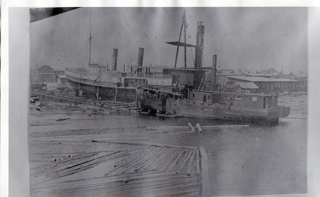
Shipyard. Note: not on Bayou St. John.

In the 1920s and ‘30s, thanks in no small part to the New Deal, Bayou St. John got a huge makeover.

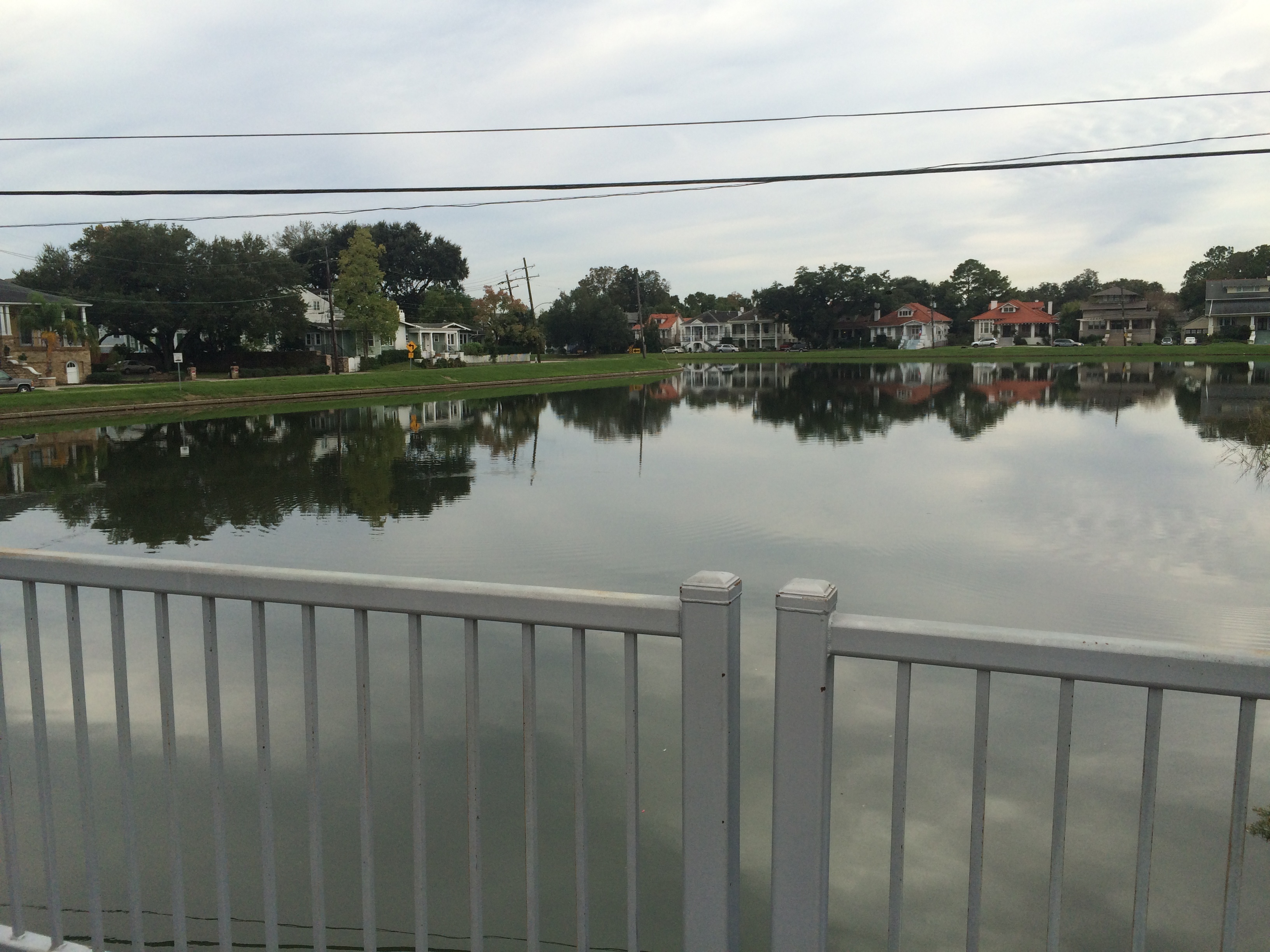
No more mudflats and sunken garbage! No more crumbling levees! No more broken shell roads! No more houseboats and boathouses and ramshackle wharves! All of those things, after all, do not befit the name “Bayou St. John Aquatic Park,” which is what the weed-choked small craft parking lot, crisscrossed with outdated bridges, would become over the course of a few short years.

This is not to suggest the “old bayou” didn’t go down without a fight.

Perhaps the most heated argument to come out of this transformation occurred between Walter Parker, President of the Bayou St. John Improvement Association, and Joseph Dupuy, owner of the last remaining shipyard between Esplanade and Hagan Avenues. You see, the bayou’s makeover wasn’t only cosmetic; its essential character and function needed an overhaul as well. Its very role within the city, according to those at the helm (no pun intended!), needed redefining. After all—the Carondelet Canal, which once extended the bayou to the French Quarter along the path of today’s Lafitte Greenway, was no longer in use, and by 1938 was completely filled in. Without its manmade limb, the bayou served very little commercial purpose. And yet, old habits die hard. Along with the vestiges of other miscellaneous industries once connected with the waterway, two large shipyards remained active along the bayou’s lower banks by the time its makeover was proposed.

What’s wrong with a couple shipyards, you ask?

In short, they require the wrong kind of bridges.

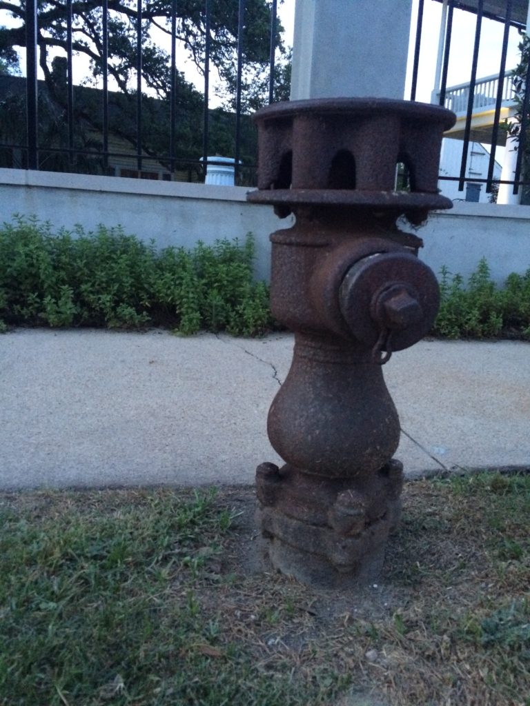
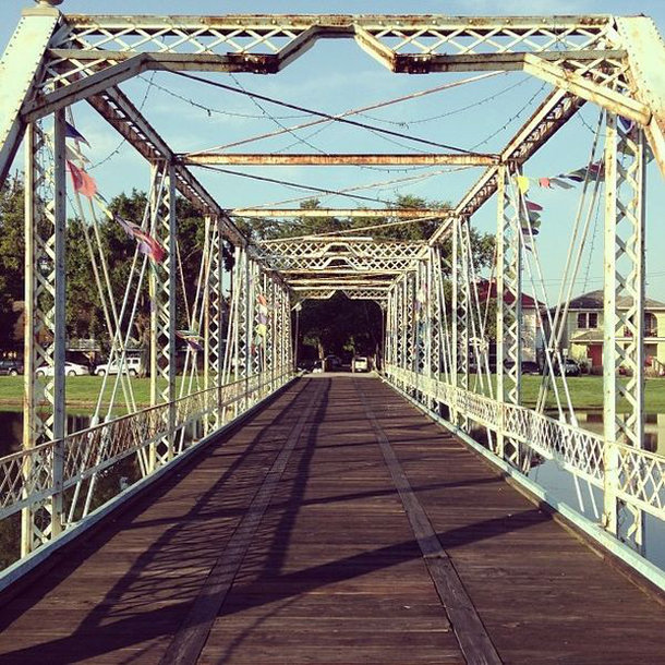
In order for bigger boats to travel to the shipyards for repair, they needed the bayou’s drawbridges to open—most notably, the old Esplanade Bridge and the present-day Magnolia (or Cabrini) bridge. But Parker and the rest of the BSJIA did not envision drawbridges in the new Aquatic Park: they interfered with City Park-bound traffic, and, as is illustrated below, required much planning and many resources to operate.

According to Parker, opening the bridges required the services of a “specially trained crew” of at least five men (members of the Public Service Organization, and therefore not available to the city at a moment’s notice), often took upwards of 30-45 minutes to complete, and required notifications of the police department (for assistance detouring traffic), the Public Service Transportation Department (to reroute buses), Charity Hospital ambulances, and the fire department. Traffic had to be detoured to the Magnolia Bridge, and then, half an hour later, rerouted again so that the Magnolia Bridge could be opened. All, as Parker added for emphasis, so that “one boat can go to one boatyard for repair.” [1]

By the early 1930s, the Mullens Shipyard (near Esplanade Avenue) had agreed to be moved, but up until 1936, much to Parker’s chagrin, Dupuy refused to be relocated. But how would they finish their revetment work? And how would they install the proposed “fixed-span” bridges, with enough clearance only for canoes and other such small “pleasure craft”?

It wasn’t until Congress declared the bayou a “non-navigable stream” in 1936 that the city finally claimed the right to put its foot down. Eventually, the Dupuy shipyard was forced to move lake-ward. The bayou, goshdarnit, was to be recreational! I have to admit to having a soft spot for this shipyard, or at least the memory of it. Every time I pass by Dumaine Street’s intersection with the bayou, I imagine its skeletal hulls-in-progress, its busy workers, its stubborn desire to stay put.

1. City Engineer’s Bridge Records, 1918-1967, City Archives, Louisiana Division, New Orleans Public Library.

A BRIDGE’S MANY LIVES

Did you know that the historic, blue-tinted bridge spanning Bayou St. John across from Cabrini High School—colloquially referred to as the “Cabrini Bridge,” or Magnolia Bridge—has not always lived where it lives now? For decades, it spanned the bayou at Esplanade Avenue, serving as the last link along that bustling artery connecting downtown with City Park and Metairie Road.

Imagine how many thousands of buggy wheels have rolled across its stretch! How many clopping horse hooves and clattering streetcars!

photo from Wikimedia Commons

In 1909, before upgrading to a significantly larger steel trunnion bridge, they unhooked the Magnolia Bridge from its foundations and floated it down to its present location on a barge. The original idea was to re-erect it across from Grand Route St. John, but the curve at that spot in the bayou rendered the location less than ideal. So the bridge was set down in its current location, where it began its second life as a key artery for residents of the surrounding neighborhoods until it ceased serving vehicular traffic sometime in the middle of the last century.

The re-location of the old Magnolia Bridge in 1909 went off without a hitch, but the same cannot be said about the construction of the new bridge at Esplanade that same year. On May 19, 1909, the Times-Picayune reported that during a routine test during the bridge’s construction, “With a terrific crash, the span of the steel bascule trunnion bridge in course of construction at the Esplanade Street end, crossing Bayou St. John, snapped in twain, and the heavy superstructure fell into the bayou, effectually closing navigation of that waterway for some time to come. Five men were injured, one of them, Frank Cunningham, fatally, two others severely and two slightly….”

Frank Cunningham, originally from Oklahoma, Mississippi, was only 24 years old. Newly married, he had been living in New Orleans for eight years doing iron and steel work. When the new bridge “snapped in twain,” Cunningham “was struck on the head by a piece of iron…and, falling, the base of his skull was fractured. He lay there unconscious until he was carried to Picdeloup’s saloon, opposite, remaining there until the ambulance arrived and took him to the hospital.” [1]

The rest of the new bridge’s construction saw its fair share of mishaps and delays, even once repairs were made. In fact, its entire existence was besotted by inefficiencies, closures, and repairs. All in all, it seems our Magnolia Bridge was far more trustworthy—not to mention older and more unique.

This just goes to show you that a bridge, in all its day-to-day stillness, can be far more than it appears to be.


1. “Bayou Bridge Wrecked, Killing One, Injuring Four. Steel Structure Across Esplanade Avenue Breaks Under Strain.” Times-Picayune 19 May 1909: 5. NewsBank. Web. 28 Dec. 2016.

BOYS OF THE BAYOU: THEN AND NOW

While attending last week’s July 4th boat parade on Bayou St. John, led by the Krewe of Kolossos, I was reminded of a letter I came across last summer. The flotilla’s preamble was not merely the spreading of picnic blankets along the bayou’s shore, or the adjusting of raft decorations, you see. It also involved several surprising aerial feats!

Like this backlit bike flip, facilitated by a wooden ramp on the bayou’s edge:

Or these guys climbing to the top of Magnolia Bridge (aka Cabrini Bridge) and hurling themselves off:

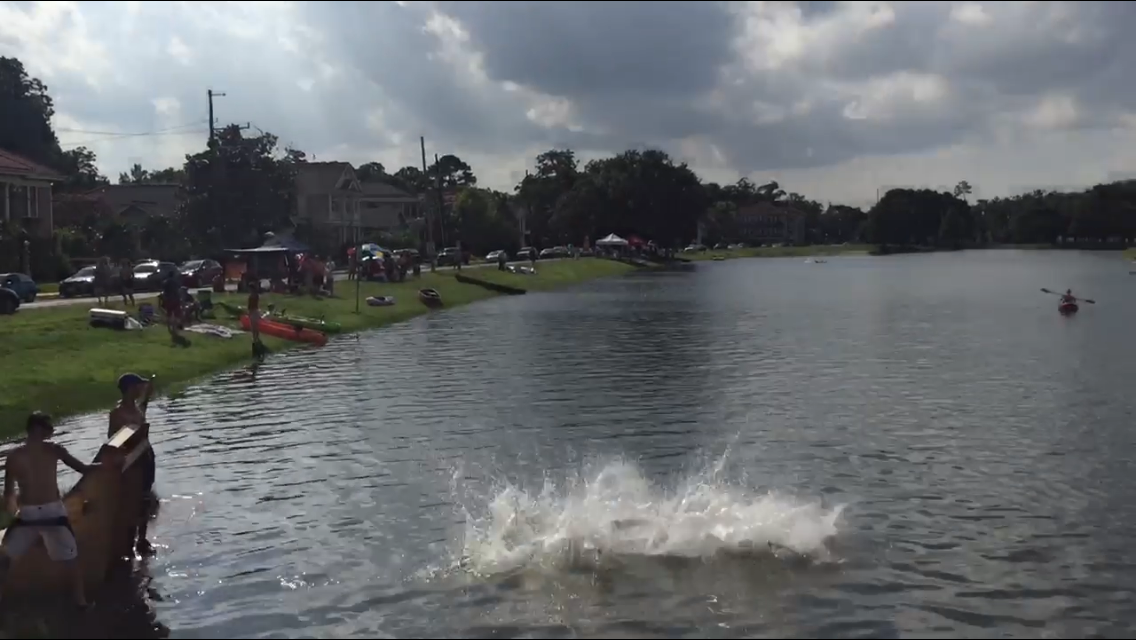
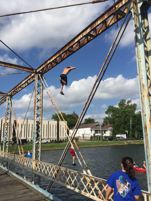
These guys were the ones to remind me of that letter I came across while doing some bayou research at the New Orleans Public Library last summer. The letter was written by a certain Walter Parker, Chairman of the Bayou St. John Improvement Association (and future mayor of New Orleans), to Honorable George Reyer, Superintendent of Police, and dated April 10, 1934. It read as follows:

“It would help a great deal were some of your men to pass along the Bayou as frequently as practicable. Some boys who do not have bathing suits, do not hesitate to bathe in very scant underwear. At the Dumaine Street bridge many boys make the dangerous practice of climbing on the bridge structure. At the Magnolia Bridge (Harding Drive) boys dive from the top of the bridge pretty much all day.” [1]

Boys in their undies, jumping off bayou bridges “pretty much all day”!

What complicated this practice (aside from the boys showing a lot of skin) was that, at the time this letter was written, quite a few houseboats still occupied the bayou. Many of them had electrical and even telephone hookups, but virtually *none* were equipped with any kind of on-board “sewage management.” Meaning…the sewage went straight into the bayou. The four-foot-deep, barely-flowing bayou. Walter Parker was not only perturbed by their rowdiness, but also apparently concerned for their health.

The letter goes on to cover another issue we’re all familiar with when it comes to outdoor festivals, particularly those along the bayou: litter!

“In so far as I know, people have a right to fish [and organize flotillas] on the Bayou. But when they leave crab bait, old papers and remnants of lunch behind, they create a nuisance. I have found that such things usually are the result of thoughtlessness rather than viciousness, and a simple request or word of warning brings a correction….”

Does this tension between recreational use of the bayou and concerned bayou residents sound familiar? I hope none of you left any crab bait behind when you packed up to head home last Monday evening. Or old papers! Or remnants of lunch! Or jumped off the bridge scantily-clad! But if you did, you’ve simply joined the ranks of the bayou’s many nuisance-makers throughout our city’s history….

NOT-SO-SECRET VOODOO CEREMONIES

From Wikimedia Commons: 1920 painting of Marie Laveau (1794–1881) by Frank Schneider, based on an 1835 painting by George Catlin. Source: Louisiana State Museum, New Orleans

According to historian Gwendolyn Midlo Hall, voodoo came to New Orleans not only as a result of the Haitian Revolution—when droves of refugees, both white and black, flocked to New Orleans in the early 1800s bringing the primary popular religion of Haiti with them—but far earlier in the city’s history with the arrival of enslaved Africans in the 1700s.

New Orleans elites in the early years of the 19th century were terrified a similar uprising might happen here. In 1817, City Council forbid blacks from congregating in large groups except in specified places at specified times. Therefore, voodoo rituals of the day had to hide from view, which meant—in the days before the city’s vast cypress forests were drained and developed—they moved into the swamps.

According to Bayou St. John historian Edna Freiberg, these policies explain why the famous voodoo queen Marie Laveau is said to have held her annual St. John’s Eve rituals along the banks of our swampy bayou. And yet, she seems to have invited everyone to come out and see it anyway!

I’m fascinated by Marie Laveau, along with, like, everyone ever, specifically because I want to know more about her success in bringing voodoo into the public (i.e. white) eye—one of the many things she is known for. What was the purpose of this? What was the benefit? I have much more reading to do on the subject, but as we near June 23rd, St. John’s Eve, I wanted to provide you with an interesting (and dated, and hugely offensive) Times-Picayune article of yesteryear describing this annual event. Part of the reason why we can read about the event now is precisely because it was open to white voyeurs, for reasons I still can’t figure out.

Was Laveau simply cashing in on whites’ need to witness what they termed a “barbaric spectacle,” to remind themselves, once again, of their ultimate superiority? Was it all a ploy, a “decoy,” while the “real” ritual unfolded place elsewhere?

In 1924, this Times-Picayune reporter wrote on the supposed history of this annual event: “This cabala of St. John’s Eve was for years a topic of discussion in New Orleans and even attracted national attention. In barbaric color and African hideousness, nothing has ever surpassed it. Thousands of curiosity-seekers, journalists, and freelance writers, who chanced to be in New Orleans at the time of this jubilee, would go out in the swamp lands after nightfall and walk through the rough paths, eager to glimpse the orgy. It is generally known that Marie LaVeau [sic] welcomed whites as this particular saturnalia and it is often remarked that it was the decoy, the real worship of the voodoo taking place at other times in remote regions of the swamp, near the shanty which has been styled the ‘summer home’ of Marie LaVeau.”[1]

For the modern-day St. John’s Eve head-washing ceremony (decidedly less fraught), head out to Magnolia Bridge on June 23rd!


1. Times-Picayune 16 Mar. 1924: 71. NewsBank. Web. 14 Jun. 2016.

NEW ORLEANS’ OLDEST FIRE HYDRANT

Given the recent rejection of a property tax by New Orleans residents to help fund firefighter  backpay, I figured I would focus on a little-known historical landmark on the bayou’s shores.

Rumor has it Bayou St. John is home to the oldest fire hydrant still standing in the city of New Orleans. (If you know of an older one, tell me where it is!)

Photo by author

Photo by author

This proud little dude stands at the corner of Grand Route St. John and Moss Street, and according to his markings, was installed on September 14, 1869. It’s an example of a “Birdsill Holly” hydrant, named for its inventor. Until 1891, the fire department in New Orleans was purely volunteer-run; for 62 years, the Firemen’s Charitable Association sought to protect the city of New Orleans from “conflagrations,” and was organized into several “companies,” or groups, each with their own engine.

Apparently, around the time of our friend’s installation, spectators would gather around to see which engines could “throw” water the farthest. In 1876, four engines were competing for the record: Creole No. 9, Mississippi No. 2, Crescent No. 24, and James Campbell No. 7. No. 7 was by far the reigning champion, having thrown 320-feet-2-inches, until a final contest was called for June 25, 1876, on the banks of Bayou St. John.

The Times-Picayune reported: “At a late hour of the night the decision of the judges on the engine-throwing match, was received, and Mississippi No. 2 once more is proud to be the winner of the champion horns. The match was for $100, through 100 feet of hose, and came off near the Magnolia Garden, on Bayou St. John.” [1]

We don’t know how far Mississippi No. 2 was able to throw that night, but we know she was the winner. Is it possible our Birdshill Holly hydrant supplied the water for such an occasion? Magnolia Gardens, after which Magnolia Bridge (a.k.a. Cabrini Bridge) was named, would have been fairly close by….

In my travels researching this hydrant, I came across this photograph of a carving in Cypress Grove Cemetery—featuring none other than “No. 2,” our reigning champion!

Photo by Michael Homan, Wikimedia Commons

Well, I don’t know that for sure, but given the 19th century origins of this carving and the fine reputation of the Mississippi No. 2, one can only assume. Someday, I will go check it out for myself. For now, I will content myself with visiting Mr. Birdshill (he told me to call him “Birdie” for short) on the banks of my favorite bayou….

1. “Sunday Amusements. All the World in Search of Pleasure A Chronicle of Pic-Nics and Other.” Times-Picayune 26 Jun. 1876: 1. NewsBank. Web. 18 May 2016.

LOAFING ROWDIES AND GOOSE RACES

This past New Year’s Eve, there was no shortage of conflict between revelers and police along Bayou St. John. I personally witnessed a city garbage truck chow down on a wooden barge that was to be set into the bayou near Magnolia Bridge and lit on fire—an extension, perhaps, of the debates over New Year’s Eve bonfires in Mid-City over the past decade.

The bayou, you may not be surprised to learn, has been the site of many “fringe rituals” over the centuries—as well as plenty of city-sanctioned recreational activities too, of course. New Orleans seems to specialize in these kinds of tensions; apparently we simply cannot resist the opportunity for a bit of fun, no matter the potential repercussions.…

In perusing the City Engineer’s Bridge Records from 1918-1967 this past summer, I found a letter from Walter Parker, Chairman of the Bayou St. John Improvement Association and future New Orleans mayor, to Honorable George Reyer, Superintendent of Police, dated April 10, 1934:

“It would help a great deal were some of your men to pass along the Bayou as frequently as practicable. Some boys who do not have bathing suits, do not hesitate to bathe in very scant underwear. At the Dumaine Street bridge many boys make the dangerous practice of climbing on the bridge structure. At the Magnolia Bridge (Harding Drive) boys dive from the top of the bridge pretty much all day. In so far as I know, people have a right to fish on the Bayou. But when they leave crab bait, old papers and remnants of lunch behind, they create a nuisance. I have found that such things usually are the result of thoughtlessness rather than viciousness, and a simple request or word of warning brings a correction….” [1]

Many of you have probably heard about the annual St. John’s Eve voodoo ceremony that takes place on the Magnolia Bridge every June 23rd. Bayou historian Edna Freiberg explains that after the Haitian Revolution, New Orleans authorities began to get jittery about potential slave uprisings in their own city. On October 15, 1817, City Council forbid people of color from congregating in large groups “except in times and places specified by authorities.” [2]

Following this mandate, voodoo rituals moved to the untamed upper bayou, along the shores of Lake Pontchartrain, where the authorities wouldn’t be as likely to quash them. The voodoo rituals performed on the bayou today may be an extension of these religious ceremonies pushed to the fringe by the powers that be. (More on this when I conduct in-depth research on the subject.)

Aside from the recreational pursuits of the New Orleans elite in the 19th and early 20th centuries (rowing races for which thousands of finely-dressed spectators turned out during the summer months; picnics at Magnolia Gardens, where visitors could purchase beer and ice cream; sketching parties on the bayou’s banks; a “young ladies rowing club,” complete with “costumes” and “chaperones”; and “pleasure drives” along the shell road to Lake Pontchartrain, to name a few), neither was there a shortage of ad hoc recreational events along the bayou during those years, some deemed more acceptable than others.

Readers may remember a “strange duel” I mentioned in a previous post, for example.

Or take this Times-Picayune piece from June 20, 1872, in which a set of “loafing rowdies” are up to no good: “The attention of the police is called to the fact there is a crowd of men who daily congregate on or about the bridge over Bayou St. John and demean themselves most disgracefully. They appear to find especial pleasure in making use of the vilest sort of language, yelling, singing unchaste songs, and insulting persons whose necessities carry them in that direction. This sort of thing has grown to be an intolerable nuisance, and should be abated at once. Bayou St. John is one of our most popular afternoon promenades during the heated term, and the ladies and gentlemen who seek recreation and pleasure at that point are entitled to a share of police protection from the misconduct of loafing rowdies. It is suggested that one or more officers be stationed near the bridge, day and night, as the services of the police are very often needed by the residents in the neighborhood.”[3]

And one of my favorite examples, from 1876: “A goose race is proposed to come off at Bayou St. John next Sunday. There will be several contestants, each in his tub, which will be drawn upon the water by six geese. There distance will be one hundred yards.”[4] Does anyone else feel like a hundred yards is actually pretty far to travel via goose-drawn tub?

Or an example of the kind of entertainment one might hope to find on a summer’s day at Spanish Fort: “Prof. Clark, the renowned swimmer, appears again this evening and to-morrow in a series of difficult feats on water at the lake end of Bayou St. John. This novel exhibition is to include eating, drinking, and writing under water; also a military drill by the skillful Professor. To the end of providing for the many going, the cars of the City Park and Lake Railroad will run every half hour without fail.”[5]

Lastly, although this is a bit of a stretch, I wanted to include the strange recreational habits of a Mrs. Taylor Shatford, who lived for a time on Bayou St. John: “It was in 1916, after a trip abroad, that Mrs. Shatford became convinced that she was controlled by the spirit of Shakespeare. Operating with a ouija board she began to take dictation from him, and later declared she had trained her psychic senses…and could actually hear the words from his ghostly lips.”

The article provides us with a snippet of The Bard’s genius-beyond-the-grave, via Shatford’s ouija board: “‘We carry here the man we were. Our longings, like, some hatreds as of yore. And I who wove my rhyme am he, the same, except for my soul’s tears. To all who yearn to know if still man lives without his bones I say Complete. He dies never. His ashes are remnants of his suit. I have my whiskers still.”[6]

See?! Even the long-dead William Shakespeare can’t resist shenanigans the bayou every now and again!

1. New Orleans City Engineer’s Bridge Records, 1918-1967, City Archives Louisiana Division, New Orleans Public Library
2. Freiberg, Edna B., Bayou St. John in Colonial Louisiana 1699-1803. (New Orleans: Harvey Press, 1980) 294.
3. “The City. Public Hacks and Hack Drivers. Their Condition And Future Prospects.” Times-Picayune 20 Jun. 1872: 2. NewsBank. Web. 13 Jan. 2016.
4. “City Gossip.” Times-Picayune 29 May 1876: 2. NewsBank. Web. 13 Jan. 2016.

5. “Aquatics At Spanish Fort.” Times-Picayune 14 Jul. 1876: 1. NewsBank. Web. 13 Jan. 2016.
6. “Spirit Of Shakespeare Works Through Medium Revelations of Poet Made in New Orleans to “Medium.” Times-Picayune 11 Jan. 1920, |: 33. NewsBank. Web. 13 Jan. 2016.

CASCADES OF ENERGY: A WHIMSICAL TAKE

These bayou posts have become a way for the two sides of my writing life to converge: the history and the poetry, the “reality” and the imaginary. See below for an example of what I mean.

My favorite part of Sherwood Gagliano’s “Geoarchaeology of the Northern Gulf Shore” is when he talks about natural systems: “Natural systems are defined by recurring patterns of flow of energy and materials on, or near, the earth’s surface. These energy flows or fluxes are most commonly in the form of fluid movement (water, ice, wind, etc.) but may also be through chemical processes. Energy flow is the integrating factor that defines the natural system.”[1 ]In New Orleans, we are part of a deltaic coastal “cascading system.” We live at a point of interaction between deltaic and coastal forces—where fresh water and salt water meet: “a chain of systems…dynamically linked by a cascade of energy.”[2] This energetic formula defines our geography, and therefore our history. I love the word “energy” because it’s both scientific and whimsical in its usages. Another convergence. Let’s follow it!

Around where the Bayou St. John meets Esplanade Avenue, near the entrance to City Park: this place is its own energetic system, according to me. The phenomena, geological and historical, that have unfolded at this location over the last few thousand years have charged it up so much that next time you’re there—crossing over the bridge to go to the NOMA, for example—you might be able to feel it. Let me give you the briefest of brief histories about this particular spot:

When the planet warmed after the last ice age, the frozen water that had spread across our continent began to melt, flushing into a massive declivity in the landscape called the Mississippi Embayment and flowing down to the Gulf, bringing with it monumental amounts of sediment. The sediment accumulated until it rose up out of the sea and formed its own land. Anywhere this proto-Mississippi River went, it built the land beneath itself higher and higher. Eventually, with the help of gravity, it would slice through its own banks and find a more direct path to the sea. In this way, the Mississippi has been building and swinging, building and swinging, for thousands of years. For a while, before it swung toward its current path 700 years ago, a main arm of it flowed west to east from present-day Kenner, through the heart of New Orleans, out to present-day New Orleans East.[3]

They call this, among other similar names, the Metairie-Sauvage distributary. This former limb of the Mississippi River is crucial to our tale. For one thing, it built up the relatively high, well-drained Metairie-Gentilly ridge system (which, along with the Esplanade Ridge, was crucial to our city’s early history) through the alluvial process outlined above. It also spawned (gasp!) the bayou itself! Near where modern-day Esplanade Avenue nears City Park, this former distributary meandered…sharply. No one quite knows why it did, but we do know that in the process of meandering it sent yet another distributary southward (a body of water simply called the Unknown Bayou, that would eventually form Esplanade Ridge) and another, smaller distributary northward, toward the lake (the Bayou St. John!). For some inexplicable reason, the Metairie-Sauvage distributary split into three, irregular fingers at this location—and thank goodness it did!

Here’s another theory about the bayou’s birth, since what I’ve explained above is not 100% certain: it’s possible that after the Mississippi chose its current path 700 years ago and the Metairie-Sauvage course was abandoned, becoming a sluggish bayou in the process, the Bayou St. John formed as a drainage conduit for this larger bayou. At a weak point in the natural levee (around where present-day Esplanade nears City Park!) the Metairie-Sauvage flood waters crevassed and flowed toward the lake, a process that would repeat itself until the bayou was gouged permanently into the landscape. It’s possible, indeed probable, that the formation of the bayou is a combination of these theories—a drainage conduit throughout the millennia, if you will.

Either way you slice it, this spot—near where City Park Avenue meets Carrollton at Moss, near the roundabout with P.G.T. Beauregard at its center, near where the bridge spans the bayou and oak-lined Esplanade begins—has seen a lot of prehistoric action. Water trickling, gushing, overflowing, bifurcating—to the north, to the southeast, to the east. Water heaping up and creeping through. It’s seen a lot of historic action as well. Did you know, for example, that in 1908 they removed the bridge that spanned the bayou at Esplanade to make way for a larger bridge, more accommodating to automobiles, and that after they removed it, they strapped it to a barge and floated it down to a spot just across from present-day Cabrini High School? That’s right: our iconic Magnolia Bridge was once at Esplanade Avenue. And did you know that in the construction of this new fancy bridge at Esplanade, there was a tragic accident and the thing collapsed and fell, killing and injuring workers on its way down?

Yes, this mini energy system is roiling indeed. See if you notice it next time you’re there!

Where City Park Avenue intersects Carrollton Avenue at Moss Street. photo by author

The bayou, riverside of the Esplanade bridge. photo by author

The Esplanade bridge looking toward the entrance of City Park. photo by author

1. Sherwood M. Gagliano, “Geoarchaeology of the Northern Gulf Shore,” Perspectives on Gulf Coast Prehistory, ed. Dave D. Davis (Gainesville: University of Florida Press/Florida State Museum, 1984) 6.
2. Gagliano, “Geoarchaeology of the Northern Gulf Shore,” 11.
3. Richard Campanella,Bienville’s Dilemma: A Historical Geography of New Orleans(Lafayette: Center for Louisiana Studies, 2008).

FLUNG ROSES AND STOPLIGHT GRAVEYARDS

After a long hiatus, bayou posts are back! I know you’ve been waiting on tenterhooks….

After four months of more general Bayou St. John research, I am about to start focused research for the first chapter of the book—on the bayou’s geomorphic/geographic and Native American history. If anyone has any advice for me—ideas for what to read, who to talk to, etc.—reach out! I get to talk about former Mississippi River pathways, sediment deposits, pirogues, trade routes, slight-but-significant ridges.… CAN’T WAIT.

The past couple weeks, I’ve been on a few bayou adventures.

I biked the almost-100%-completed Lafitte Greenway—a 2.6-mile bicycle and pedestrian trail extending from N. Alexander St., near the base of City Park, to the French Quarter.

New Orleans residents may or may not realize that the Lafitte Greenway follows the path of the former Carondelet Canal, a waterway hand-dug by slaves in the late 18th century, when New Orleans was still under Spanish control, and utilized throughout the 19th century as a commercial conduit between the bayou and the French Quarter. This meant ships laden with goods from settlements north of Lake Pontchartrain or along the Gulf could avoid navigating the Mississippi River altogether and travel through Lake Pontchartrain, down Bayou St. John and into the Carondelet Canal in order to off-load their goods at the rear of the French Quarter.

A vew of the Lafitte Greenway between the bayou and Broad St.

If you ever wondered where old New Orleans stoplights ended up….

The open canal that runs between Broad Street and the bayou, positively gushing as it exits the Broad St. pumping station. Doesn’t it look almost turquoise? Don’t let that fool you. It stinks.

The giant locks at the Broad St. pumping station that control whether water flows up the underground culvert beneath Broad St., or else out to the Orleans outfall canal, via the open canal along the greenway.

There is much more I could (and WILL, in the book) say about the Carondelet Canal. But for now: there is a fabulous (free!) exhibit at the Pitot House on the history of the Carondelet Canal, curated by the Louisiana Landmarks Society, in celebration of the opening of the Lafitte Greenway. So many beautiful old maps and photographs!!! It is both succinct and intensely interesting. I HIGHLY recommend it.

After biking the greenway, I checked out the historic Ossorno House in the Quarter, at 913 Governor Nicholls.

This house was built on the Bayou St. John sometime before 1781 and apparently dismantled and transported, most likely via mule and cart, along Bayou Road to its present location—as were all goods traveling from the bayou to the Quarter before the Carondelet Canal was dug. According to geographic historian Richard Campanella (one of my heroes), in his Geographies of New Orleans: Urban Fabrics Before the Storm, the house is a fine example of a French Creole-style plantation house (although the roof was remodeled sometime in the 1830s)—one of only two plantation-style houses to be found in the French Quarter (the other being Madame John’s Legacy)—which testifies to its rural birth on the bayou. Campanella tells us it’s “the oldest extant structure in the rear of the original city” (106).

I then decided to bike the approximate path of this all-important route along Bayou Road, one of the principal reasons why New Orleans was founded where it was (for access to the river without having to navigate its mouth, as was mentioned above).

In traveling along the (approximate) portage route, one follows Bayou Road, which ends at the crazy, navigationally-nightmarish, odd-angled intersection of Bayou Road, N. Dorgenois, Desoto, Bell, and Kerlerec streets (thank god there’s delicious food right there, at Pagoda Cafe, for the weary, confused traveler) and continues along Bell Street (approximately) to the bayou. The exact location of the original route’s intersection with the bayou was probably somewhere between Bell St. and Desoto (more on this once I continue more in-depth research on the subject).

This terrible panoramic photo (thanks iPhone!) taken from next to Pagoda Cafe, while inaccurate in perspective, I think does justice to the psychological experience of navigating this intersection….

While in this neighborhood, I found…

A historic cornstalk fence at the historic (1870) Dufour-Plassan House.

The approximate general region where Almonaster built a leper hospital in the late 18th century.

An awkward spot where Barracks Street and Bayou Road diverge at a bizarre angle, since Bayou Road does not adhere to the grid plan the rest of the streets in the area adhere to—following, as it does, a natural ridge, the one the Native Americans used to cross the uncrossable swamp between the bayou and what is now the French Quarter.

Finally, I arrived at the bayou itself. Here are a few spots of interest along its banks, a couple of which I was lucky enough to get to go inside of (!!), courtesy of the generous, unsuspecting homeowners I found busying themselves in their front yards.

The house, at 1222 Moss Street, that sits atop what was once a small bayou connecting Bayou St. John and Bayou Sauvage, long since filled in.

What is referred to as “the old Spanish custom house,” although it never officially served as a custom house (there are various theories as to why people refer to it as such). I was lucky enough to get an in-depth tour of the inside of this home (!!!), the owner of which has been painstakingly renovating it for six years. Beneath layers and layers of renovations that have been done over the past two and a half centuries, he has made some amazing discoveries—like anactual iron jail cell, apparently dating from the Spanish colonial period, that the current owner suspects was used to hold folks who were smuggling illegal goods up the bayou, or who perhaps couldn’t pay the toll. ARE YOU KIDDING THAT’S AMAZING.

Below is the plaque that explains a bit more about the house.


Roses that someone had flung into the bayou near the Magnolia Bridge.

And, last but certainly not least, what is perhaps my favorite historic house along the bayou, built in the last decade of the 18th century: “The Sanctuary.” Walter Parker, former mayor of New Orleans, who spearheaded the “beautification” of the bayou in the 1920s and 1930s and who is therefore responsible, in large part, for the bayou as we know it today, once lived in this house. I wasalsolucky enough to be able to see the back courtyard of this home—guarded by a three-hundred-year-old live oak tree that predates the house, and other amazing, old, beautiful things. More on this house, and its many previous owners, to come.

A BUNDLE OF GATOR PARTS: NO BIG DEAL

Fun fact: the historic blue-tinted bridge we all call the Cabrini bridge (above), built some time in the mid 19th century, was for many decades the bridge spanning the bayou at Esplanade. When they built a new bridge at Esplanade in 1909 (a much bigger, double-track bridge meant to accommodate streetcars, “autos,” and pedestrians, all on their way to the newly-improved City Park), they unhooked the old one from its foundations and floated it down to its present location on a barge. They originally wanted to re-erect it across from Grand Route St. John, but some engineers thought the curve in the bayou at that spot would cause problems. Perhaps some folks in the neighborhood already knew this fun fact (particularly those involved in the planned restorations of the Cabrini bridge) but I do know that, at least in the sources I’ve encountered in my research thus far, there has been considerable confusion on this point. Some even guessed that, based on old photographs, the old Esplanade bridge and the current Cabrini bridge were built to look like twins. Not so! Not so! They are one and the same.

And now, a couple of my favorite articles from the Historic Times-Picayune database from the past couple weeks of research:

September 17, 1904: “TWO MEN FOUND DROWNED. Went Bathing in Bayou St. John Near the Bridge. Locked in Each Others’ Arms. Neither Could Be Identified Up To Last Night.

Two men, whose identity remains a mystery at present, were found drowned in Bayou St. John, about a mile and a half from the Esplanade Bridge, yesterday forenoon, and every evidence points to accidental death.

The men must have gone in bathing a few days ago and one of them began drowning and his friend went to assist him. They soon had their arms locked about each others’ body, and both were drowned. Yesterday forenoon J. L. Debausque discovered the bodies and notified the police, who went out in a skiff and took charge of the remains of the men. Seeing that they were without clothing, the policemen felt the men had gone in bathing and were drowned, and after pulling the bodies away from one another, they made a hunt for the clothing. On one of the banks the clothing of the men had been piled up. There were dark and check trousers, a pink and white striped shirt, a black felt hat, a gray hat, a gray or slate-colored coat, black socks and low-quarter patent leather shoes, and a pair of button shoes. The bodies were conveyed to the Morgue, where they will be held for identification. The men had dark hair and rather dark complexions. One was about 19 years old, while the other was about 25 years old. They were big men.”

This story really gets to me. Reading hundreds of articles about street paving, garbage carts, “society events,” etc. and then coming across a story like this—

Such humanity in the detailed descriptions of their clothing.And they never let go of each other!The one who, apparently,couldswim, never let go of his friend. Or else, the one who could not swim clutched for dear life to the one who could, and brought them both down…. A story of the ultimate loyalty, or perhaps not….

And, lastly, a story of a naughty little boy who got what was coming to him:

February 18, 1909: “TAFT’S ALLIGATOR STEAK.

A boy named James Ware, residing at No. 933 North Hagan Ave., found a package on the bridge across Bayou St. John at Dumaine Street and took it home with him. On opening the bundle to his horror he found what appeared to him to be two human hands. A note included in the package only added to his horror, for it said, ‘Remaining part of this body will be found at L. and N. crossing, due south by east, near switch lock block signal.’ Inspector O’Connor turned the matter over to Sergeant Leroy, who at once reached the conclusion that the hands were really the claws of an alligator, and the mystery was solved.”

Questions: Do alligator claws really lookthat muchlike human hands? Even Inspector O’Connor wasn’t sure.

Why was there a package of alligator claws just lying on the Dumaine Street bridge, and why were they separated from “the rest of the body” stashed in some very specific, distant location?

James, James, James—I hope you learned your lesson! It sounds like you did.

WHAT THE BAYOU HAS TAUGHT ME SO FAR

What I’ve learned from my first week of research: enter research institution with a full stomach and an empty bladder; do not attempt to plan how long you’ll spend with any given source—you’ll never know what you’ll find, or where it will lead you, or the time required for s​uch adventures; I can’t remember what else I’ve learned, because I’m exhausted.

This past week I read about a ghost cemetery that once existed alongside the bayou, near the Lafitte Greenway. Not a cemetery full of ghosts—those are all over New Orleans—but a cemetery that has become a ghost itself: briefly in use in the mid-19th c. and then “filled in” (What does that mean? What did they do with the bodies??) after just two or three decades, due to a land dispute I need to learn more about. The cemetery was intended to be half Protestant, half Catholic, with each half further divided into sections for whites, free people of color, and slaves.

Mostly, I’ve been rifling through boxes filled with folders filled with tissue-thin letters written on typewriters from 1933-1936 about the WPA-funded Bayou St. John Aquatic Park Project—when that mucky, rubbish-filled, houseboat-infested water was swept clean of its refuse, dredged, leveed, straightened, decked out with grassy banks and flowering bushes and newly paved highways, strapped with fixed-span bridges.… No more ragamuffin children in underwear jumping from broken bridges! Only gondolas, and ladies in nice hats!

I don’t mean to make fun of those fine men whose letters back and forth to one another (letters, I imagine, that were dictated to secretaries as said men paced the floor, gesticulating wildly, like in the movies) I’ve been immersed in all week. The historian’s role is not to judge (but this is a blog, after all…). I actually might miss Walter Parker, Chairman of the Bayou St. John Improvement Association, once I have to move on to other sources. Walter Parker—a man with vision and persistence and the ability to persuade, who is largely responsible for the bayou we all know and love today….

P.S. I’m in the market for a cheap canoe, or a reliable floating-something of any kind, and a single paddle. (Oh! And a doggie lifejacket, size small!)

Photo credit: Lauren Gauthier. Magnolia Bridge, looking up.