RENOVATIONS AND BOOK LAUNCHES: A CONVERSATION BETWEEN THE MAGNOLIA BRIDGE AND BAYOU HISTORIAN CASSIE PRUYN

Since both author Cassie Pruyn and the iconic Magnolia Bridge have much to look forward to in the coming months, they thought it would be a good idea to get together and chat. The following conversation took place on Saturday, November 25th, 2017, on the banks of Bayou St. John.

Cassie Pruyn (CP): First of all, Ms. Bridge—

Magnolia Bridge (MG): Please! Call me Mag.

CP: Ok, Mag. First of all, congratulations on your upcoming $1.3 million renovation, scheduled to begin in January. You must be thrilled!

MG: Thank you, Cassie. And congratulations to you on the release of your book on the history of Bayou St. John! Yes, I’m totally psyched about the reno. It’s been a long time in coming, and the area’s civic organizations, together with City Councilwoman Susan Guidry, have worked tirelessly to get it going. Obviously, this won’t be my first renovation. The WPA reno in 1937 still brings back fond memories. But this one is much-needed, and I’m really looking forward to getting my substructure repaired, among other things.

CP: I’m really looking forward to setting foot on your repaired decking, and seeing your new paint job (not that I don’t love the cool “distressed” look you’ve got going on currently!).

MG: Thanks. I will be nice to feel the love and care the city still has for me after all these years.

CP: Speaking of “all these years,” why don’t you remind us how you came to be Bayou St. John’s most iconic bridge?

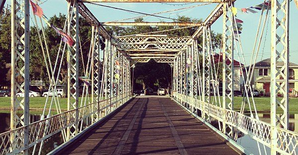
MG: Well, it all started some time in the latter half of the 19th century. Alas, I’m embarrassed to say I don’t remember the exact date. But back in those days, I was the bridge at Esplanade Avenue—I served as that all-important connective link for years, which many residents may not realize. Oh, the traffic I used to see back then! Horses and buggies, that sort of thing. Later, big lumbering streetcars. I know, just the thought of something that heavy crossing these splintery planks gives you the shivers, but back then I could handle it. Soon, automobiles were crossing my span, and alas—I just wasn’t big enough to support the increase in traffic at that location. So, in 1908, to make way for the new bridge (which—and this is kind of petty to say—that thing not only collapsed while they were building it, actually killing someone, but it also broke just a few years later! A terrible design, but I won’t go into it….), they floated me down to my current location, where I replaced an old footbridge that used to be here. And I’ve been here ever since.

CP: Amazing.

MG: Ok, enough about me! I’m really excited to talk about your newly-released book on the history of Bayou St. John! I hear I’m featured on the cover in my original Esplanade Avenue location—are the rumors true?!

CP: That’s right! The book, which is a comprehensive history of Bayou St. John (the first of its kind) comes out on November 27th. I’ll have a launch event at Octavia Books on Sunday, December 10th, at 2pm, and another at Fair Grinds on Saturday, December 16, from 9:30-noon. I know those are going to be tricky for you to make, but I’ll be sure to drop by and give you a copy. And yes, you are indeed featured on the front, looking really elegant in black-and-white….

MG: Cut it out! I’m blushing! Give us a bit of context for this project. What brought you to it, and what’s the journey been like?

CP: Sure. Around 3 years ago or so, a friend urged me to take this project on. As a poet who’s always been interested in history, bodies of water, and the intersection of the two, I just couldn’t say no. I learned a lot along the way, needless to say, and got lots of help and support from local institutions, experts, and folks in the community. It was such a fun and challenging project, and it’s a true honor to be handing it over to readers on the eve of the city’s Tricentennial celebration in 2018. I couldn’t be more excited!

MG: Me either! I can’t wait to learn more about this waterway that’s been flowing beneath me for close to 150 years now—that’s going to be really special for me. Where can folks get more information about the book?

CP: Interested readers can visit The History Press to purchase the book, and can check out my blog series on the the bayou’s history over at ViaNolaVieas well as right here on my website.

MG: Awesome! I don’t spend much time online, but if I did….

CP: I get it! No worries, Mag. Listen, it’s been nice chatting with you! Good luck on all the big changes awaiting you. And keep in touch!

MG: I’ll be here whenever you want to stop by. See you around!
BSJ’s STUBBORN SHIPYARDS

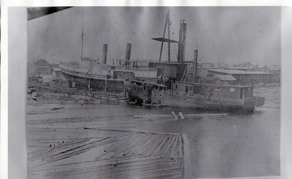
Shipyard. Note: not on Bayou St. John.

In the 1920s and ‘30s, thanks in no small part to the New Deal, Bayou St. John got a huge makeover.

No more mudflats and sunken garbage! No more crumbling levees! No more broken shell roads! No more houseboats and boathouses and ramshackle wharves! All of those things, after all, do not befit the name “Bayou St. John Aquatic Park,” which is what the weed-choked small craft parking lot, crisscrossed with outdated bridges, would become over the course of a few short years.

This is not to suggest the “old bayou” didn’t go down without a fight.

Perhaps the most heated argument to come out of this transformation occurred between Walter Parker, President of the Bayou St. John Improvement Association, and Joseph Dupuy, owner of the last remaining shipyard between Esplanade and Hagan Avenues. You see, the bayou’s makeover wasn’t only cosmetic; its essential character and function needed an overhaul as well. Its very role within the city, according to those at the helm (no pun intended!), needed redefining. After all—the Carondelet Canal, which once extended the bayou to the French Quarter along the path of today’s Lafitte Greenway, was no longer in use, and by 1938 was completely filled in. Without its manmade limb, the bayou served very little commercial purpose. And yet, old habits die hard. Along with the vestiges of other miscellaneous industries once connected with the waterway, two large shipyards remained active along the bayou’s lower banks by the time its makeover was proposed.

What’s wrong with a couple shipyards, you ask?

In short, they require the wrong kind of bridges.

In order for bigger boats to travel to the shipyards for repair, they needed the bayou’s drawbridges to open—most notably, the old Esplanade Bridge and the present-day Magnolia (or Cabrini) bridge. But Parker and the rest of the BSJIA did not envision drawbridges in the new Aquatic Park: they interfered with City Park-bound traffic, and, as is illustrated below, required much planning and many resources to operate.

According to Parker, opening the bridges required the services of a “specially trained crew” of at least five men (members of the Public Service Organization, and therefore not available to the city at a moment’s notice), often took upwards of 30-45 minutes to complete, and required notifications of the police department (for assistance detouring traffic), the Public Service Transportation Department (to reroute buses), Charity Hospital ambulances, and the fire department. Traffic had to be detoured to the Magnolia Bridge, and then, half an hour later, rerouted again so that the Magnolia Bridge could be opened. All, as Parker added for emphasis, so that “one boat can go to one boatyard for repair.” [1]

By the early 1930s, the Mullens Shipyard (near Esplanade Avenue) had agreed to be moved, but up until 1936, much to Parker’s chagrin, Dupuy refused to be relocated. But how would they finish their revetment work? And how would they install the proposed “fixed-span” bridges, with enough clearance only for canoes and other such small “pleasure craft”?

It wasn’t until Congress declared the bayou a “non-navigable stream” in 1936 that the city finally claimed the right to put its foot down. Eventually, the Dupuy shipyard was forced to move lake-ward. The bayou, goshdarnit, was to be recreational! I have to admit to having a soft spot for this shipyard, or at least the memory of it. Every time I pass by Dumaine Street’s intersection with the bayou, I imagine its skeletal hulls-in-progress, its busy workers, its stubborn desire to stay put.

1. City Engineer’s Bridge Records, 1918-1967, City Archives, Louisiana Division, New Orleans Public Library.

IMAGINING THE LULING TWINS

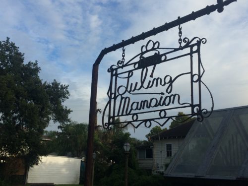
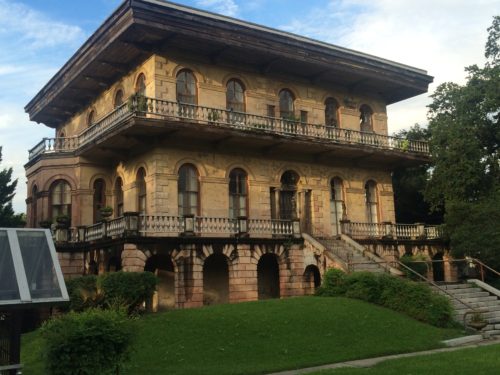
I just plunged down a deep, deep rabbit hole, and am now writing myself out. Yesterday, I stumbled across a mention of the Luling Mansion, located on Leda Court near the Fairgrounds. This 1865 Italianate behemoth, built by the famous architect James Gallier, Jr. for cotton merchant Florence Luling, now stands faded and almost abandoned-looking, hidden from view just off Esplanade.

photo by author

Its interior has been converted into apartments, and as recently as January 2015, a few of them were up for rent. What inspired the rabbit hole for me, though, was the mention of Bayou St. John in this story.

photo by author

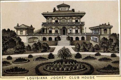
In 1871, Luling sold the mansion to the Louisiana Jockey Club, which had recently acquired the race track we all know today as the Fairgrounds. The mansion and its 80 acres fronting Esplanade became the Jockey Club’s headquarters, in which they threw fancy parties of all kinds. Why would Luling sell the mansion he’d just spent $24,000 to build after only six years? Because, according to all the sources I came across, Luling’s two young sons drowned in Bayou St. John soon after they moved into the mansion, prompting him to sell it.

Oh! I thought to myself. Maybe I can find the newspaper article on the boys’ drowning to flesh this out a little bit. Over the course of my bayou research, I’ve been simply amazed by the number of bayou drownings mentioned in the newspaper—freak accidents of all kinds, involving members of all classes, with the most bizarre circumstances surrounding them. And yet, no such article appears to exist—or at least I can’t find it. So the story is left to its bare bones.

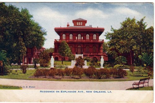
Luling Mansion in its heyday; 1908 postcard by C. B. Mason, New Orleans; public domain

The poet in me (sometimes inclined toward the morbid and occult) considered writing a post in which I reimagined the boys’ death—playing on the edge of their property (did their property extend to the bayou?) one day in, say, 1870, maybe searching for turtles in the grass along the shore, digging their little sticks in the mud. I’m imagining them as twins now, each in his own little nineteenth-century suit, maybe four or five years old. They’re speaking to each other in nonsense phrases that are nonetheless completely clear to each of them, since they’re twins, and since the adults are often too busy filling ships with cotton (their father), or else fulfilling domestic duties (their mother) to speak to them much. But where is the governess meant to be looking after them? Who is she? What is she up to? The day is warm. The bayou slips along, brown and sluggish….

Louisiana Jockey Club House (Luling Mansion), New Orleans, 1884; from souvenir booklet “New Orleans,” unknown author; public domain

Ok! I just did what I said I wasn’t going to do. Really I’d planned on including another Times-Picayune article of a sad and mysterious drowning, hoping that others would find it as interesting as I did.

To be continued….

SEARCHING FOR A GHOST TRENCH

Last weekend, I went searching for a bayou’s ghost.

When the French arrived on the scene back at the end of the 17th century, a small trickle of water connected Bayou St. John with Bayou Gentilly—an even smaller, more sluggish slip of liquid, even more deserving of the term “bayou,” than the waterbodies it linked together. There was no indication that the waterway was used for navigation, or much of anything at all, but it appeared on early maps snaking along what would eventually become the heart of Faubourg St. John. Its claim to fame might have been that the old portage route followed its basic arc from Bayou St. John to Bayou Gentilly (to the site of the Place Bretonne Indian market) before continuing on its way toward the present-day French Quarter.

map by author, used in previous post on Place Bretonne

The official name of this bayou (I’ve come across several), and when exactly it got filled in, remain a mystery. But during an interview with a Faubourg St. John resident, I was told that a slight declivity along N. Dupre street marks the old trench of this long-forgotten bayou. And, of course, I wanted more—I wanted to trace the ghost-bayou’s bed from start to finish!

Alas, the results of my adventure through the neighborhood are not all that impressive. Nothing definitive. No ghost-bayous jumping out to spook me. Just small dips along the relevant roadways that may or may not have anything to do with said trickle of yesteryear. As any New Orleanian knows, irregularities in the elevation of the city’s streets are not exactly rare….

I walked from Moss to Crete streets, zig-zagging between DeSoto and Bell along Hagan, N. Rendon, N. Lopez, N. Gayoso, N. Dupre, and N. White—searching all the while for indications of the ghost-bayou’s wanderings.

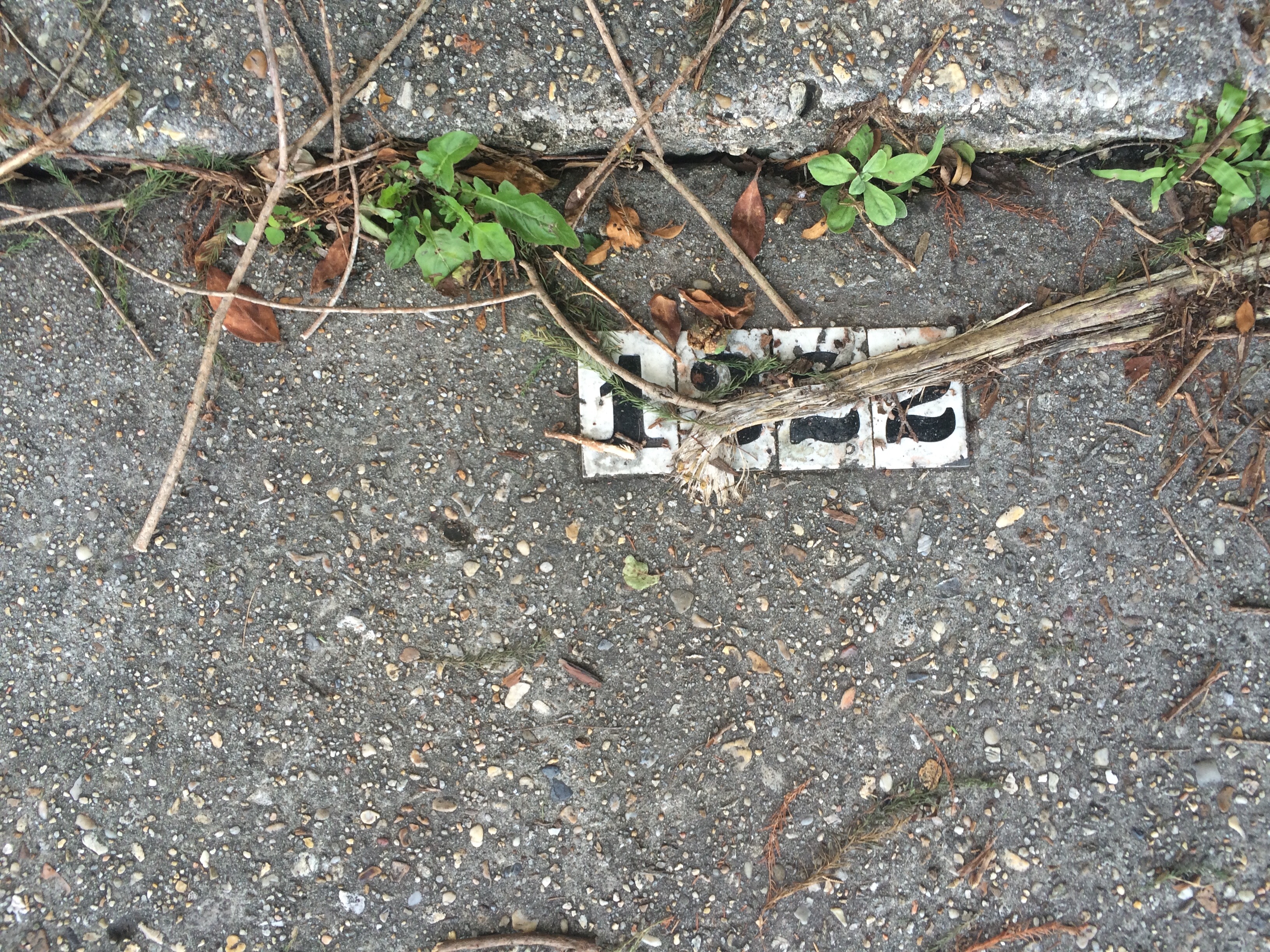
It is said that the bayou broke off from Bayou St. John around present-day 1222 Moss Street. It’s as if the house itself—hiding behind its lush foliage—seeks to hide its watery underpinnings….

photo by author

photo by author

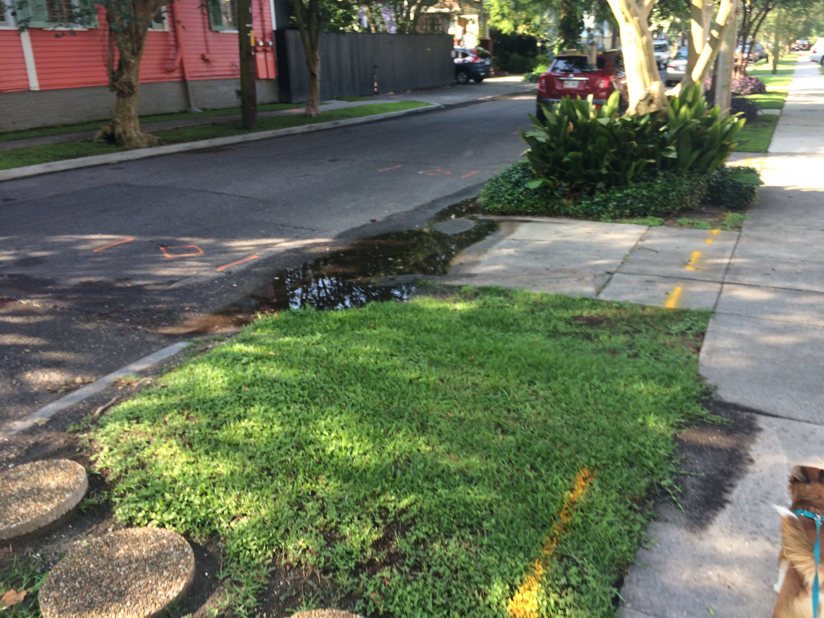
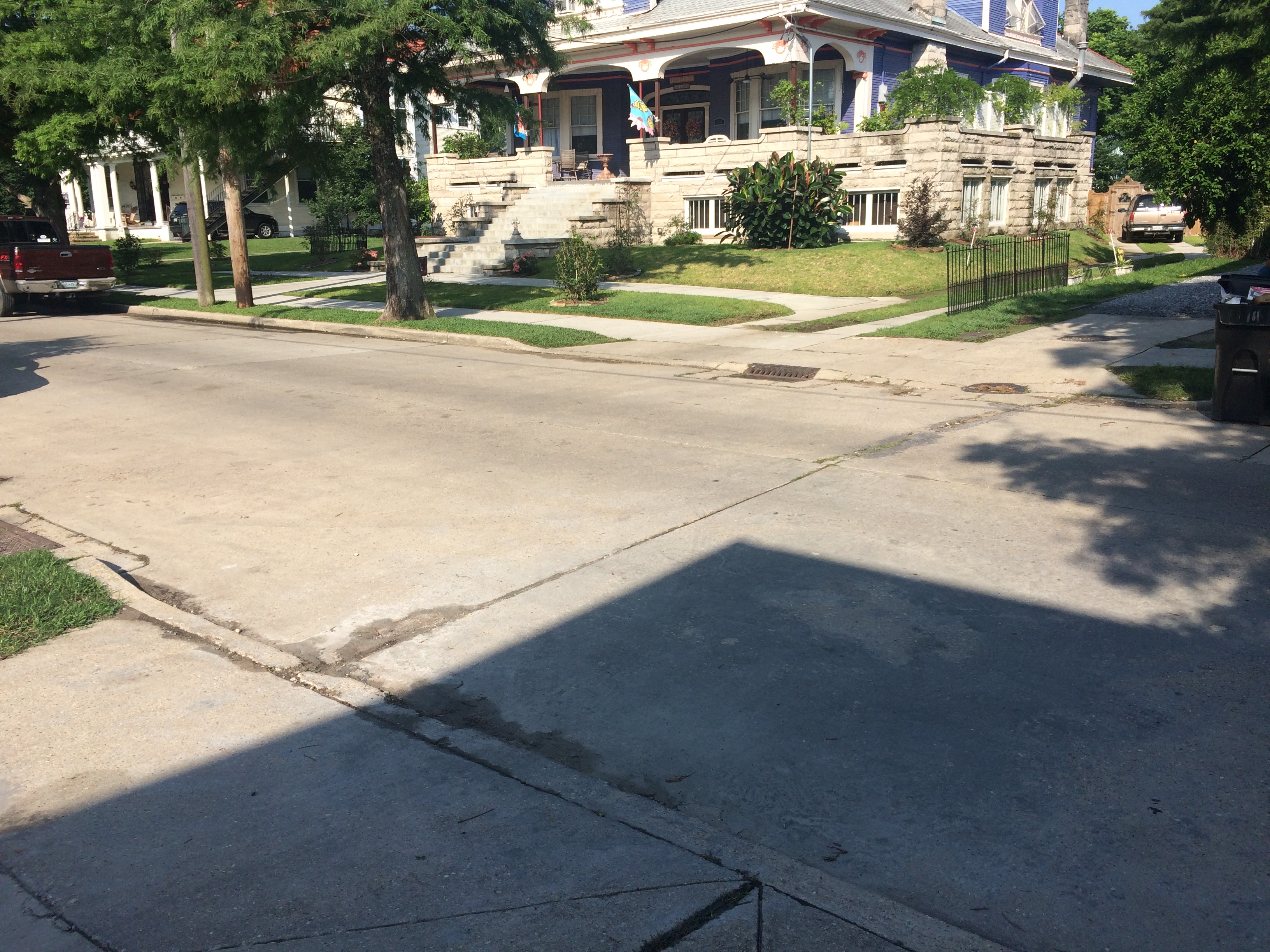
Does this puddle along Hagan Avenue indicate a bayou-related dip?

photo by author

What about this driveway’s slope on N. Rendon?

photo by author

Or this mansion’s sunken drive?

photo by author

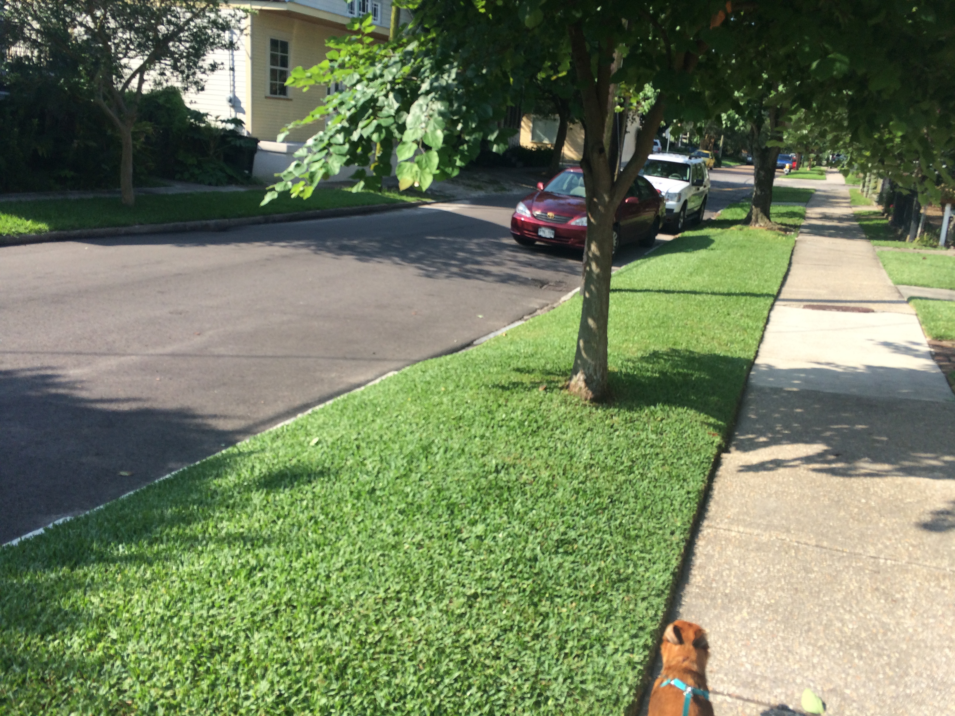
Is it just me, or does N. Lopez look a little concave right here? (My dog’s second photobomb…he was helping me look.)

Photo by author

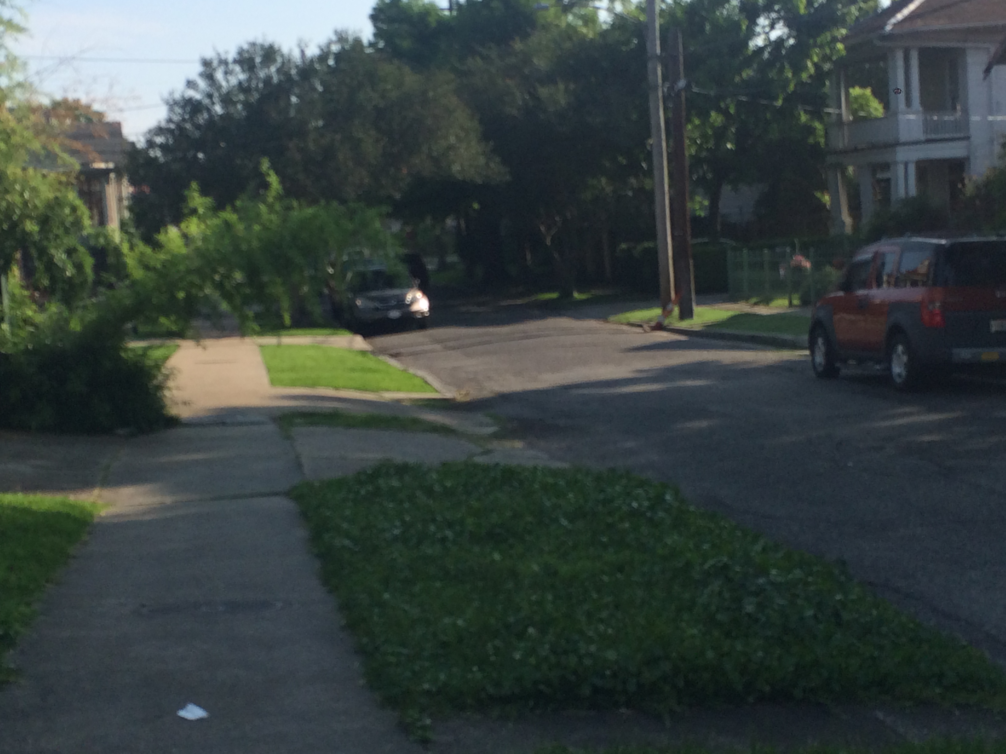
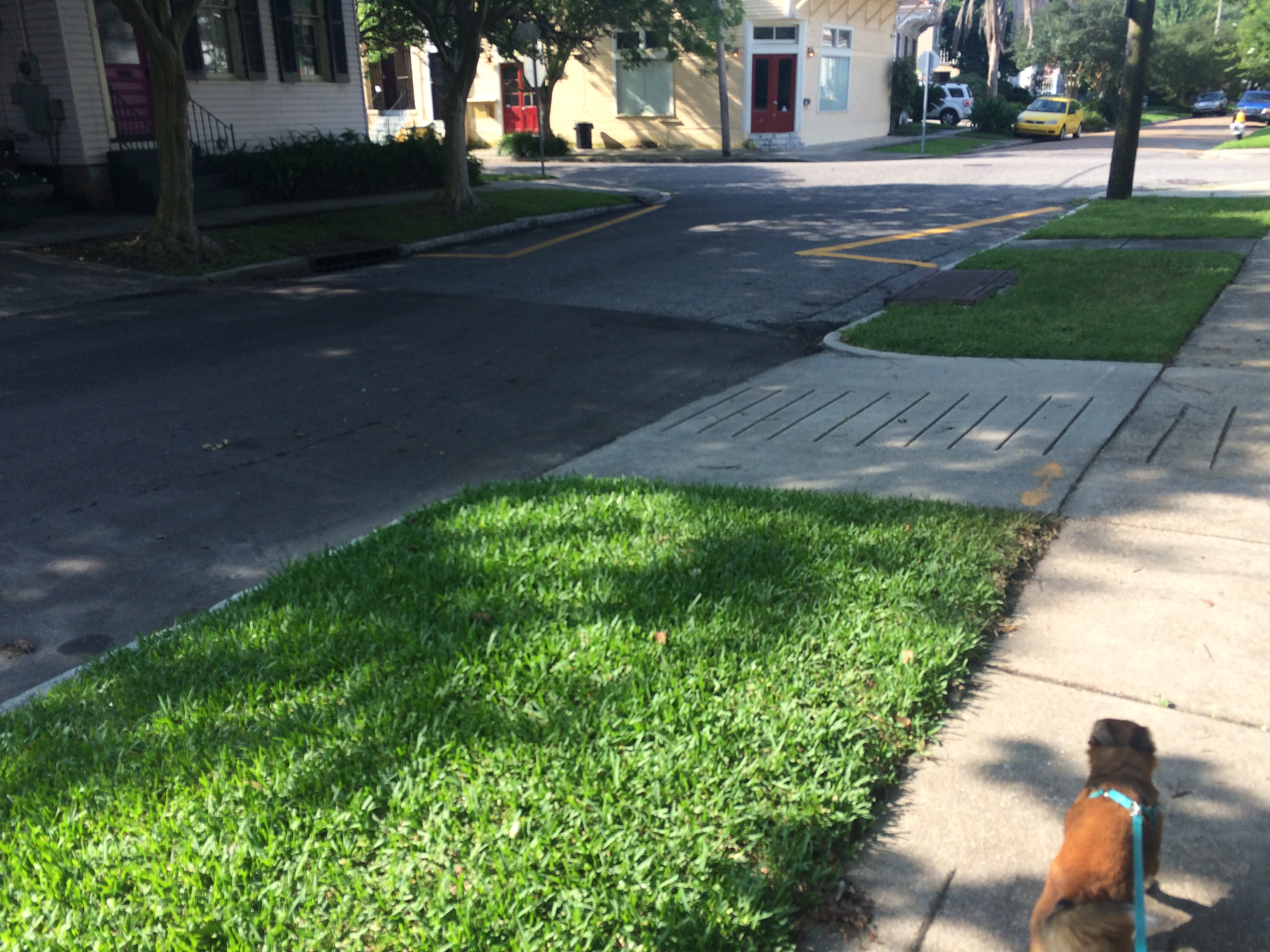
What about here? The slightest of dips along N. Dupre….

photo by author

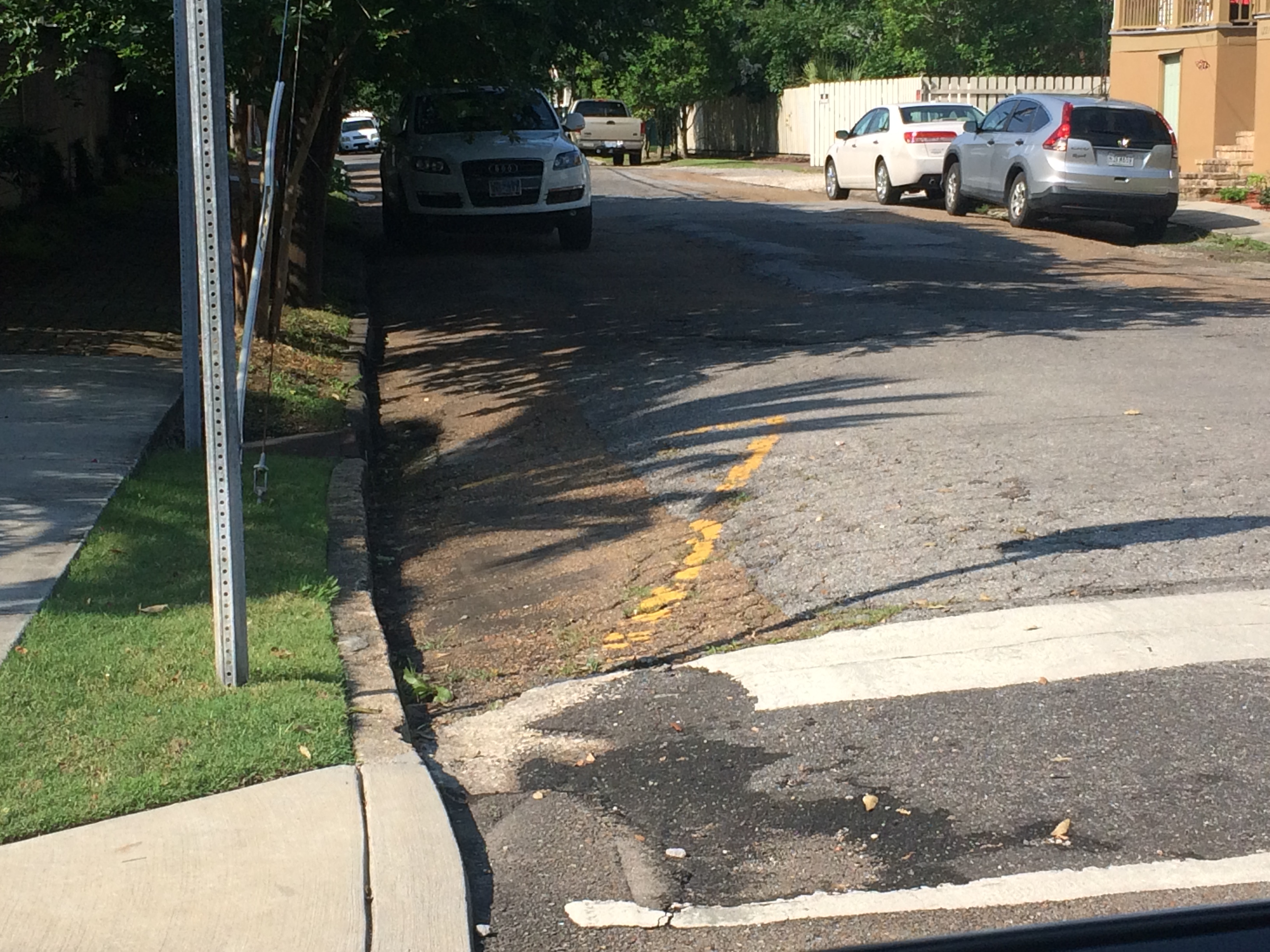
Here is the clearest indication of the ghost trench (shown to me by the same Faubourg St. John resident mentioned above), where Crete meets Esplanade.

photo by author

Ok, like I said, nothing too terribly amazing. But was the journey worth it? You bet! And maybe someone reading this post will have their own bayou ghost story to share, and will tell us all where to look next time we’re in the neighborhood….

BRILLIANT ASSEMBLIES OF LADIES

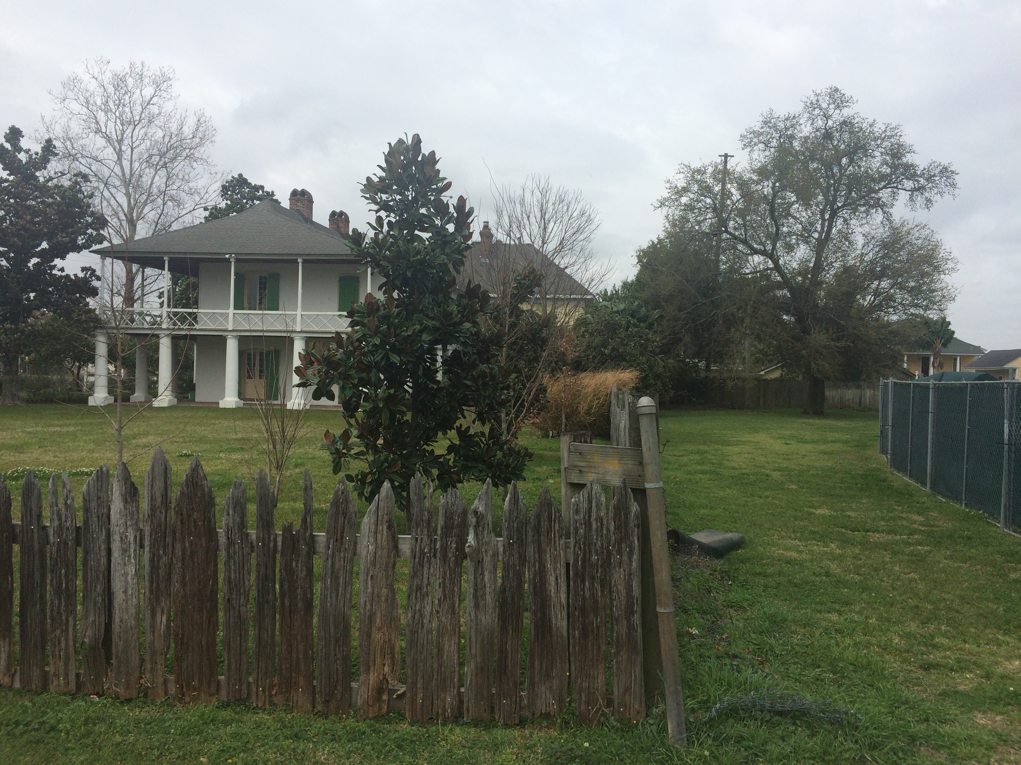
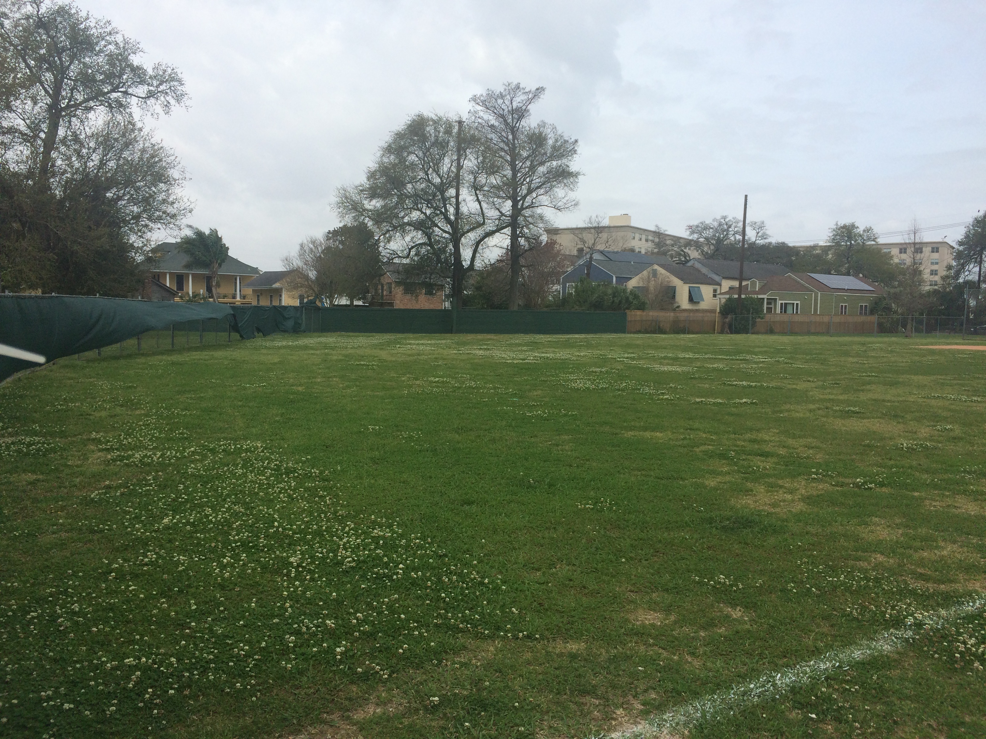
Did you know that where the Pitot House and Desmare Playground sit now was once a 19th century pleasure garden called “the Tivoli”? Leonard Victor Huber in his New Orleans: A Pictorial History even calls it New Orleans’ first park. At that time, the area around the bayou was seen as a rural escape from the hustle and bustle of city living and boasted several pleasure gardens by the end of the 19th century—green spaces where residents could dance, drink, and mingle in true New Orleans fashion.


Pitot House

Field behind Desmare Playground

Edna Freiberg, in her book Bayou St. John in Colonial Louisiana 1699-1803, includes a description of Tivoli patrons by a Mr. John F. Watson, a Philadelphia man visiting New Orleans in 1804. He tells us how those visiting the garden would “walk out in the dust and walk home after ten o’clock at night” (I picture ladies in their finery trudging along Bayou Road, although I’m not exactly sure what he means here). He also mentions ladies “of the best families” dressed to the nines, arriving at the gardens in their ox carts. [1]

LSU professor Lake Douglas, in his fascinating book Public Spaces, Private Gardens, quotes another traveler to New Orleans in 1806, the Irishman Thomas Ashe: “Every Sunday evening, ‘all the beauty of the country concentrates, without any regard to birth, wealth, or colour…. The room is spacious and circular; well painted and adorned, and surrounded by orange trees and aromatic shrubs, which diffuse through it a delightful odor. I went to Tivoli, and danced in a very brilliant assembly of ladies.’” [2]

Douglas goes on to highlight Ashe’s phrase “without any regard to birth, wealth, or colour,” which speaks volumes when put into the context of Ashe’s wider study of 19th century New Orleans’ social customs surrounding gender, race, and class—which were complicated to say the least, and which could often be observed in microcosm in the city’s dance halls. More on this to come: I am attempting to learn more about Ashe, New Orleans’ “quadroon balls,” and the city’s relationship to race and gender more generally as it transitioned into the 19th century.

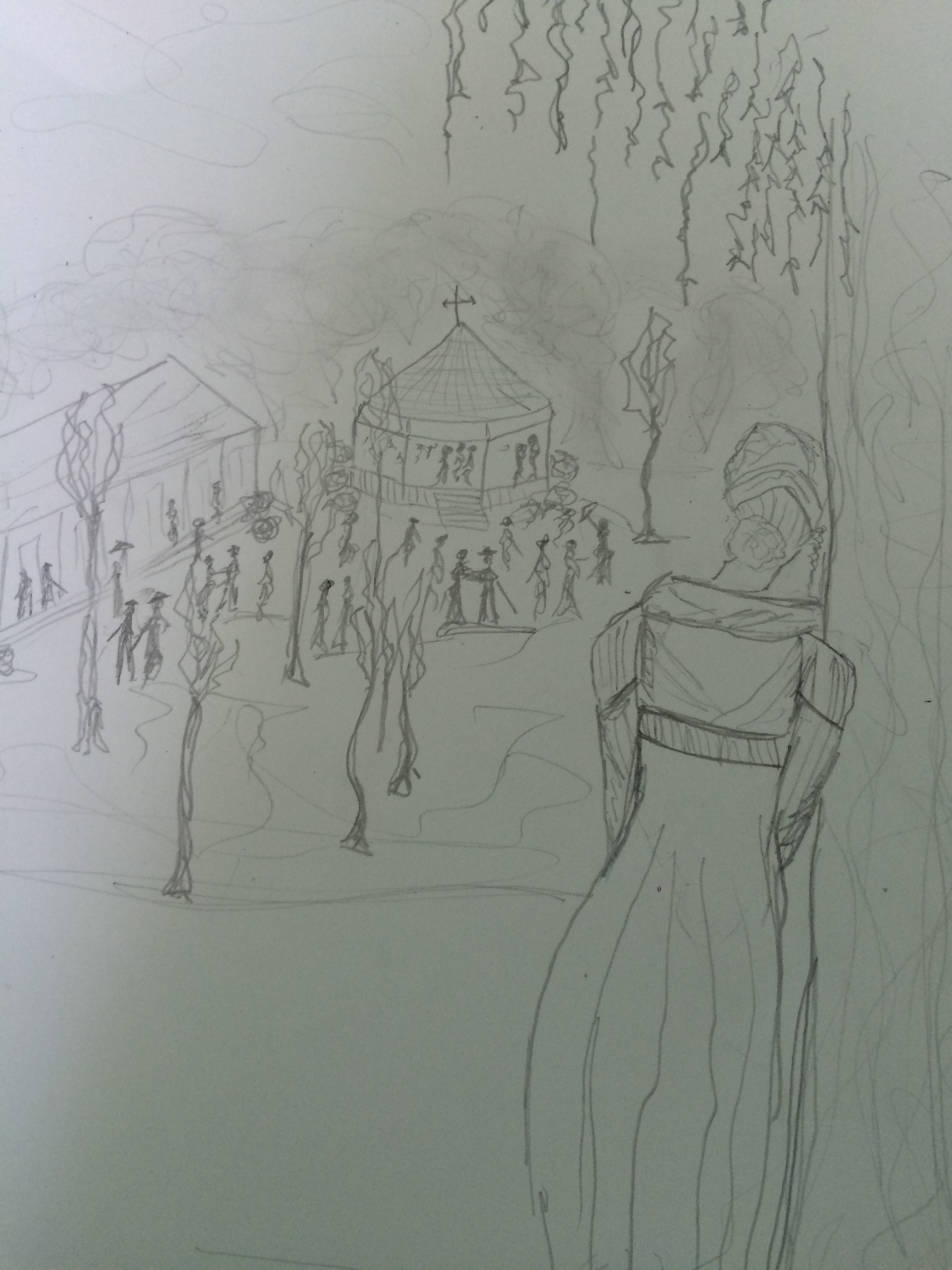
For now, I’ll just do a little poetic imagining. Beneath the traffic sounds of Esplanade, can you still hear the clopping arrival of those ladies in their ox carts? Can you smell the orange blossoms? Can you see the circular, lantern-lit pavilion set amongst the trees, and the couples strolling about in their fancy hats and walking canes and rustling skirts? When you look up, can you see the stars beginning to emerge around the edges of the evening clouds? Can you hear the music warbling in the breeze, distorted by the passage of hundreds of years and layers upon layers of history?

(This is me, hiding behind a cypress tree, imagining myself into the scene. I even put on my early 19th century dress with the high waistline for the occasion! Don’t ask me where the hill I’m standing on came from….it’s an illusion. I don’t have an ox cart (Uber?? Where are you??) so I’ll have to walk along Bayou Road to get home….)

1 .Edna Freiberg, Bayou St. John in Colonial Louisiana 1699-1803 (New Orleans: Harvey Press, 1980) 324.
2. Lake Douglas, Public Spaces, Private Gardens: A History of Designed Landscapes in New Orleans (Baton Rouge: Louisiana State University Press, 2011) 73.

ANCIENT AND ODD-ANGLED: THE ROAD TO BAYOU ST. JOHN

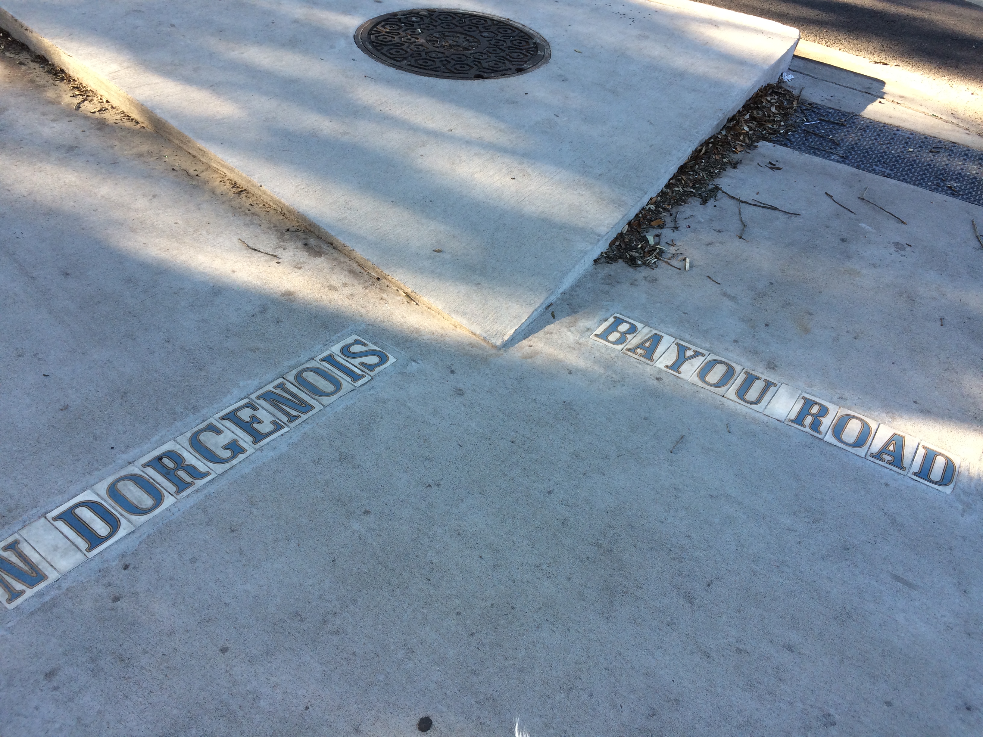
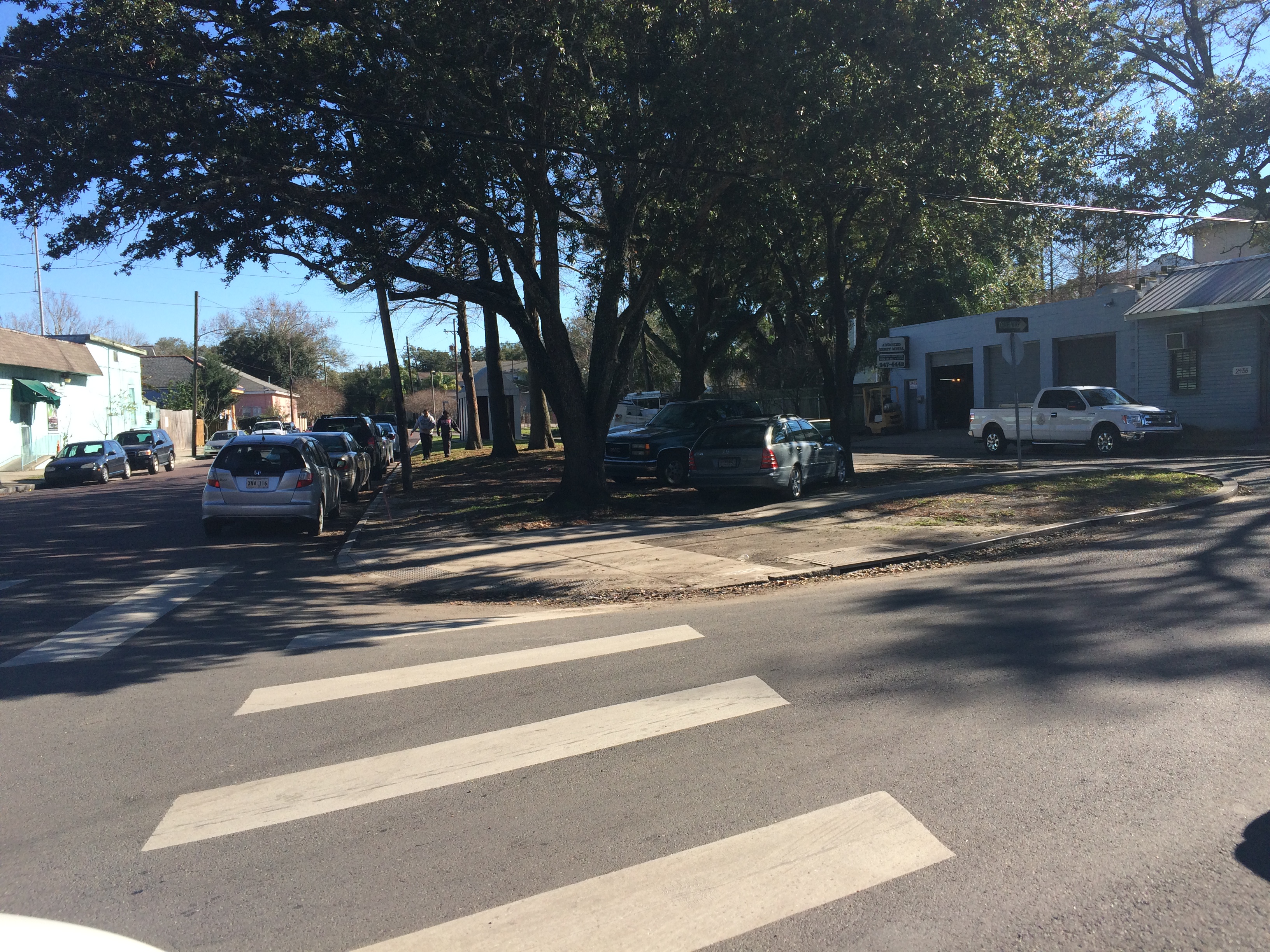
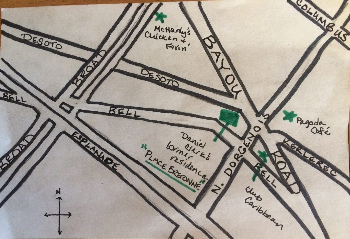
Since moving to my new address on N. Dorgenois Street, my fascination with the charming and disorienting formation of streets between Esplanade, N. Rocheblave, Columbus, and Broad has only grown. Residents may know this spot as home to Pagoda Café, Club Caribbean, and McHardy’s Chicken.

From N. Dorgenois, facing Bayou Road and Bell Street. photo by author

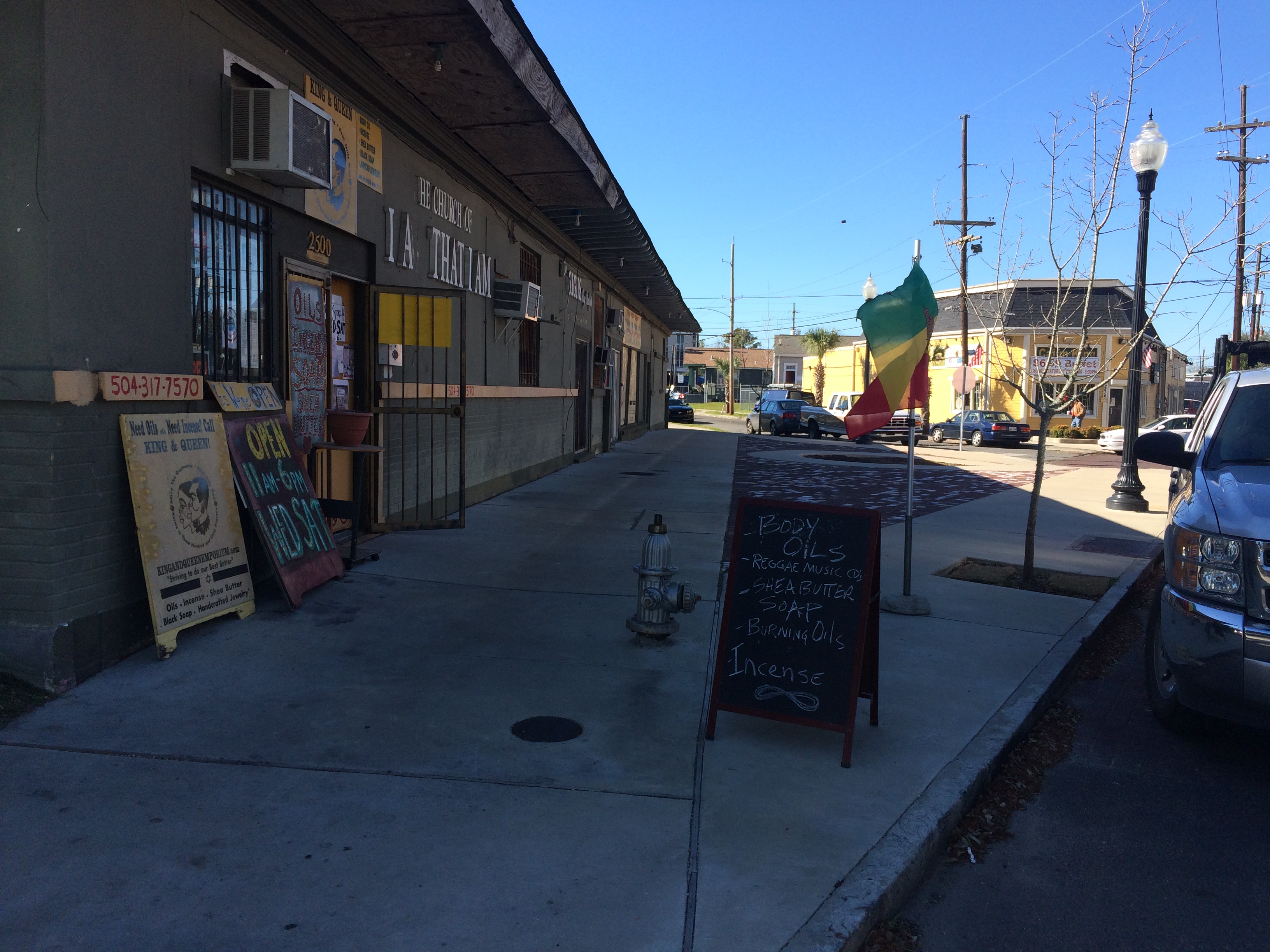
Alongside King and Queen Emporium Itn’l on Bayou Road, facing where Desoto breaks off to the left. photo by author

This bizarre intersection has everything to do with the odd-angled Bayou Road, “the road, trace, or portage [that] predated the city, following a narrow strip of high land that led from the Mississippi River past Bayou Sauvage, called Gentilly, to an intersection with Bayou St. John”[1]. Bayou Road was the thread, some argue, that made New Orleans possible—by lending the French a “backdoor route” from the Gulf through Lakes Borgne and Pontchartrain, down Bayou St. John, along the elevated ridge Bayou Road occupies to the Mississippi’s banks. The French could perch along the river’s edge, and thereby control the entire massive artery, without having to fight their way up its tumultuous mouth.

New Orleans Architecture explains that the corridor of “Bayou Road, on both its left and right sides, served as frontage for a series of concessions made first by the Company of the Indies, then by the kings of France, and later, the Spanish Crown. Simultaneously to the laying out of the city [ the present-day French Quarter]…these tracts of land to the rear of the city were developed into habitations (plantations) with houses and outbuildings facing each side of Bayou Road, having orchards behind and cultivated fields extending to the swamps” [2]. Even after the neighborhoods flanking Bayou Road were developed according to orthogonal street grids in the 19th century onward, Bayou Road was left to continue on its ancient, crooked way—there were too many houses and buildings already oriented along its trajectory.

So, back to my favorite intersection! Where, like, seven irregular triangles touch noses! The energy of the spot kept pulling me in, but until I did a little extra research in order to write this post, I didn’t realize how truly charged it was.…

It turns out N. Dorgenois Street formed the boundary line between some of these Bayou Road plantations that were continually changing hands throughout the city’s early history.

Chains of title can be kind of dull, but, in brief, between 1723 and 1834 the swath of land between N. Dorgenois and Bayou St. John (broken up into various parcels) was owned by folks with surnames like: Française, Langlois, Lebreton, Brasilier, Chalon, Almonester (the city’s wealthiest resident by the mid-1780s), Blanc, Vidal, Suarez, Clark, and Blanc again, until “…on September 26, 1836, Blanc sold to the Corporation of the City of New Orleans his ‘land or plantation, irregularly shaped having about twelve arpents frontage on Bayou St. John and bound by said Bayou, Carondelet Canal, Bayou Road, and Dorgenois…for $50,000’”[3].

Until around the time of the Louisiana Purchase, the particular sliver of land between N. Dorgenois and Broad was cultivated, but had no structures on it yet. Then comes Daniel Clark, Jr., the man who wanted to turn the land between the bayou and Dorgenois into Faubourg St. John. Historian Lawrence Powell tells us more about Clark: “…a young Philedelphian named Daniel Clark, Jr., Irish-born and Eton-educated, parlayed fluency in French and Spanish to become Governor Miró’s English translator, and then used that position to facilitate an illegal tobacco trade in which the governor silently partnered with Clark’s uncle, a wealthy Baton Rouge planter and New Orleans merchant. The younger Clark soon amassed a fortune from shipping and real estate, in the meantime joining the ranks of the slave-holding gentry”[4]. Later Powell tells us the two Daniel Clarks were some of the city’s largest slave-importers during the latter half of the 18th century.

Daniel Clark’s daughter, Myra Clark Gaines, stalled the development of Faubourg St. John after Clark’s death for close tosix decades via “the longest-running lawsuit in the history of the United States court system”(!!!) claiming she was the sole heir to his properties. (More on this fascinating lawsuit to come!) Before he died, Clark had succeeded in subdividing the faubourg into 35 irregularly-shaped blocks, however, and had envisioned the focal point of the neighborhood to be the fan-like formation of streets that inspired this blog post. New Orleans Architecture tells us that Clark built his country seat at the juncture of Bell, Desoto, and Bayou Road, roughly where King & Queen Emporium International is today. He died in the house in 1813 and it “ultimately fell into ruin and was demolished” [5].

So now we know a bit about the mainstream history of this tangle of streets in the 7th Ward. In my next post, I will seek to explore the little-known, less-recognized facets of this intersection’s history.…

1. Roulhac Toledano and Mary Louise Christovich, New Orleans Architecture Volume VI: Faubourg Tremé and the Bayou Road (Gretna: Pelican Publishing Company, 1980) xi.
2. Toledano and Christovich, New Orleans Architecture, xi.
3. Toledano and Christovich, New Orleans Architecture, 54-56.
4. Lawrence N. Powell, The Accidental City: Improvising New Orleans (Cambridge: Harvard University Press, 2012) 194.
5. Toledano and Christovich, New Orleans Architecture, 56.

CASCADES OF ENERGY: A WHIMSICAL TAKE

These bayou posts have become a way for the two sides of my writing life to converge: the history and the poetry, the “reality” and the imaginary. See below for an example of what I mean.

My favorite part of Sherwood Gagliano’s “Geoarchaeology of the Northern Gulf Shore” is when he talks about natural systems: “Natural systems are defined by recurring patterns of flow of energy and materials on, or near, the earth’s surface. These energy flows or fluxes are most commonly in the form of fluid movement (water, ice, wind, etc.) but may also be through chemical processes. Energy flow is the integrating factor that defines the natural system.”[1 ]In New Orleans, we are part of a deltaic coastal “cascading system.” We live at a point of interaction between deltaic and coastal forces—where fresh water and salt water meet: “a chain of systems…dynamically linked by a cascade of energy.”[2] This energetic formula defines our geography, and therefore our history. I love the word “energy” because it’s both scientific and whimsical in its usages. Another convergence. Let’s follow it!

Around where the Bayou St. John meets Esplanade Avenue, near the entrance to City Park: this place is its own energetic system, according to me. The phenomena, geological and historical, that have unfolded at this location over the last few thousand years have charged it up so much that next time you’re there—crossing over the bridge to go to the NOMA, for example—you might be able to feel it. Let me give you the briefest of brief histories about this particular spot:

When the planet warmed after the last ice age, the frozen water that had spread across our continent began to melt, flushing into a massive declivity in the landscape called the Mississippi Embayment and flowing down to the Gulf, bringing with it monumental amounts of sediment. The sediment accumulated until it rose up out of the sea and formed its own land. Anywhere this proto-Mississippi River went, it built the land beneath itself higher and higher. Eventually, with the help of gravity, it would slice through its own banks and find a more direct path to the sea. In this way, the Mississippi has been building and swinging, building and swinging, for thousands of years. For a while, before it swung toward its current path 700 years ago, a main arm of it flowed west to east from present-day Kenner, through the heart of New Orleans, out to present-day New Orleans East.[3]

They call this, among other similar names, the Metairie-Sauvage distributary. This former limb of the Mississippi River is crucial to our tale. For one thing, it built up the relatively high, well-drained Metairie-Gentilly ridge system (which, along with the Esplanade Ridge, was crucial to our city’s early history) through the alluvial process outlined above. It also spawned (gasp!) the bayou itself! Near where modern-day Esplanade Avenue nears City Park, this former distributary meandered…sharply. No one quite knows why it did, but we do know that in the process of meandering it sent yet another distributary southward (a body of water simply called the Unknown Bayou, that would eventually form Esplanade Ridge) and another, smaller distributary northward, toward the lake (the Bayou St. John!). For some inexplicable reason, the Metairie-Sauvage distributary split into three, irregular fingers at this location—and thank goodness it did!

Here’s another theory about the bayou’s birth, since what I’ve explained above is not 100% certain: it’s possible that after the Mississippi chose its current path 700 years ago and the Metairie-Sauvage course was abandoned, becoming a sluggish bayou in the process, the Bayou St. John formed as a drainage conduit for this larger bayou. At a weak point in the natural levee (around where present-day Esplanade nears City Park!) the Metairie-Sauvage flood waters crevassed and flowed toward the lake, a process that would repeat itself until the bayou was gouged permanently into the landscape. It’s possible, indeed probable, that the formation of the bayou is a combination of these theories—a drainage conduit throughout the millennia, if you will.

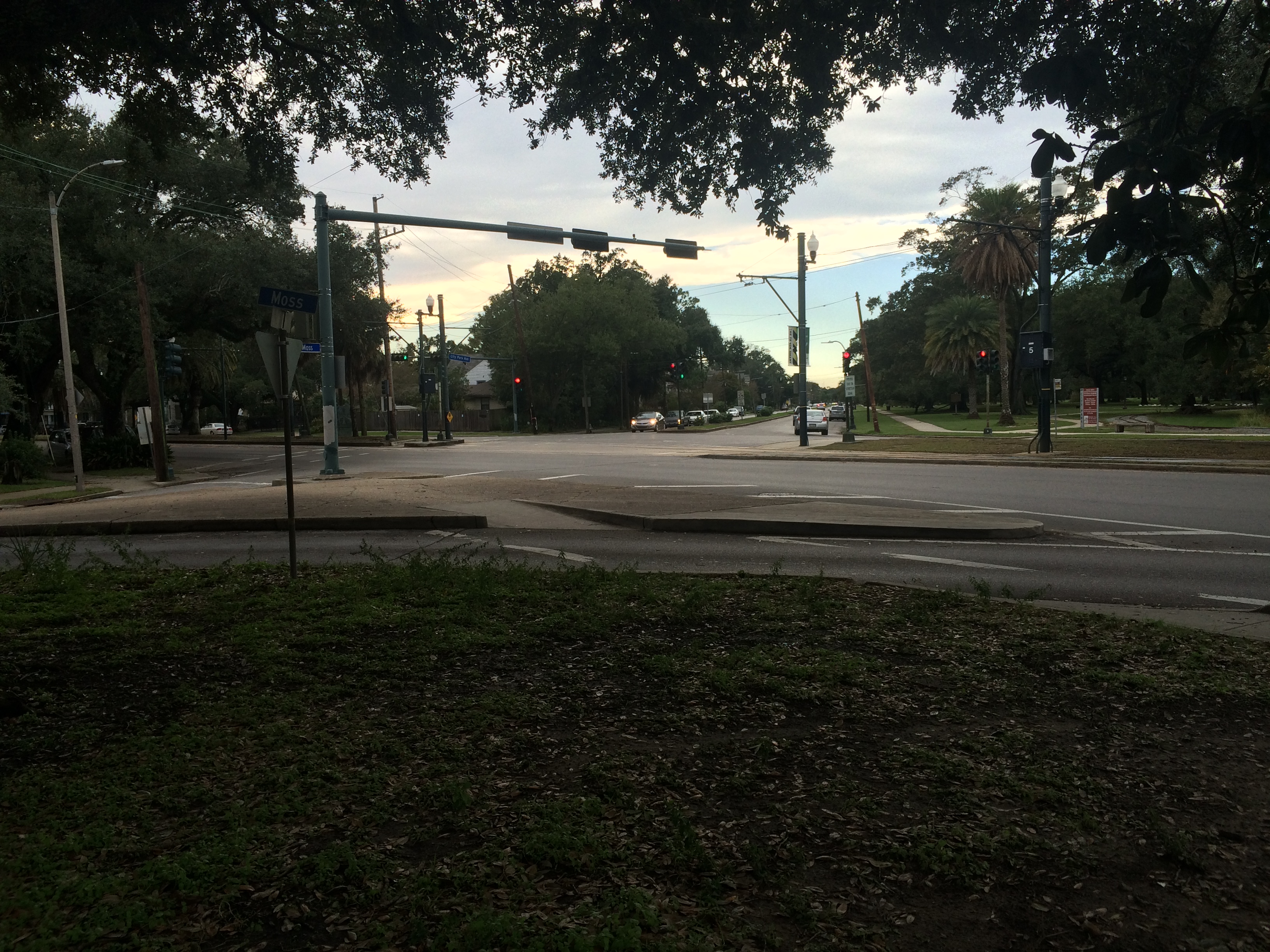
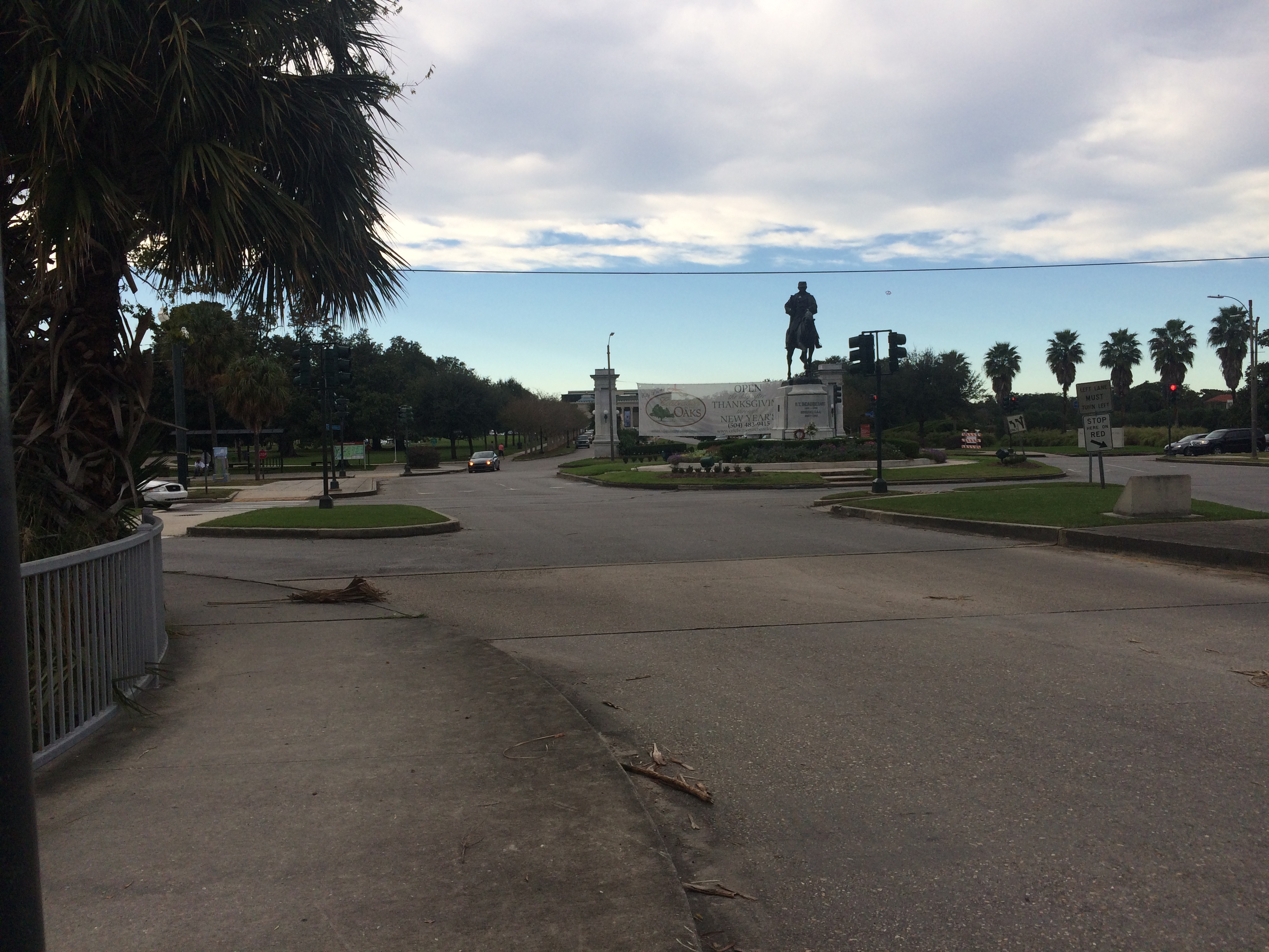
Either way you slice it, this spot—near where City Park Avenue meets Carrollton at Moss, near the roundabout with P.G.T. Beauregard at its center, near where the bridge spans the bayou and oak-lined Esplanade begins—has seen a lot of prehistoric action. Water trickling, gushing, overflowing, bifurcating—to the north, to the southeast, to the east. Water heaping up and creeping through. It’s seen a lot of historic action as well. Did you know, for example, that in 1908 they removed the bridge that spanned the bayou at Esplanade to make way for a larger bridge, more accommodating to automobiles, and that after they removed it, they strapped it to a barge and floated it down to a spot just across from present-day Cabrini High School? That’s right: our iconic Magnolia Bridge was once at Esplanade Avenue. And did you know that in the construction of this new fancy bridge at Esplanade, there was a tragic accident and the thing collapsed and fell, killing and injuring workers on its way down?

Yes, this mini energy system is roiling indeed. See if you notice it next time you’re there!

Where City Park Avenue intersects Carrollton Avenue at Moss Street. photo by author

The bayou, riverside of the Esplanade bridge. photo by author

The Esplanade bridge looking toward the entrance of City Park. photo by author

1. Sherwood M. Gagliano, “Geoarchaeology of the Northern Gulf Shore,” Perspectives on Gulf Coast Prehistory, ed. Dave D. Davis (Gainesville: University of Florida Press/Florida State Museum, 1984) 6.
2. Gagliano, “Geoarchaeology of the Northern Gulf Shore,” 11.
3. Richard Campanella,Bienville’s Dilemma: A Historical Geography of New Orleans(Lafayette: Center for Louisiana Studies, 2008).

A BUNDLE OF GATOR PARTS: NO BIG DEAL

Fun fact: the historic blue-tinted bridge we all call the Cabrini bridge (above), built some time in the mid 19th century, was for many decades the bridge spanning the bayou at Esplanade. When they built a new bridge at Esplanade in 1909 (a much bigger, double-track bridge meant to accommodate streetcars, “autos,” and pedestrians, all on their way to the newly-improved City Park), they unhooked the old one from its foundations and floated it down to its present location on a barge. They originally wanted to re-erect it across from Grand Route St. John, but some engineers thought the curve in the bayou at that spot would cause problems. Perhaps some folks in the neighborhood already knew this fun fact (particularly those involved in the planned restorations of the Cabrini bridge) but I do know that, at least in the sources I’ve encountered in my research thus far, there has been considerable confusion on this point. Some even guessed that, based on old photographs, the old Esplanade bridge and the current Cabrini bridge were built to look like twins. Not so! Not so! They are one and the same.

And now, a couple of my favorite articles from the Historic Times-Picayune database from the past couple weeks of research:

September 17, 1904: “TWO MEN FOUND DROWNED. Went Bathing in Bayou St. John Near the Bridge. Locked in Each Others’ Arms. Neither Could Be Identified Up To Last Night.

Two men, whose identity remains a mystery at present, were found drowned in Bayou St. John, about a mile and a half from the Esplanade Bridge, yesterday forenoon, and every evidence points to accidental death.

The men must have gone in bathing a few days ago and one of them began drowning and his friend went to assist him. They soon had their arms locked about each others’ body, and both were drowned. Yesterday forenoon J. L. Debausque discovered the bodies and notified the police, who went out in a skiff and took charge of the remains of the men. Seeing that they were without clothing, the policemen felt the men had gone in bathing and were drowned, and after pulling the bodies away from one another, they made a hunt for the clothing. On one of the banks the clothing of the men had been piled up. There were dark and check trousers, a pink and white striped shirt, a black felt hat, a gray hat, a gray or slate-colored coat, black socks and low-quarter patent leather shoes, and a pair of button shoes. The bodies were conveyed to the Morgue, where they will be held for identification. The men had dark hair and rather dark complexions. One was about 19 years old, while the other was about 25 years old. They were big men.”

This story really gets to me. Reading hundreds of articles about street paving, garbage carts, “society events,” etc. and then coming across a story like this—

Such humanity in the detailed descriptions of their clothing.And they never let go of each other!The one who, apparently,couldswim, never let go of his friend. Or else, the one who could not swim clutched for dear life to the one who could, and brought them both down…. A story of the ultimate loyalty, or perhaps not….

And, lastly, a story of a naughty little boy who got what was coming to him:

February 18, 1909: “TAFT’S ALLIGATOR STEAK.

A boy named James Ware, residing at No. 933 North Hagan Ave., found a package on the bridge across Bayou St. John at Dumaine Street and took it home with him. On opening the bundle to his horror he found what appeared to him to be two human hands. A note included in the package only added to his horror, for it said, ‘Remaining part of this body will be found at L. and N. crossing, due south by east, near switch lock block signal.’ Inspector O’Connor turned the matter over to Sergeant Leroy, who at once reached the conclusion that the hands were really the claws of an alligator, and the mystery was solved.”

Questions: Do alligator claws really lookthat muchlike human hands? Even Inspector O’Connor wasn’t sure.

Why was there a package of alligator claws just lying on the Dumaine Street bridge, and why were they separated from “the rest of the body” stashed in some very specific, distant location?

James, James, James—I hope you learned your lesson! It sounds like you did.

HATCHETS, SLEEPWALKERS, AND DRUNKEN BEARS

More Times-Picayune gems for your perusal, culled from my Bayou St. John research on the Times-Picayune Historical database this past week.

Police notes, July 9, 1878: “Between 10 and 11 o’clock Monday morning, a dispute arose over a game of cards on board a fishing smack lying in Bayou St. John, near the lake, between a Manila man named Marian Lacroste, aged 25 years, and Louis Bancart, his partner. The dispute was ended by Bancart, who seized a hatchet, and inflicted a severe cut on Lacroste’s hip. The wounded man was conveyed to Charity Hospital, and an affidavit was made against Bancart.”

Losing at cards? Just grab your hatchet!!


September 8, 1880: “An Unfortunate Somnambulist: A Woman While Asleep Walks Into the Bayou St. John

Yesterday morning the body of a white woman clad in her night clothes was found floating in the Bayou St. John, between Dupre and White streets. The fact of only having her night gown on, led to the supposition that the woman had committed suicide, and an investigation was at once set on foot by the Coroner Board. It was ascertained that the deceased was named Mrs. Ruth A.G. Patterson, aged 57 years, and residing at [obscured] Canal street.

The unfortunate woman was afflicted with somnambulism and fell a victim to her disease. During the night she walked into the canal and was drowned. The jury returned a verdict in accordance with the circumstances, and the remains were taken in charge by friends.”

Poor, poor Ruth. What an eerie image: Ruth walking from Canal into the bayou in the middle of the night….I wonder what she was dreaming?


September 8, 1882:”On last Wednesday night an unknown thief entered the sexton’s office of the St. Louis Cemetery, on Esplanade street, near the Bayou St. John. The thief stole two cages, containing live singing birds, which were owned by Mr. H. Bienvenu.”

Wow, those birds must really have been worth something! But to poor Mr. Bienvenu, alone in his office amidst that sea of tombs day after day, their singing must have been pretty key….


July 10, 1883: “Garroters in a Streetcar: At half-past nine o’clock last Monday night as car No. 4, of the Dumaine street line, turned the corner of Dumaine and Bayou St. John, two unknown highway men jumped into the car and rushing at Paul Bertuchaux, the driver, demanded his money.

Paul was not going to be bulldozed, and refused to deliver up his cash, whereupon he was assaulted and beaten and cut over the face by the parties. He tried to defend himself by striking at them, when they ran off without accomplishing their purpose.

Their description as far as could be learned has been telegraphed to all the stations.”

Paul would NOT allow himself to be bulldozed!! I hope the city gave him a raise.


April 1, 1884: “The Performing Bear and Its Masters Find Their Way to the Lock-Up

For some days past a Frenchman named Costick, and a Turk named Yunovasch Turnovich, have been exhibiting a performing bear on Bayou St. John near Metairie Ridge. On last Monday evening the owners of the bear and the beast himself imbibed too freely of spiritous liquors, and as a consequence became drunk.

The bear was told to pounce upon one David Edmonds, which it did, and in a few moments Edmonds was lying on the broad of his back, as if Sullivan had hit him. Edmonds well knew he was no match for his grizzly opponent, and thereupon summoned Sergeant O’Rourke and Officer Hanley to his rescue. The bear was taken away; its masters were taken to jail for being drunk and maintaining a public nuisance in exhibiting the bear without a license, and for causing the animal to assault Edmonds.”

Wait, is this an April Fool’s joke? The bear got drunk too? Only in New Orleans, as they say….